Property Record
17100 Nw 59Th Ave, Hialeah, FL 33015


Current Lease Availabilities
Property Detail
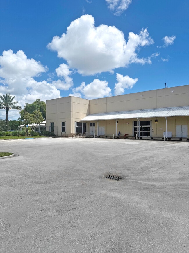
17100 Nw 59Th Ave
30-2012-027-0010
BARNETT BANK TRACT PB 146-98 T-18939 TR A LOT SIZE 13.13 AC M/L FAU 30-2012-000-0162 COC 21430-2726 06 2003 6
Officebuilding
Miami-Dade
6051
Florida
AE The base floodplain where base flood elevations are provided. AE Zones are now used on new format FIRMs instead of A1-A30 Zones.
13.13 AC
2025
Miami Lakes
2025
South Florida
011602
Miami-Miami Beach-Kendall, FL
116,486 SF
NEARBY LISTINGS FOR SALE OR LEASE
DEMOGRAPHICS near 17100 Nw 59Th Ave
1 mile
3 mile
5 mile
2025 Total Population
24,773
172,302
492,476
2030 Population
26,374
183,136
524,109
Pop Growth 2025-2030
+ 6.46%
+ 6.29%
+ 6.42%
Average Age
40
41
41
2025 Total Households
8,844
55,953
161,991
HH Growth 2025-2030
+ 6.40%
+ 6.26%
+ 6.47%
Median Household Inc
$74,124
$78,057
$69,303
Avg Household Size
2.80
3.00
2.90
2025 Avg HH Vehicles
2.00
2.00
2.00
Median Home Value
$373,756
$441,533
$412,939
Median Year Built
1985
1982
1984
Nearby Places
Map Layers
Map Styles
 Street
 Aerial
Layers
 Traffic
 Biking
Places
Listings with unknown addresses are not visible on the map
- Restaurants
- Banks
- Shops
- Fitness
- Groceries
PUBLIC TRANSPORTATION
COMMUTER RAIL
Opa-Locka (Tri-County Commuter - South Florida Regional Transportation Authority (Tri-Rail))
Drive
Walk
Distance
Opa-Locka (Tri-County Commuter - South Florida Regional Transportation Authority (Tri-Rail))
10 min
5.0 mi
Hialeah (Metrorail Green Line - Miami-Dade Transit (Metrorail/Metromover))
Drive
Walk
Distance
Hialeah (Metrorail Green Line - Miami-Dade Transit (Metrorail/Metromover))
14 min
7.1 mi
AIRPORT
Miami International
Drive
Walk
Distance
Miami International
25 min
13.7 mi
Fort Lauderdale/Hollywood International
Drive
Walk
Distance
Fort Lauderdale/Hollywood International
29 min
18.5 mi
Nearby Properties
Address
Land Use
TOTAL SIZE
Lot Size
Zoning
Address
Land Use
TOTAL SIZE
Lot Size
Zoning
1,837,228 SF
498.34 AC
8500
Address
Land Use
TOTAL SIZE
Lot Size
Zoning
614,708 SF
22.54 AC
4400
Address
Land Use
TOTAL SIZE
Lot Size
Zoning
436,707 SF
32.94 AC
RM3
Address
Land Use
TOTAL SIZE
Lot Size
Zoning
359,351 SF
28.25 AC
RM3
Address
Land Use
TOTAL SIZE
Lot Size
Zoning
426,620 SF
17.69 AC
RM3
Address
Land Use
TOTAL SIZE
Lot Size
Zoning
649,901 SF
124.04 AC
9400
Address
Land Use
TOTAL SIZE
Lot Size
Zoning
696,550 SF
2.97 AC
6109
Address
Land Use
TOTAL SIZE
Lot Size
Zoning
1,165,101 SF
115.84 AC
8000
Address
Land Use
TOTAL SIZE
Lot Size
Zoning
110,869 SF
155.94 AC
RL
Address
Land Use
TOTAL SIZE
Lot Size
Zoning
355,120 SF
18 AC
5000
Address
Land Use
TOTAL SIZE
Lot Size
Zoning
331,131 SF
12.09 AC
3900
Address
Land Use
TOTAL SIZE
Lot Size
Zoning
370,044 SF
17.86 AC
6051
Address
Land Use
TOTAL SIZE
Lot Size
Zoning
315,033 SF
11.48 AC
6109
Address
Land Use
TOTAL SIZE
Lot Size
Zoning
536,184 SF
29.16 AC
7100
Address
Land Use
TOTAL SIZE
Lot Size
Zoning
552,632 SF
6.05 AC
4100
Address
Land Use
TOTAL SIZE
Lot Size
Zoning
189,293 SF
6.08 AC
RM3
Address
Land Use
TOTAL SIZE
Lot Size
Zoning
389,450 SF
50.72 AC
9400
Address
Land Use
TOTAL SIZE
Lot Size
Zoning
261,263 SF
9.22 AC
6109
Address
Land Use
TOTAL SIZE
Lot Size
Zoning
468,316 SF
13.20 AC
4100
Address
Land Use
TOTAL SIZE
Lot Size
Zoning
286,547 SF
9.47 AC
6109
Address
Land Use
TOTAL SIZE
Lot Size
Zoning
167,427 SF
6.85 AC
3900
Address
Land Use
TOTAL SIZE
Lot Size
Zoning
68,227 SF
388.62 AC
8000
Address
Land Use
TOTAL SIZE
Lot Size
Zoning
223,723 SF
35.59 AC
0100
Address
Land Use
TOTAL SIZE
Lot Size
Zoning
279,008 SF
13.06 AC
3800
Address
Land Use
TOTAL SIZE
Lot Size
Zoning
483,970 SF
55.80 AC
8000
Address
Land Use
TOTAL SIZE
Lot Size
Zoning
225,716 SF
25.79 AC
6062
Address
Land Use
TOTAL SIZE
Lot Size
Zoning
239,635 SF
13.12 AC
PID
Address
Land Use
TOTAL SIZE
Lot Size
Zoning
145,325 SF
11.40 AC
3800
Address
Land Use
TOTAL SIZE
Lot Size
Zoning
255,391 SF
14.10 AC
3800
Address
Land Use
TOTAL SIZE
Lot Size
Zoning
479,270 SF
22.91 AC
7100
The World's #1 Commercial Real Estate Marketplace
Connect with us
© 2026 CoStar Group
The information above has been obtained from sources believed reliable. While we do not doubt its accuracy we have not verified it and make no guarantee, warranty or representation about it. It is your responsibility to independently confirm its accuracy and completeness. Any projections, opinions, assumptions, or estimates used are for example only and do not represent the current or future performance of the property. The value of this transaction to you depends on tax and other factors which should be evaluated by your tax, financial, and legal advisors. You and your advisors should conduct a careful, independent investigation of the property to determine to your satisfaction the suitability of the property for your needs.