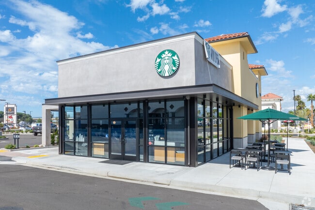
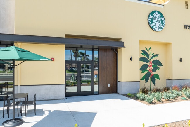
Property Record
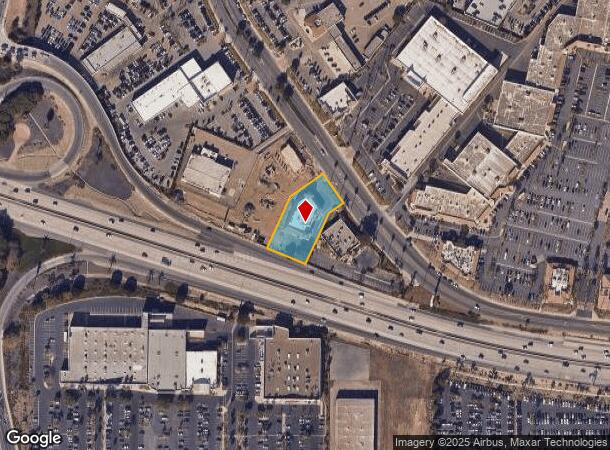
1720 Ventura Blvd, Camarillo, CA 93010
NEARBY LISTINGS FOR SALE OR LEASE
Property Detail
1720 Ventura Blvd
Oxnard-Thousand Oaks-Ventura, CA
Parcel Map 90-10
144-0-134-085
LOT: A REF: 51PM60
Restaurantdrivein
Ventura
X
California
06111C0910E
a
2024
0.82 AC
2025
Oxnard/Port Hueneme
005002
Los Angeles
7,088 SF
DEMOGRAPHICS near 1720 Ventura Blvd
1 Mile
3 Mile
5 Mile
2024 Total Population
16,086
103,118
261,426
2029 Population
15,757
101,254
256,985
Pop Growth 2024-2029
(2.05%)
(1.81%)
(1.70%)
Average Age
35
36
38
2024 Total Households
4,170
28,536
75,532
HH Growth 2024-2029
(2.13%)
(1.88%)
(1.75%)
Median Household Inc
$89,683
$86,074
$88,693
Avg Household Size
3.70
3.50
3.30
2024 Avg HH Vehicles
3.00
2.00
2.00
Median Home Value
$644,029
$643,802
$626,747
Median Year Built
1992
1979
1976
Nearby Places
Map Layers
Map Styles
 Street
 Aerial
- Restaurants
- Banks
- Shops
- Fitness
- Groceries
PUBLIC TRANSPORTATION
COMMUTER RAIL
Oxnard (Ventura County Line - Southern California Regional Rail Authority (Metrolink))
DRIVE
WALK
Distance
Oxnard (Ventura County Line - Southern California Regional Rail Authority (Metrolink))
8 min
3.6 mi
DRIVE
WALK
Distance
8 min
3.9 mi
SALE & LEASE HISTORY
LISTING DATE
SALE/LEASE

Sep 23, 2024
For Sale
Oct 12, 2016
For Lease
Nearby Properties
Address
Land Use
TOTAL SIZE
Lot Size
Zoning
Address
Land Use
TOTAL SIZE
Lot Size
Zoning
135,631 SF
74.32 AC
Address
Land Use
TOTAL SIZE
Lot Size
Zoning
25.09 AC
Address
Land Use
TOTAL SIZE
Lot Size
Zoning
35.90 AC
BRP
Address
Land Use
TOTAL SIZE
Lot Size
Zoning
8.03 AC
CPD
Address
Land Use
TOTAL SIZE
Lot Size
Zoning
480,733 SF
14.26 AC
Address
Land Use
TOTAL SIZE
Lot Size
Zoning
31.75 AC
Address
Land Use
TOTAL SIZE
Lot Size
Zoning
505,728 SF
20.81 AC
Address
Land Use
TOTAL SIZE
Lot Size
Zoning
15.09 AC
Address
Land Use
TOTAL SIZE
Lot Size
Zoning
95,637 SF
40.70 AC
Address
Land Use
TOTAL SIZE
Lot Size
Zoning
6.14 AC
Address
Land Use
TOTAL SIZE
Lot Size
Zoning
352,898 SF
16.57 AC
ML
Address
Land Use
TOTAL SIZE
Lot Size
Zoning
3.96 AC
Address
Land Use
TOTAL SIZE
Lot Size
Zoning
11.28 AC
CMPD
Address
Land Use
TOTAL SIZE
Lot Size
Zoning
2.63 AC
Address
Land Use
TOTAL SIZE
Lot Size
Zoning
3.12 AC
Address
Land Use
TOTAL SIZE
Lot Size
Zoning
30,800 SF
32.79 AC
M-1-
Address
Land Use
TOTAL SIZE
Lot Size
Zoning
1,675 SF
18.62 AC
Address
Land Use
TOTAL SIZE
Lot Size
Zoning
110,434 SF
3.81 AC
Address
Land Use
TOTAL SIZE
Lot Size
Zoning
15.59 AC
Address
Land Use
TOTAL SIZE
Lot Size
Zoning
8,398 SF
45.88 AC
M1PD
Address
Land Use
TOTAL SIZE
Lot Size
Zoning
70,392 SF
19.97 AC
4
Address
Land Use
TOTAL SIZE
Lot Size
Zoning
191,035 SF
8.54 AC
R3PD
Address
Land Use
TOTAL SIZE
Lot Size
Zoning
158,736 SF
6.33 AC
Address
Land Use
TOTAL SIZE
Lot Size
Zoning
41,327 SF
7.04 AC
Address
Land Use
TOTAL SIZE
Lot Size
Zoning
770 SF
9.80 AC
M1
Address
Land Use
TOTAL SIZE
Lot Size
Zoning
13,833 SF
13.91 AC
Address
Land Use
TOTAL SIZE
Lot Size
Zoning
138,475 SF
2.77 AC
Address
Land Use
TOTAL SIZE
Lot Size
Zoning
138,475 SF
2.77 AC
Address
Land Use
TOTAL SIZE
Lot Size
Zoning
72,335 SF
10.67 AC
Address
Land Use
TOTAL SIZE
Lot Size
Zoning
2,440 SF
7.49 AC
C2
The World's #1 Commercial Real Estate Marketplace
Connect with us
© 2025 CoStar Group
The information above has been obtained from sources believed reliable. While we do not doubt its accuracy we have not verified it and make no guarantee, warranty or representation about it. It is your responsibility to independently confirm its accuracy and completeness. Any projections, opinions, assumptions, or estimates used are for example only and do not represent the current or future performance of the property. The value of this transaction to you depends on tax and other factors which should be evaluated by your tax, financial, and legal advisors. You and your advisors should conduct a careful, independent investigation of the property to determine to your satisfaction the suitability of the property for your needs.