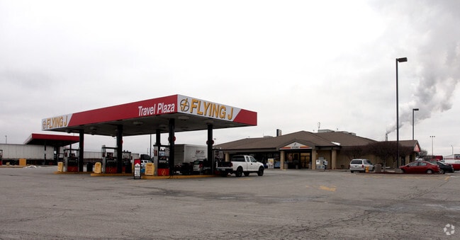
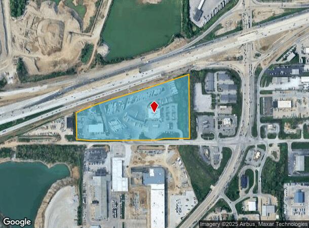
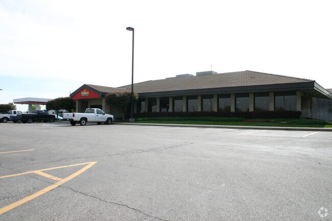
Property Record
1720 W Thompson Rd, Indianapolis, IN 46217
NEARBY LISTINGS FOR SALE OR LEASE
Property Detail
1720 W Thompson Rd
Indianapolis-Carmel-Greenwood, IN
PT NW1/4 S3 T14 R3 & PT SW1/4 S34 T15 R3 BEG NE COR NW1/4 S3 T14 R3 P.O.B. S15 W576 N15 W1328.85 N362.27 NE219.45 NE248.09 NERLY412.87 NE541.84 NE1.28 S781.14 E559.36 TO BEG 18.163AC
49-11-34-100-001.000-500
Marion
Servicestationmarket
Indiana
2023
18.16 AC
2024
Airport
380103
Indianapolis
17,404 SF
DEMOGRAPHICS near 1720 W Thompson Rd
1 Mile
3 Mile
5 Mile
2024 Total Population
1,068
46,096
166,453
2029 Population
1,047
45,253
165,220
Pop Growth 2024-2029
(1.97%)
(1.83%)
(0.74%)
Average Age
34
36
36
2024 Total Households
341
17,675
63,216
HH Growth 2024-2029
(2.05%)
(1.91%)
(0.76%)
Median Household Inc
$110,494
$62,810
$59,773
Avg Household Size
3.10
2.50
2.50
2024 Avg HH Vehicles
2.00
2.00
2.00
Median Home Value
$165,144
$176,888
$167,495
Median Year Built
1949
1974
1968
Nearby Places
Map Layers
Map Styles
 Street
 Aerial
- Restaurants
- Banks
- Shops
- Fitness
- Groceries
PUBLIC TRANSPORTATION
COMMUTER RAIL
DRIVE
WALK
Distance
12 min
6.1 mi
AIRPORT
Indianapolis International
DRIVE
WALK
Distance
Indianapolis International
27 min
13.9 mi
Nearby Properties
Address
Land Use
TOTAL SIZE
Lot Size
Zoning
Address
Land Use
TOTAL SIZE
Lot Size
Zoning
5,470 SF
35.46 AC
Address
Land Use
TOTAL SIZE
Lot Size
Zoning
405,888 SF
19.56 AC
ZO01
Address
Land Use
TOTAL SIZE
Lot Size
Zoning
5,279 SF
18.07 AC
ZO01
Address
Land Use
TOTAL SIZE
Lot Size
Zoning
1,812 SF
11.08 AC
ZO01
Address
Land Use
TOTAL SIZE
Lot Size
Zoning
3,818 SF
15.24 AC
Address
Land Use
TOTAL SIZE
Lot Size
Zoning
5,779 SF
15.77 AC
Address
Land Use
TOTAL SIZE
Lot Size
Zoning
4,476 SF
12.18 AC
Address
Land Use
TOTAL SIZE
Lot Size
Zoning
1,925 SF
29.98 AC
Address
Land Use
TOTAL SIZE
Lot Size
Zoning
3,337 SF
21.53 AC
ZO01
Address
Land Use
TOTAL SIZE
Lot Size
Zoning
65,551 SF
12.84 AC
ZO01
Address
Land Use
TOTAL SIZE
Lot Size
Zoning
5,665 SF
25.25 AC
ZO01
Address
Land Use
TOTAL SIZE
Lot Size
Zoning
39,618 SF
8.17 AC
ZO01
Address
Land Use
TOTAL SIZE
Lot Size
Zoning
1,932 SF
19.63 AC
ZO01
Address
Land Use
TOTAL SIZE
Lot Size
Zoning
18,209 SF
38.23 AC
ZO01
Address
Land Use
TOTAL SIZE
Lot Size
Zoning
2,928 SF
17.76 AC
Address
Land Use
TOTAL SIZE
Lot Size
Zoning
220,708 SF
26.81 AC
ZO01
Address
Land Use
TOTAL SIZE
Lot Size
Zoning
1,372 SF
25.27 AC
Address
Land Use
TOTAL SIZE
Lot Size
Zoning
112,178 SF
23.51 AC
ZO01
Address
Land Use
TOTAL SIZE
Lot Size
Zoning
5,075 SF
8 AC
ZO01
Address
Land Use
TOTAL SIZE
Lot Size
Zoning
72,509 SF
11.07 AC
ZO01
Address
Land Use
TOTAL SIZE
Lot Size
Zoning
24,398 SF
4.12 AC
ZO01
Address
Land Use
TOTAL SIZE
Lot Size
Zoning
355,250 SF
42.64 AC
ZO01
Address
Land Use
TOTAL SIZE
Lot Size
Zoning
104,036 SF
9.27 AC
ZO01
Address
Land Use
TOTAL SIZE
Lot Size
Zoning
18,211 SF
16.44 AC
ZO01
Address
Land Use
TOTAL SIZE
Lot Size
Zoning
22,364 SF
92.67 AC
ZO01
Address
Land Use
TOTAL SIZE
Lot Size
Zoning
1,639 SF
11.26 AC
ZO01
Address
Land Use
TOTAL SIZE
Lot Size
Zoning
141,785 SF
8.54 AC
Address
Land Use
TOTAL SIZE
Lot Size
Zoning
163,291 SF
20.99 AC
ZO01
Address
Land Use
TOTAL SIZE
Lot Size
Zoning
49,810 SF
6.40 AC
Address
Land Use
TOTAL SIZE
Lot Size
Zoning
93,650 SF
7.71 AC
ZO01
The World's #1 Commercial Real Estate Marketplace
Connect with us
© 2026 CoStar Group
The information above has been obtained from sources believed reliable. While we do not doubt its accuracy we have not verified it and make no guarantee, warranty or representation about it. It is your responsibility to independently confirm its accuracy and completeness. Any projections, opinions, assumptions, or estimates used are for example only and do not represent the current or future performance of the property. The value of this transaction to you depends on tax and other factors which should be evaluated by your tax, financial, and legal advisors. You and your advisors should conduct a careful, independent investigation of the property to determine to your satisfaction the suitability of the property for your needs.