Property Record
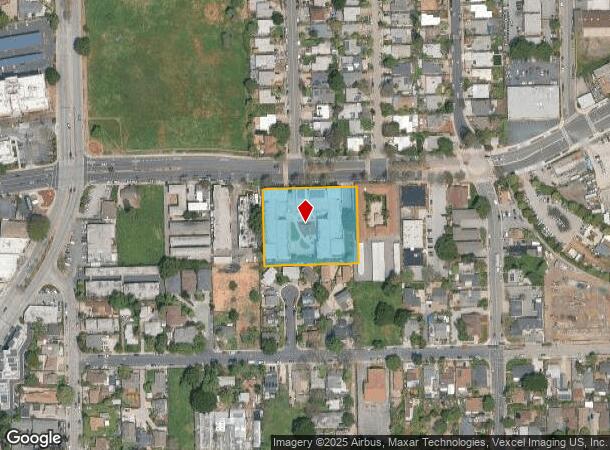
1730 Bay Rd, East Palo Alto, CA 94303
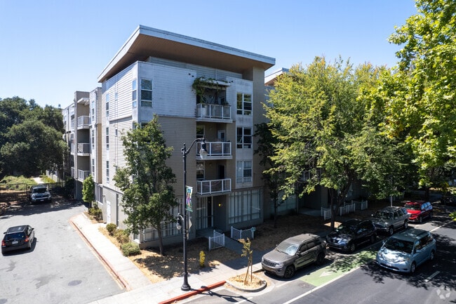
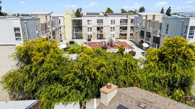
This Property Is For Sale
NEARBY LISTINGS FOR SALE OR LEASE
Property Detail
1730 Bay Rd
063-221-590
Map Faber Subdivision
Multifamilydwelling
1.596 AC MOL PAR 1 PARCEL MAP VOL 75/85-87
X
San Mateo
06081C0307F
California
2024
1.60 AC
2025
East Palo Alto
611901
San Francisco
106,705 SF
San Francisco-Redwood City-South San Francisco, CA
DEMOGRAPHICS near 1730 Bay Rd
1 Mile
3 Mile
5 Mile
2024 Total Population
22,463
86,012
216,121
2029 Population
21,152
82,368
208,413
Pop Growth 2024-2029
(5.84%)
(4.24%)
(3.57%)
Average Age
36
39
39
2024 Total Households
5,583
29,078
73,196
HH Growth 2024-2029
(6.07%)
(4.16%)
(3.50%)
Median Household Inc
$100,842
$157,137
$146,640
Avg Household Size
3.70
2.80
2.70
2024 Avg HH Vehicles
2.00
2.00
2.00
Median Home Value
$1,045,573
$1,129,992
$1,130,535
Median Year Built
1963
1959
1966
Nearby Places
- Restaurants
- Banks
- Shops
- Fitness
- Groceries
PUBLIC TRANSPORTATION
COMMUTER RAIL
Palo Alto (Caltrain - Caltrain (Caltrain), Express - Caltrain (Caltrain), Limited - Caltrain (Caltrain), Local Weekday - Caltrain (Caltrain), Local Weekend - Caltrain (Caltrain))
DRIVE
WALK
Distance
Palo Alto (Caltrain - Caltrain (Caltrain), Express - Caltrain (Caltrain), Limited - Caltrain (Caltrain), Local Weekday - Caltrain (Caltrain), Local Weekend - Caltrain (Caltrain))
9 min
3.0 mi
Menlo Park (Caltrain - Caltrain (Caltrain), Limited - Caltrain (Caltrain), Local Weekday - Caltrain (Caltrain), Local Weekend - Caltrain (Caltrain))
DRIVE
WALK
Distance
Menlo Park (Caltrain - Caltrain (Caltrain), Limited - Caltrain (Caltrain), Local Weekday - Caltrain (Caltrain), Local Weekend - Caltrain (Caltrain))
9 min
3.9 mi
AIRPORT
Norman Y Mineta San Jose International
DRIVE
WALK
Distance
Norman Y Mineta San Jose International
22 min
15.3 mi
San Francisco International
DRIVE
WALK
Distance
San Francisco International
25 min
19.2 mi
Metro Oakland International
DRIVE
WALK
Distance
Metro Oakland International
35 min
26.4 mi
Freight Ports
Port of Redwood City
DRIVE
WALK
Distance
Port of Redwood City
10 min
6.1 mi
Nearby Properties
Address
Land Use
TOTAL SIZE
Lot Size
Zoning
Address
Land Use
TOTAL SIZE
Lot Size
Zoning
719,052 SF
56.03 AC
Address
Land Use
TOTAL SIZE
Lot Size
Zoning
999,999 SF
56.91 AC
Address
Land Use
TOTAL SIZE
Lot Size
Zoning
1,395,540 SF
51.72 AC
C3
Address
Land Use
TOTAL SIZE
Lot Size
Zoning
22.07 AC
Address
Land Use
TOTAL SIZE
Lot Size
Zoning
Address
Land Use
TOTAL SIZE
Lot Size
Zoning
520,988 SF
8.88 AC
Address
Land Use
TOTAL SIZE
Lot Size
Zoning
Address
Land Use
TOTAL SIZE
Lot Size
Zoning
528,437 SF
9.69 AC
Address
Land Use
TOTAL SIZE
Lot Size
Zoning
210,000 SF
10.79 AC
Address
Land Use
TOTAL SIZE
Lot Size
Zoning
247,567 SF
3.52 AC
Address
Land Use
TOTAL SIZE
Lot Size
Zoning
212,924 SF
1.83 AC
Address
Land Use
TOTAL SIZE
Lot Size
Zoning
164,853 SF
3.89 AC
Address
Land Use
TOTAL SIZE
Lot Size
Zoning
145,617 SF
8.24 AC
EA00C1
Address
Land Use
TOTAL SIZE
Lot Size
Zoning
190,389 SF
11.20 AC
M20000
Address
Land Use
TOTAL SIZE
Lot Size
Zoning
143,429 SF
2.12 AC
Address
Land Use
TOTAL SIZE
Lot Size
Zoning
149,700 SF
2.28 AC
Address
Land Use
TOTAL SIZE
Lot Size
Zoning
222,234 SF
6.39 AC
Address
Land Use
TOTAL SIZE
Lot Size
Zoning
Address
Land Use
TOTAL SIZE
Lot Size
Zoning
190,000 SF
3.37 AC
Address
Land Use
TOTAL SIZE
Lot Size
Zoning
171,563 SF
3.57 AC
Address
Land Use
TOTAL SIZE
Lot Size
Zoning
2,024 SF
1.38 AC
Address
Land Use
TOTAL SIZE
Lot Size
Zoning
68,488 SF
1.38 AC
M20000
Address
Land Use
TOTAL SIZE
Lot Size
Zoning
259,586 SF
17.92 AC
LMD
Address
Land Use
TOTAL SIZE
Lot Size
Zoning
102,690 SF
6.71 AC
Address
Land Use
TOTAL SIZE
Lot Size
Zoning
129,899 SF
1.77 AC
Address
Land Use
TOTAL SIZE
Lot Size
Zoning
129,899 SF
1.47 AC
Address
Land Use
TOTAL SIZE
Lot Size
Zoning
297,014 SF
10.12 AC
Address
Land Use
TOTAL SIZE
Lot Size
Zoning
179,025 SF
4.96 AC
Address
Land Use
TOTAL SIZE
Lot Size
Zoning
0.41 AC
A
Address
Land Use
TOTAL SIZE
Lot Size
Zoning
0.40 AC
A
The World's #1 Commercial Real Estate Marketplace
Connect with us
© 2025 CoStar Group
The information above has been obtained from sources believed reliable. While we do not doubt its accuracy we have not verified it and make no guarantee, warranty or representation about it. It is your responsibility to independently confirm its accuracy and completeness. Any projections, opinions, assumptions, or estimates used are for example only and do not represent the current or future performance of the property. The value of this transaction to you depends on tax and other factors which should be evaluated by your tax, financial, and legal advisors. You and your advisors should conduct a careful, independent investigation of the property to determine to your satisfaction the suitability of the property for your needs.