Property Record
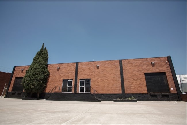
1735 W 132Nd St, Gardena, CA 90249


Property Detail
1735 W 132Nd St
6102-006-020
PANAMA ACRES LOT 29 BLK 6
Lightindustrial
Los Angeles
GAM1
California
B and X Area of moderate flood hazard, usually the area between the limits of the 100-year and 500-year floods.
29
2025
0.91 AC
2025
Gardena/Hawthorne
602900
Los Angeles
16,200 SF
Los Angeles-Long Beach-Glendale, CA
NEARBY LISTINGS FOR SALE OR LEASE
DEMOGRAPHICS near 1735 W 132Nd St
1 mile
3 mile
5 mile
2025 Total Population
22,412
313,971
805,108
2030 Population
22,254
311,049
795,118
Pop Growth 2025-2030
(0.70%)
(0.93%)
(1.24%)
Average Age
41
39
38
2025 Total Households
7,230
99,367
244,320
HH Growth 2025-2030
(0.95%)
(1.11%)
(1.41%)
Median Household Inc
$92,081
$71,541
$72,728
Avg Household Size
3.00
3.00
3.20
2025 Avg HH Vehicles
2.00
2.00
2.00
Median Home Value
$711,640
$733,025
$742,697
Median Year Built
1957
1960
1958
Nearby Places
Map Layers
Map Styles
 Street
 Aerial
Layers
 Traffic
 Biking
Places
Listings with unknown addresses are not visible on the map
- Restaurants
- Banks
- Shops
- Fitness
- Groceries
PUBLIC TRANSPORTATION
AIRPORT
Los Angeles International
Drive
Walk
Distance
Los Angeles International
13 min
8.3 mi
Long Beach (Daugherty Field)
Drive
Walk
Distance
Long Beach (Daugherty Field)
21 min
13.8 mi
Bob Hope
Drive
Walk
Distance
Bob Hope
38 min
28.8 mi
Freight Ports
Port of Long Beach
Drive
Walk
Distance
Port of Long Beach
23 min
15.7 mi
SALE & LEASE HISTORY
LISTING DATE
SALE/LEASE

Sep 06, 2018
For Sale
Oct 13, 2020
For Sale
Aug 14, 2017
For Sale
Nearby Properties
Address
Land Use
TOTAL SIZE
Lot Size
Zoning
Address
Land Use
TOTAL SIZE
Lot Size
Zoning
Address
Land Use
TOTAL SIZE
Lot Size
Zoning
Address
Land Use
TOTAL SIZE
Lot Size
Zoning
Address
Land Use
TOTAL SIZE
Lot Size
Zoning
Address
Land Use
TOTAL SIZE
Lot Size
Zoning
319,182 SF
13.30 AC
LCM11/2-B1
Address
Land Use
TOTAL SIZE
Lot Size
Zoning
227,596 SF
14.38 AC
HAM1YY
Address
Land Use
TOTAL SIZE
Lot Size
Zoning
216,354 SF
3.52 AC
HAC3
Address
Land Use
TOTAL SIZE
Lot Size
Zoning
214,782 SF
3.66 AC
GAR3
Address
Land Use
TOTAL SIZE
Lot Size
Zoning
986,604 SF
42.66 AC
HAM2YY
Address
Land Use
TOTAL SIZE
Lot Size
Zoning
59,422 SF
2.89 AC
HAM2YY
Address
Land Use
TOTAL SIZE
Lot Size
Zoning
515,047 SF
4.87 AC
COMH*
Address
Land Use
TOTAL SIZE
Lot Size
Zoning
514,397 SF
24.34 AC
COMH-B*
Address
Land Use
TOTAL SIZE
Lot Size
Zoning
472,062 SF
24.39 AC
COMH-B*
Address
Land Use
TOTAL SIZE
Lot Size
Zoning
544,967 SF
10.74 AC
HAM2YY
Address
Land Use
TOTAL SIZE
Lot Size
Zoning
230,694 SF
9.02 AC
COMH-B*
Address
Land Use
TOTAL SIZE
Lot Size
Zoning
1,106,631 SF
1.12 AC
INC2YY
Address
Land Use
TOTAL SIZE
Lot Size
Zoning
301,506 SF
CAML*
Address
Land Use
TOTAL SIZE
Lot Size
Zoning
169,426 SF
3.50 AC
LCM11/2-B1
Address
Land Use
TOTAL SIZE
Lot Size
Zoning
121,090 SF
4.18 AC
LCM2*
Address
Land Use
TOTAL SIZE
Lot Size
Zoning
109,179 SF
4.55 AC
LCM2*
Address
Land Use
TOTAL SIZE
Lot Size
Zoning
132,173 SF
11.53 AC
LCM2-B1*
Address
Land Use
TOTAL SIZE
Lot Size
Zoning
147,280 SF
6.58 AC
CAML*
Address
Land Use
TOTAL SIZE
Lot Size
Zoning
483,516 SF
11.10 AC
GAM2
Address
Land Use
TOTAL SIZE
Lot Size
Zoning
242,423 SF
6.62 AC
HAC2
Address
Land Use
TOTAL SIZE
Lot Size
Zoning
118,699 SF
5.21 AC
LCM2-B1*
Address
Land Use
TOTAL SIZE
Lot Size
Zoning
289,834 SF
6.67 AC
LCM2*
Address
Land Use
TOTAL SIZE
Lot Size
Zoning
111,266 SF
3.42 AC
LAMR1
Address
Land Use
TOTAL SIZE
Lot Size
Zoning
133,519 SF
9.31 AC
HAM2
Address
Land Use
TOTAL SIZE
Lot Size
Zoning
138,504 SF
0.59 AC
HAR4*
Address
Land Use
TOTAL SIZE
Lot Size
Zoning
106,411 SF
7.99 AC
GAC2
The World's #1 Commercial Real Estate Marketplace
Connect with us
© 2026 CoStar Group
The information above has been obtained from sources believed reliable. While we do not doubt its accuracy we have not verified it and make no guarantee, warranty or representation about it. It is your responsibility to independently confirm its accuracy and completeness. Any projections, opinions, assumptions, or estimates used are for example only and do not represent the current or future performance of the property. The value of this transaction to you depends on tax and other factors which should be evaluated by your tax, financial, and legal advisors. You and your advisors should conduct a careful, independent investigation of the property to determine to your satisfaction the suitability of the property for your needs.