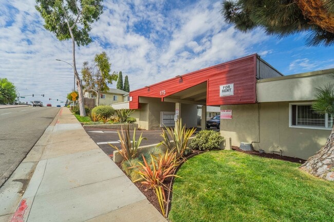
Property Record
175 E St, Chula Vista, CA 91910


Save to a Folder
{{folder.Name}}
{{folder.ListingIds.length}} Properties
{{folder.ListingIds.length}} Property
Create a New Folder
Property Detail
175 E St
566-251-16
LOT 20 (EX ST)ALLEY CLSD ADJ&ELY 123 FT OF LOT 17 THRU TR 001304
Multifamilydwelling
San Diego
R3
California
B and X Area of moderate flood hazard, usually the area between the limits of the 100-year and 500-year floods.
20,17
2025
0.73 AC
2026
Rosebank
012303
San Diego
1,472 SF
San Diego-Chula Vista-Carlsbad, CA
NEARBY LISTINGS FOR SALE OR LEASE
DEMOGRAPHICS near 175 E St
1 mile
3 mile
5 mile
2025 Total Population
26,039
179,152
436,455
2030 Population
26,240
179,120
436,069
Pop Growth 2025-2030
+ 0.77%
(0.02%)
(0.09%)
Average Age
40
39
39
2025 Total Households
9,372
56,309
128,005
HH Growth 2025-2030
+ 0.66%
(0.16%)
(0.23%)
Median Household Inc
$76,941
$78,384
$84,638
Avg Household Size
2.70
3.10
3.20
2025 Avg HH Vehicles
2.00
2.00
2.00
Median Home Value
$705,697
$705,061
$708,320
Median Year Built
1965
1967
1973
Nearby Places
Map Layers
Map Styles
 Street
 Aerial
Layers
 Traffic
 Biking
Places
Listings with unknown addresses are not visible on the map
- Restaurants
- Banks
- Shops
- Fitness
- Groceries
PUBLIC TRANSPORTATION
COMMUTER RAIL
San Diego (Santa Fe Depot) (Coaster - San Diego North County Transit District (Coaster/Sprinter/Breeze))
Drive
Walk
Distance
San Diego (Santa Fe Depot) (Coaster - San Diego North County Transit District (Coaster/Sprinter/Breeze))
16 min
9.6 mi
AIRPORT
San Diego International
Drive
Walk
Distance
San Diego International
17 min
11.7 mi
SALE & LEASE HISTORY
LISTING DATE
SALE/LEASE

Nov 10, 2022
For Sale
Mar 19, 2020
For Sale
Apr 17, 2019
For Sale
Nearby Properties
Address
Land Use
TOTAL SIZE
Lot Size
Zoning
Address
Land Use
TOTAL SIZE
Lot Size
Zoning
19.28 AC
60
Address
Land Use
TOTAL SIZE
Lot Size
Zoning
17.38 AC
UNZ
Address
Land Use
TOTAL SIZE
Lot Size
Zoning
9,999 SF
11.42 AC
CP
Address
Land Use
TOTAL SIZE
Lot Size
Zoning
9,999 SF
6.55 AC
MXD-2
Address
Land Use
TOTAL SIZE
Lot Size
Zoning
115.70 AC
Marine Ter
Address
Land Use
TOTAL SIZE
Lot Size
Zoning
9,999 SF
8.79 AC
R3
Address
Land Use
TOTAL SIZE
Lot Size
Zoning
24.70 AC
C-6
Address
Land Use
TOTAL SIZE
Lot Size
Zoning
9,999 SF
9.62 AC
MXD-2
Address
Land Use
TOTAL SIZE
Lot Size
Zoning
9,999 SF
9.44 AC
PC
Address
Land Use
TOTAL SIZE
Lot Size
Zoning
25.35 AC
UC-7
Address
Land Use
TOTAL SIZE
Lot Size
Zoning
9,999 SF
10.43 AC
RM-2
Address
Land Use
TOTAL SIZE
Lot Size
Zoning
9,999 SF
15 AC
UC-14
Address
Land Use
TOTAL SIZE
Lot Size
Zoning
9,999 SF
9.84 AC
C
Address
Land Use
TOTAL SIZE
Lot Size
Zoning
9,999 SF
7.52 AC
MCR-2
Address
Land Use
TOTAL SIZE
Lot Size
Zoning
24.06 AC
R3
Address
Land Use
TOTAL SIZE
Lot Size
Zoning
8.96 AC
UC-4
Address
Land Use
TOTAL SIZE
Lot Size
Zoning
9,999 SF
6.03 AC
R3
Address
Land Use
TOTAL SIZE
Lot Size
Zoning
9,999 SF
2.81 AC
IP
Address
Land Use
TOTAL SIZE
Lot Size
Zoning
9,999 SF
1.05 AC
C-1
Address
Land Use
TOTAL SIZE
Lot Size
Zoning
34,200 SF
1.38 AC
CCPD-R
Address
Land Use
TOTAL SIZE
Lot Size
Zoning
10 SF
2.41 AC
MXC-1
Address
Land Use
TOTAL SIZE
Lot Size
Zoning
9,999 SF
6.85 AC
IL
Address
Land Use
TOTAL SIZE
Lot Size
Zoning
6,410 SF
UNZ
Address
Land Use
TOTAL SIZE
Lot Size
Zoning
9,999 SF
RM-3
Address
Land Use
TOTAL SIZE
Lot Size
Zoning
9,999 SF
6.07 AC
MXD-1
Address
Land Use
TOTAL SIZE
Lot Size
Zoning
9,999 SF
0.68 AC
MXU
Address
Land Use
TOTAL SIZE
Lot Size
Zoning
9,999 SF
1.43 AC
UC-2
Address
Land Use
TOTAL SIZE
Lot Size
Zoning
6,920 SF
2.38 AC
RM-2
Address
Land Use
TOTAL SIZE
Lot Size
Zoning
9,999 SF
1.88 AC
UC-2
Address
Land Use
TOTAL SIZE
Lot Size
Zoning
6,876 SF
4.82 AC
CCD
The World's #1 Commercial Real Estate Marketplace
Connect with us
© 2026 CoStar Group
The information above has been obtained from sources believed reliable. While we do not doubt its accuracy we have not verified it and make no guarantee, warranty or representation about it. It is your responsibility to independently confirm its accuracy and completeness. Any projections, opinions, assumptions, or estimates used are for example only and do not represent the current or future performance of the property. The value of this transaction to you depends on tax and other factors which should be evaluated by your tax, financial, and legal advisors. You and your advisors should conduct a careful, independent investigation of the property to determine to your satisfaction the suitability of the property for your needs.