Property Record
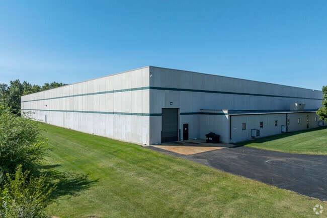
1750 Orchard Rd, Montgomery, IL 60538

NEARBY LISTINGS FOR SALE OR LEASE
Property Detail
1750 Orchard Rd
15-31-326-032
Industial-Montgomery
Industrialgeneral
THE WLY 475 FT OF THE SW 1/4 SEC 31-38-8 DESC IN DOC 90K31567 (EX PT DESC IN DOC 2001K041483) PART SW 1/4 SEC 31-38-8 LOT DIMENSIONS: 479.68 X 475 LOT SIZE: 5.23 ACRES APPROX LOT SQ FT 227818.8 SUBDIVISION: INDUSTIAL-MONTGOMERY
X
Kane
17089C0401H
Illinois
2024
5.23 AC
2024
I-88 West
854002
Chicago
84,884 SF
Chicago-Naperville-Elgin, IL-IN-WI
DEMOGRAPHICS near 1750 Orchard Rd
1 Mile
3 Mile
5 Mile
2024 Total Population
2,471
63,546
177,003
2029 Population
2,593
66,757
183,424
Pop Growth 2024-2029
+ 4.94%
+ 5.05%
+ 3.63%
Average Age
36
38
37
2024 Total Households
822
21,663
58,100
HH Growth 2024-2029
+ 4.38%
+ 4.94%
+ 3.75%
Median Household Inc
$99,568
$83,800
$78,193
Avg Household Size
3.00
2.90
3.00
2024 Avg HH Vehicles
2.00
2.00
2.00
Median Home Value
$229,577
$236,615
$230,991
Median Year Built
2001
1986
1981
Nearby Places
Map Layers
Map Styles
 Street
 Aerial
- Restaurants
- Banks
- Shops
- Fitness
- Groceries
PUBLIC TRANSPORTATION
COMMUTER RAIL
Aurora Station (Burlington Northern-Santa Fe Railway Line - Northeast Illinois Regional Commuter Railroad (Metra))
DRIVE
WALK
Distance
Aurora Station (Burlington Northern-Santa Fe Railway Line - Northeast Illinois Regional Commuter Railroad (Metra))
11 min
5.2 mi
AIRPORT
Chicago O'Hare International
DRIVE
WALK
Distance
Chicago O'Hare International
60 min
42.6 mi
Freight Ports
Port Milwaukee
DRIVE
WALK
Distance
Port Milwaukee
141 min
114.3 mi
Nearby Properties
Address
Land Use
TOTAL SIZE
Lot Size
Zoning
Address
Land Use
TOTAL SIZE
Lot Size
Zoning
19.80 AC
Address
Land Use
TOTAL SIZE
Lot Size
Zoning
350.78 AC
Address
Land Use
TOTAL SIZE
Lot Size
Zoning
989,724 SF
49.41 AC
Address
Land Use
TOTAL SIZE
Lot Size
Zoning
56.02 AC
Address
Land Use
TOTAL SIZE
Lot Size
Zoning
218,020 SF
21.35 AC
Address
Land Use
TOTAL SIZE
Lot Size
Zoning
169,918 SF
20 AC
Address
Land Use
TOTAL SIZE
Lot Size
Zoning
428,544 SF
41.38 AC
Address
Land Use
TOTAL SIZE
Lot Size
Zoning
97,136 SF
6.08 AC
Address
Land Use
TOTAL SIZE
Lot Size
Zoning
9.86 AC
Address
Land Use
TOTAL SIZE
Lot Size
Zoning
259,140 SF
18.05 AC
Address
Land Use
TOTAL SIZE
Lot Size
Zoning
366,503 SF
11.88 AC
Address
Land Use
TOTAL SIZE
Lot Size
Zoning
136,900 SF
3.63 AC
Address
Land Use
TOTAL SIZE
Lot Size
Zoning
118,236 SF
20.93 AC
Address
Land Use
TOTAL SIZE
Lot Size
Zoning
56.13 AC
Address
Land Use
TOTAL SIZE
Lot Size
Zoning
217,505 SF
17.50 AC
Address
Land Use
TOTAL SIZE
Lot Size
Zoning
3.85 AC
Address
Land Use
TOTAL SIZE
Lot Size
Zoning
581,048 SF
37.29 AC
Address
Land Use
TOTAL SIZE
Lot Size
Zoning
34,822 SF
136.74 AC
Address
Land Use
TOTAL SIZE
Lot Size
Zoning
17.35 AC
Address
Land Use
TOTAL SIZE
Lot Size
Zoning
60,275 SF
3 AC
Address
Land Use
TOTAL SIZE
Lot Size
Zoning
287,902 SF
3.31 AC
Address
Land Use
TOTAL SIZE
Lot Size
Zoning
146,500 SF
8.65 AC
Address
Land Use
TOTAL SIZE
Lot Size
Zoning
84,870 SF
5.28 AC
Address
Land Use
TOTAL SIZE
Lot Size
Zoning
98,716 SF
3.06 AC
Address
Land Use
TOTAL SIZE
Lot Size
Zoning
118,498 SF
11.28 AC
Address
Land Use
TOTAL SIZE
Lot Size
Zoning
159,966 SF
3.90 AC
Address
Land Use
TOTAL SIZE
Lot Size
Zoning
127,229 SF
11.36 AC
Address
Land Use
TOTAL SIZE
Lot Size
Zoning
224,589 SF
4.95 AC
Address
Land Use
TOTAL SIZE
Lot Size
Zoning
129,626 SF
3.50 AC
The World's #1 Commercial Real Estate Marketplace
Connect with us
© 2025 CoStar Group
The information above has been obtained from sources believed reliable. While we do not doubt its accuracy we have not verified it and make no guarantee, warranty or representation about it. It is your responsibility to independently confirm its accuracy and completeness. Any projections, opinions, assumptions, or estimates used are for example only and do not represent the current or future performance of the property. The value of this transaction to you depends on tax and other factors which should be evaluated by your tax, financial, and legal advisors. You and your advisors should conduct a careful, independent investigation of the property to determine to your satisfaction the suitability of the property for your needs.