Property Record
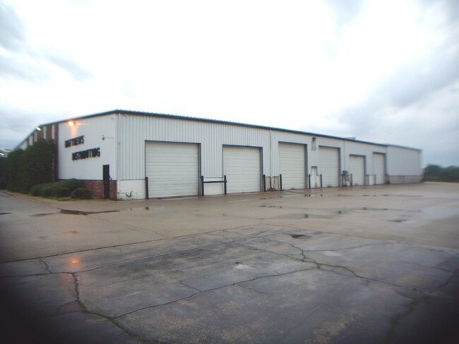
1750 S Walnut Rd, Freeport, IL 61032


Property Detail
1750 S Walnut Rd
18-19-06-300-024
PT NE1/4 SW1/4 SEC 6-26-8
Publicstorage
Stephenson
B and X Area of moderate flood hazard, usually the area between the limits of the 100-year and 500-year floods.
Illinois
2024
2.75 AC
2024
Other Market Areas
001200
Freeport, IL
NEARBY LISTINGS FOR SALE OR LEASE
DEMOGRAPHICS near 1750 S Walnut Rd
1 mile
3 mile
5 mile
2025 Total Population
7,072
24,440
27,496
2030 Population
7,019
24,170
27,086
Pop Growth 2025-2030
(0.75%)
(1.10%)
(1.49%)
Average Age
42
43
44
2025 Total Households
3,040
10,679
11,990
HH Growth 2025-2030
(0.89%)
(1.30%)
(1.68%)
Median Household Inc
$52,431
$49,299
$53,542
Avg Household Size
2.20
2.20
2.20
2025 Avg HH Vehicles
1.00
1.00
2.00
Median Home Value
$65,264
$90,120
$103,530
Median Year Built
1952
1957
1959
Nearby Places
Map Layers
Map Styles
 Street
 Aerial
Layers
 Traffic
 Biking
Places
Listings with unknown addresses are not visible on the map
- Restaurants
- Banks
- Shops
- Fitness
- Groceries
PUBLIC TRANSPORTATION
AIRPORT
Chicago/Rockford International
Drive
Walk
Distance
Chicago/Rockford International
48 min
33.2 mi
Nearby Properties
Address
Land Use
TOTAL SIZE
Lot Size
Zoning
Address
Land Use
TOTAL SIZE
Lot Size
Zoning
499,200 SF
36.03 AC
Address
Land Use
TOTAL SIZE
Lot Size
Zoning
16.04 AC
Address
Land Use
TOTAL SIZE
Lot Size
Zoning
21.95 AC
Address
Land Use
TOTAL SIZE
Lot Size
Zoning
4.31 AC
Address
Land Use
TOTAL SIZE
Lot Size
Zoning
3.51 AC
Address
Land Use
TOTAL SIZE
Lot Size
Zoning
10.52 AC
Address
Land Use
TOTAL SIZE
Lot Size
Zoning
26.60 AC
Address
Land Use
TOTAL SIZE
Lot Size
Zoning
77,686 SF
4.39 AC
Address
Land Use
TOTAL SIZE
Lot Size
Zoning
46.61 AC
Address
Land Use
TOTAL SIZE
Lot Size
Zoning
11.48 AC
Address
Land Use
TOTAL SIZE
Lot Size
Zoning
2.85 AC
Address
Land Use
TOTAL SIZE
Lot Size
Zoning
7.62 AC
Address
Land Use
TOTAL SIZE
Lot Size
Zoning
1.44 AC
Address
Land Use
TOTAL SIZE
Lot Size
Zoning
8.13 AC
Address
Land Use
TOTAL SIZE
Lot Size
Zoning
Address
Land Use
TOTAL SIZE
Lot Size
Zoning
10.37 AC
Address
Land Use
TOTAL SIZE
Lot Size
Zoning
13.20 AC
Address
Land Use
TOTAL SIZE
Lot Size
Zoning
Address
Land Use
TOTAL SIZE
Lot Size
Zoning
2.02 AC
Address
Land Use
TOTAL SIZE
Lot Size
Zoning
4.21 AC
Address
Land Use
TOTAL SIZE
Lot Size
Zoning
Address
Land Use
TOTAL SIZE
Lot Size
Zoning
5.14 AC
Address
Land Use
TOTAL SIZE
Lot Size
Zoning
5.30 AC
Address
Land Use
TOTAL SIZE
Lot Size
Zoning
4.13 AC
Address
Land Use
TOTAL SIZE
Lot Size
Zoning
38.59 AC
Address
Land Use
TOTAL SIZE
Lot Size
Zoning
4.66 AC
Address
Land Use
TOTAL SIZE
Lot Size
Zoning
1.39 AC
Address
Land Use
TOTAL SIZE
Lot Size
Zoning
9.32 AC
Address
Land Use
TOTAL SIZE
Lot Size
Zoning
7,754 SF
0.61 AC
Address
Land Use
TOTAL SIZE
Lot Size
Zoning
5.43 AC
The World's #1 Commercial Real Estate Marketplace
Connect with us
© 2026 CoStar Group
The information above has been obtained from sources believed reliable. While we do not doubt its accuracy we have not verified it and make no guarantee, warranty or representation about it. It is your responsibility to independently confirm its accuracy and completeness. Any projections, opinions, assumptions, or estimates used are for example only and do not represent the current or future performance of the property. The value of this transaction to you depends on tax and other factors which should be evaluated by your tax, financial, and legal advisors. You and your advisors should conduct a careful, independent investigation of the property to determine to your satisfaction the suitability of the property for your needs.