Property Record
1755 N State St, Orem, UT 84057
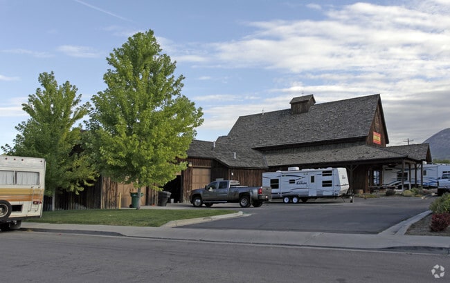

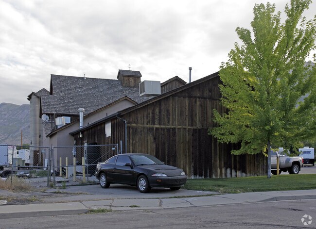

Property Detail
1755 N State St
Provo-Orem-Lehi, UT
LOT 1, PLAT A, NEALS PRIME AUTO SUBDV. AREA 1.401 AC.
47-248-0001
Utah
Storebuilding
Utah
2024
1
2025
1.40 AC
000707
Utah County
8,634 SF
Salt Lake City
NEARBY LISTINGS FOR SALE OR LEASE
DEMOGRAPHICS near 1755 N State St
1 mile
3 mile
5 mile
2025 Total Population
16,620
102,469
192,703
2030 Population
17,917
111,563
210,990
Pop Growth 2025-2030
+ 7.80%
+ 8.87%
+ 9.49%
Average Age
34
33
33
2025 Total Households
4,790
31,176
58,902
HH Growth 2025-2030
+ 8.48%
+ 9.66%
+ 10.28%
Median Household Inc
$98,456
$94,012
$94,656
Avg Household Size
3.40
3.20
3.20
2025 Avg HH Vehicles
3.00
2.00
2.00
Median Home Value
$555,827
$553,156
$567,812
Median Year Built
1990
1992
1995
Nearby Places
Map Layers
Map Styles
 Street
 Aerial
Transit
 Traffic
 Biking
Places
Listings with unknown addresses are not visible on the map
- Restaurants
- Banks
- Shops
- Fitness
- Groceries
PUBLIC TRANSPORTATION
COMMUTER RAIL
Vineyard Station (FrontRunner - Utah Transit Authority (UTA))
Drive
Walk
Distance
Vineyard Station (FrontRunner - Utah Transit Authority (UTA))
7 min
3.8 mi
Orem Central Station (FrontRunner - Utah Transit Authority (UTA))
Drive
Walk
Distance
Orem Central Station (FrontRunner - Utah Transit Authority (UTA))
11 min
5.4 mi
AIRPORT
Provo Municipal
Drive
Walk
Distance
Provo Municipal
18 min
11.8 mi
Freight Ports
Port of Stockton
Drive
Walk
Distance
Port of Stockton
749 min
732.1 mi
Nearby Properties
Address
Land Use
TOTAL SIZE
Lot Size
Zoning
Address
Land Use
TOTAL SIZE
Lot Size
Zoning
206,178 SF
16.64 AC
Address
Land Use
TOTAL SIZE
Lot Size
Zoning
472,365 SF
15.90 AC
Address
Land Use
TOTAL SIZE
Lot Size
Zoning
326,355 SF
15.12 AC
Address
Land Use
TOTAL SIZE
Lot Size
Zoning
233,302 SF
15.03 AC
Address
Land Use
TOTAL SIZE
Lot Size
Zoning
333,719 SF
11.99 AC
Address
Land Use
TOTAL SIZE
Lot Size
Zoning
230,702 SF
11.85 AC
Address
Land Use
TOTAL SIZE
Lot Size
Zoning
144,456 SF
5.55 AC
Address
Land Use
TOTAL SIZE
Lot Size
Zoning
333,724 SF
13.12 AC
Address
Land Use
TOTAL SIZE
Lot Size
Zoning
Address
Land Use
TOTAL SIZE
Lot Size
Zoning
364,248 SF
22.77 AC
Address
Land Use
TOTAL SIZE
Lot Size
Zoning
269,768 SF
14.94 AC
Address
Land Use
TOTAL SIZE
Lot Size
Zoning
194,852 SF
10.03 AC
Address
Land Use
TOTAL SIZE
Lot Size
Zoning
212,466 SF
25.89 AC
Address
Land Use
TOTAL SIZE
Lot Size
Zoning
139,462 SF
3.93 AC
Address
Land Use
TOTAL SIZE
Lot Size
Zoning
194,483 SF
10.66 AC
Address
Land Use
TOTAL SIZE
Lot Size
Zoning
179,347 SF
13.55 AC
Address
Land Use
TOTAL SIZE
Lot Size
Zoning
72,761 SF
5.92 AC
Address
Land Use
TOTAL SIZE
Lot Size
Zoning
128,992 SF
12.39 AC
Address
Land Use
TOTAL SIZE
Lot Size
Zoning
204,655 SF
8.10 AC
Address
Land Use
TOTAL SIZE
Lot Size
Zoning
59,218 SF
6.88 AC
Address
Land Use
TOTAL SIZE
Lot Size
Zoning
17,165 SF
5.29 AC
Address
Land Use
TOTAL SIZE
Lot Size
Zoning
154,973 SF
5.18 AC
Address
Land Use
TOTAL SIZE
Lot Size
Zoning
135,893 SF
9.93 AC
Address
Land Use
TOTAL SIZE
Lot Size
Zoning
2.76 AC
Address
Land Use
TOTAL SIZE
Lot Size
Zoning
83,568 SF
2 AC
Address
Land Use
TOTAL SIZE
Lot Size
Zoning
123,663 SF
5.31 AC
Address
Land Use
TOTAL SIZE
Lot Size
Zoning
127,495 SF
7.01 AC
Address
Land Use
TOTAL SIZE
Lot Size
Zoning
127,495 SF
8.02 AC
Address
Land Use
TOTAL SIZE
Lot Size
Zoning
147,492 SF
7.60 AC
Address
Land Use
TOTAL SIZE
Lot Size
Zoning
127,495 SF
7.28 AC
The World's #1 Commercial Real Estate Marketplace
Connect with us
© 2026 CoStar Group
The information above has been obtained from sources believed reliable. While we do not doubt its accuracy we have not verified it and make no guarantee, warranty or representation about it. It is your responsibility to independently confirm its accuracy and completeness. Any projections, opinions, assumptions, or estimates used are for example only and do not represent the current or future performance of the property. The value of this transaction to you depends on tax and other factors which should be evaluated by your tax, financial, and legal advisors. You and your advisors should conduct a careful, independent investigation of the property to determine to your satisfaction the suitability of the property for your needs.