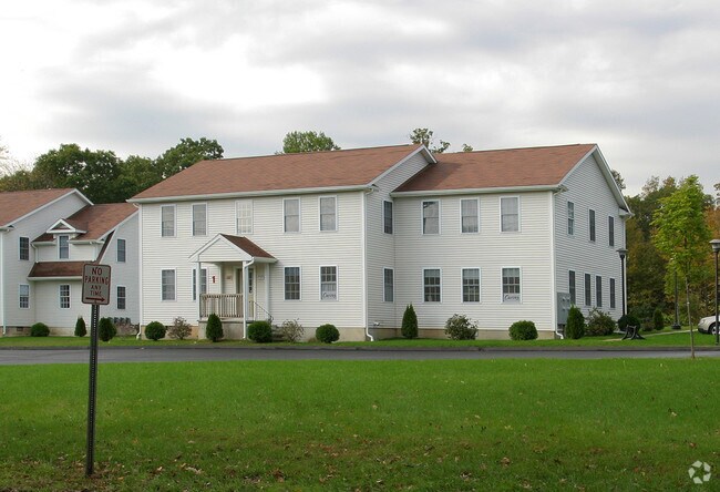
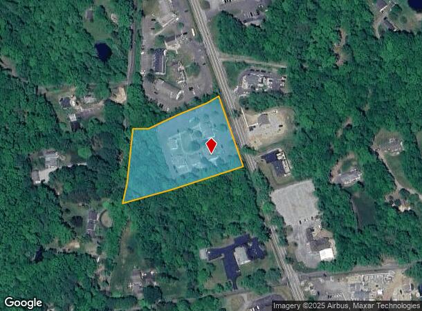
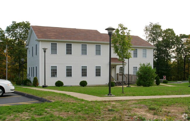
Property Record
176 Route 81, Killingworth, CT 06419
NEARBY LISTINGS FOR SALE OR LEASE
-
-
View all Killingworth listings for lease on LoopNet.com
Property Detail
176 Route 81
Commercialnec
Middlesex
X
Connecticut
09007C0310G
3.20 AC
2025
SW Midlsx/Old Saybrk/Rt 9
2025
Hartford
640100
Hartford-West Hartford-East Hartford, CT
1,624 SF
KILL-000033-000000-000067
DEMOGRAPHICS near 176 Route 81
1 Mile
3 Mile
5 Mile
2024 Total Population
914
7,433
29,589
2029 Population
916
7,442
29,582
Pop Growth 2024-2029
+ 0.22%
+ 0.12%
(0.02%)
Average Age
47
46
45
2024 Total Households
362
2,890
11,520
HH Growth 2024-2029
0.00%
(0.10%)
(0.13%)
Median Household Inc
$127,232
$129,204
$125,790
Avg Household Size
2.50
2.50
2.50
2024 Avg HH Vehicles
2.00
2.00
2.00
Median Home Value
$387,301
$372,801
$385,096
Median Year Built
1982
1980
1977
Nearby Places
Map Layers
Map Styles
 Street
 Aerial
- Restaurants
- Banks
- Shops
- Fitness
- Groceries
PUBLIC TRANSPORTATION
COMMUTER RAIL
Clinton (Shore Line East - Shore Line East)
DRIVE
WALK
Distance
Clinton (Shore Line East - Shore Line East)
10 min
5.5 mi
DRIVE
WALK
Distance
10 min
5.5 mi
AIRPORT
Tweed/New Haven
DRIVE
WALK
Distance
Tweed/New Haven
35 min
24.2 mi
Freight Ports
Port of New Haven
DRIVE
WALK
Distance
Port of New Haven
35 min
24.8 mi
SALE & LEASE HISTORY
LISTING DATE
SALE/LEASE

Sep 24, 2016
For Lease
Nearby Properties
Address
Land Use
TOTAL SIZE
Lot Size
Zoning
Address
Land Use
TOTAL SIZE
Lot Size
Zoning
384 AC
R-2
Address
Land Use
TOTAL SIZE
Lot Size
Zoning
345 AC
R-2
Address
Land Use
TOTAL SIZE
Lot Size
Zoning
60.97 AC
R-10
Address
Land Use
TOTAL SIZE
Lot Size
Zoning
3,479 SF
255.50 AC
R-2
Address
Land Use
TOTAL SIZE
Lot Size
Zoning
595.01 AC
R-2
Address
Land Use
TOTAL SIZE
Lot Size
Zoning
45.82 AC
Address
Land Use
TOTAL SIZE
Lot Size
Zoning
3.84 AC
CD
Address
Land Use
TOTAL SIZE
Lot Size
Zoning
42.50 AC
R-2
Address
Land Use
TOTAL SIZE
Lot Size
Zoning
5.60 AC
R-2
Address
Land Use
TOTAL SIZE
Lot Size
Zoning
9,030 SF
15.60 AC
R-2
Address
Land Use
TOTAL SIZE
Lot Size
Zoning
5.60 AC
CD
Address
Land Use
TOTAL SIZE
Lot Size
Zoning
12.62 AC
Address
Land Use
TOTAL SIZE
Lot Size
Zoning
7,144 SF
2 AC
R-2
Address
Land Use
TOTAL SIZE
Lot Size
Zoning
125.40 AC
R-2
Address
Land Use
TOTAL SIZE
Lot Size
Zoning
20,603 SF
2.73 AC
CD
Address
Land Use
TOTAL SIZE
Lot Size
Zoning
130.80 AC
R-80
Address
Land Use
TOTAL SIZE
Lot Size
Zoning
5.03 AC
R-2
Address
Land Use
TOTAL SIZE
Lot Size
Zoning
379.10 AC
R-2
Address
Land Use
TOTAL SIZE
Lot Size
Zoning
15.90 AC
R-2
Address
Land Use
TOTAL SIZE
Lot Size
Zoning
19,219 SF
1.52 AC
CD
Address
Land Use
TOTAL SIZE
Lot Size
Zoning
4,429 SF
1.10 AC
CD
Address
Land Use
TOTAL SIZE
Lot Size
Zoning
48.29 AC
R-80
Address
Land Use
TOTAL SIZE
Lot Size
Zoning
29,198 SF
1.91 AC
R-30
Address
Land Use
TOTAL SIZE
Lot Size
Zoning
17,450 SF
1.92 AC
ID
Address
Land Use
TOTAL SIZE
Lot Size
Zoning
1,034 SF
R-2
Address
Land Use
TOTAL SIZE
Lot Size
Zoning
5,191 SF
7.45 AC
CD
Address
Land Use
TOTAL SIZE
Lot Size
Zoning
2 AC
CD
Address
Land Use
TOTAL SIZE
Lot Size
Zoning
4,977 SF
2 AC
CD
Address
Land Use
TOTAL SIZE
Lot Size
Zoning
2,880 SF
1 AC
CD
The World's #1 Commercial Real Estate Marketplace
Connect with us
© 2025 CoStar Group
The information above has been obtained from sources believed reliable. While we do not doubt its accuracy we have not verified it and make no guarantee, warranty or representation about it. It is your responsibility to independently confirm its accuracy and completeness. Any projections, opinions, assumptions, or estimates used are for example only and do not represent the current or future performance of the property. The value of this transaction to you depends on tax and other factors which should be evaluated by your tax, financial, and legal advisors. You and your advisors should conduct a careful, independent investigation of the property to determine to your satisfaction the suitability of the property for your needs.