Property Record
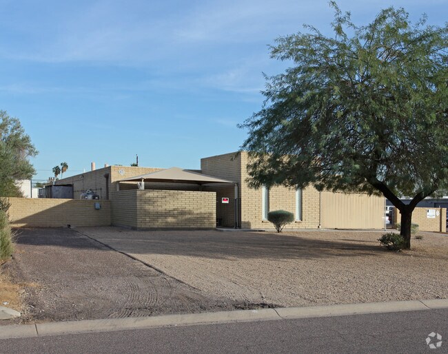
17631 N 25Th Ave, Phoenix, AZ 85023


Property Detail
17631 N 25Th Ave
208-31-016
BLACK CANYON BELL RD INDUSTRIAL PARK 1 MCR 99/02
Officebuilding
Maricopa
I-P
Arizona
C and X Area of minimal flood hazard, usually depicted on FIRMs as above the 500-year flood level.
16
2025
1 AC
2025
Deer Vly/Pinnacle Pk
618600
Phoenix
15,119 SF
Phoenix-Mesa-Chandler, AZ
NEARBY LISTINGS FOR SALE OR LEASE
DEMOGRAPHICS near 17631 N 25Th Ave
1 mile
3 mile
5 mile
2025 Total Population
14,313
148,886
323,622
2030 Population
14,663
154,635
335,146
Pop Growth 2025-2030
+ 2.45%
+ 3.86%
+ 3.56%
Average Age
39
38
39
2025 Total Households
5,509
60,240
128,180
HH Growth 2025-2030
+ 2.32%
+ 4.16%
+ 3.75%
Median Household Inc
$65,195
$73,447
$76,335
Avg Household Size
2.50
2.40
2.40
2025 Avg HH Vehicles
2.00
2.00
2.00
Median Home Value
$352,039
$387,619
$404,700
Median Year Built
1977
1985
1985
Nearby Places
Map Layers
Map Styles
 Street
 Aerial
Layers
 Traffic
 Biking
Places
Listings with unknown addresses are not visible on the map
- Restaurants
- Banks
- Shops
- Fitness
- Groceries
PUBLIC TRANSPORTATION
AIRPORT
Phoenix Sky Harbor International
Drive
Walk
Distance
Phoenix Sky Harbor International
31 min
22.3 mi
Phoenix-Mesa Gateway
Drive
Walk
Distance
Phoenix-Mesa Gateway
65 min
49.4 mi
Nearby Properties
Address
Land Use
TOTAL SIZE
Lot Size
Zoning
Address
Land Use
TOTAL SIZE
Lot Size
Zoning
249,119 SF
15.40 AC
PUD
Address
Land Use
TOTAL SIZE
Lot Size
Zoning
10.70 AC
I-P
Address
Land Use
TOTAL SIZE
Lot Size
Zoning
159,642 SF
11.85 AC
C-C
Address
Land Use
TOTAL SIZE
Lot Size
Zoning
Address
Land Use
TOTAL SIZE
Lot Size
Zoning
526,912 SF
55.64 AC
Address
Land Use
TOTAL SIZE
Lot Size
Zoning
704,521 SF
15.12 AC
C-C
Address
Land Use
TOTAL SIZE
Lot Size
Zoning
625,318 SF
15.79 AC
Address
Land Use
TOTAL SIZE
Lot Size
Zoning
16.84 AC
Address
Land Use
TOTAL SIZE
Lot Size
Zoning
434,799 SF
69.70 AC
R-8
Address
Land Use
TOTAL SIZE
Lot Size
Zoning
1,089,213 SF
53.03 AC
R-3
Address
Land Use
TOTAL SIZE
Lot Size
Zoning
17,365 SF
1.50 AC
C-G
Address
Land Use
TOTAL SIZE
Lot Size
Zoning
968,899 SF
76.37 AC
I-1
Address
Land Use
TOTAL SIZE
Lot Size
Zoning
2.62 AC
IND.PK.
Address
Land Use
TOTAL SIZE
Lot Size
Zoning
361,228 SF
24.60 AC
I-P
Address
Land Use
TOTAL SIZE
Lot Size
Zoning
296,753 SF
9.53 AC
CPBP
Address
Land Use
TOTAL SIZE
Lot Size
Zoning
314,839 SF
39 AC
R-18
Address
Land Use
TOTAL SIZE
Lot Size
Zoning
290,321 SF
37.97 AC
R-8
Address
Land Use
TOTAL SIZE
Lot Size
Zoning
28.71 AC
Address
Land Use
TOTAL SIZE
Lot Size
Zoning
291,059 SF
16.54 AC
I-1
Address
Land Use
TOTAL SIZE
Lot Size
Zoning
228,085 SF
7.84 AC
I-P
Address
Land Use
TOTAL SIZE
Lot Size
Zoning
189,524 SF
13.80 AC
I-P
Address
Land Use
TOTAL SIZE
Lot Size
Zoning
483,381 SF
27.83 AC
C-C
Address
Land Use
TOTAL SIZE
Lot Size
Zoning
229,000 SF
18.99 AC
I-P
Address
Land Use
TOTAL SIZE
Lot Size
Zoning
268,353 SF
20.45 AC
I-P
Address
Land Use
TOTAL SIZE
Lot Size
Zoning
430,038 SF
26.71 AC
M-H
Address
Land Use
TOTAL SIZE
Lot Size
Zoning
145,956 SF
10.30 AC
CP/GCP
Address
Land Use
TOTAL SIZE
Lot Size
Zoning
358,005 SF
8.54 AC
M-H
Address
Land Use
TOTAL SIZE
Lot Size
Zoning
254,079 SF
21.23 AC
Address
Land Use
TOTAL SIZE
Lot Size
Zoning
221,641 SF
21.60 AC
C-2
Address
Land Use
TOTAL SIZE
Lot Size
Zoning
171,751 SF
8.61 AC
C-2
The World's #1 Commercial Real Estate Marketplace
Connect with us
© 2026 CoStar Group
The information above has been obtained from sources believed reliable. While we do not doubt its accuracy we have not verified it and make no guarantee, warranty or representation about it. It is your responsibility to independently confirm its accuracy and completeness. Any projections, opinions, assumptions, or estimates used are for example only and do not represent the current or future performance of the property. The value of this transaction to you depends on tax and other factors which should be evaluated by your tax, financial, and legal advisors. You and your advisors should conduct a careful, independent investigation of the property to determine to your satisfaction the suitability of the property for your needs.