Property Record
17801 Dix Rd, Melvindale, MI 48122
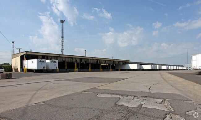


Property Detail
17801 Dix Rd
Detroit-Warren-Dearborn, MI
CA 1 THAT PART OF PRIVATE CLAIM 49 51 AND 59 DESCRIBED AS BEGINNING AT A POINT ON THE SE LINE OF SCHAEFER & DIX SUB AS RECORDED IN LIBER 55 OF PLATS PAGE 48 WCR DIS S 68D 58M W 51.66 FT FROM THE SE CORNER OF SAID SUB AND PROCEEDING TH ALONG THE BOUND
47-005-99-0001-000
Wayne
Industrialgeneral
Michigan
R1 1 FA
0001
B and X Area of moderate flood hazard, usually the area between the limits of the 100-year and 500-year floods.
15.91 AC
0
Downriver North
2025
Detroit
578600
NEARBY LISTINGS FOR SALE OR LEASE
DEMOGRAPHICS near 17801 Dix Rd
1 mile
3 mile
5 mile
2025 Total Population
12,624
103,015
294,270
2030 Population
12,357
101,498
289,505
Pop Growth 2025-2030
(2.12%)
(1.47%)
(1.62%)
Average Age
37
38
37
2025 Total Households
4,586
38,579
106,599
HH Growth 2025-2030
(2.16%)
(1.41%)
(1.62%)
Median Household Inc
$44,126
$55,002
$56,999
Avg Household Size
2.70
2.60
2.70
2025 Avg HH Vehicles
2.00
2.00
2.00
Median Home Value
$128,576
$137,269
$151,390
Median Year Built
1952
1953
1952
Nearby Places
Map Layers
Map Styles
 Street
 Aerial
Layers
 Traffic
 Biking
Places
Listings with unknown addresses are not visible on the map
- Restaurants
- Banks
- Shops
- Fitness
- Groceries
PUBLIC TRANSPORTATION
COMMUTER RAIL
Dearborn (Wolverine - Amtrak)
Drive
Walk
Distance
Dearborn (Wolverine - Amtrak)
13 min
5.1 mi
AIRPORT
Detroit Metro Wayne County
Drive
Walk
Distance
Detroit Metro Wayne County
25 min
15.4 mi
Windsor International
Drive
Walk
Distance
Windsor International
35 min
18.0 mi
Freight Ports
Port of Toledo
Drive
Walk
Distance
Port of Toledo
68 min
53.3 mi
Nearby Properties
Address
Land Use
TOTAL SIZE
Lot Size
Zoning
Address
Land Use
TOTAL SIZE
Lot Size
Zoning
590,116 SF
388.80 AC
ID
Address
Land Use
TOTAL SIZE
Lot Size
Zoning
1,209,711 SF
69.44 AC
IB
Address
Land Use
TOTAL SIZE
Lot Size
Zoning
229,368 SF
1 AC
C 6A
Address
Land Use
TOTAL SIZE
Lot Size
Zoning
153,040 SF
2.13 AC
BC
Address
Land Use
TOTAL SIZE
Lot Size
Zoning
304,206 SF
29.53 AC
RC
Address
Land Use
TOTAL SIZE
Lot Size
Zoning
357,640 SF
13.89 AC
C 6C
Address
Land Use
TOTAL SIZE
Lot Size
Zoning
135,775 SF
18.39 AC
BC
Address
Land Use
TOTAL SIZE
Lot Size
Zoning
7,320 SF
226.49 AC
Address
Land Use
TOTAL SIZE
Lot Size
Zoning
108,960 SF
5.23 AC
OS
Address
Land Use
TOTAL SIZE
Lot Size
Zoning
678,368 SF
48.99 AC
RD RESEARC
Address
Land Use
TOTAL SIZE
Lot Size
Zoning
219,434 SF
23.91 AC
BC
Address
Land Use
TOTAL SIZE
Lot Size
Zoning
198,237 SF
11.07 AC
RE
Address
Land Use
TOTAL SIZE
Lot Size
Zoning
107,772 SF
8 AC
BC
Address
Land Use
TOTAL SIZE
Lot Size
Zoning
32,608 SF
46.51 AC
BC
Address
Land Use
TOTAL SIZE
Lot Size
Zoning
80,861 SF
1.17 AC
BC
Address
Land Use
TOTAL SIZE
Lot Size
Zoning
77,974 SF
1 AC
C 6A
Address
Land Use
TOTAL SIZE
Lot Size
Zoning
111,008 SF
26.62 AC
IB
Address
Land Use
TOTAL SIZE
Lot Size
Zoning
205,632 SF
1 AC
C 6A
Address
Land Use
TOTAL SIZE
Lot Size
Zoning
169,200 SF
19.92 AC
RD RESEARC
Address
Land Use
TOTAL SIZE
Lot Size
Zoning
637,176 SF
39.11 AC
C 6C
Address
Land Use
TOTAL SIZE
Lot Size
Zoning
303,705 SF
17.28 AC
ID
Address
Land Use
TOTAL SIZE
Lot Size
Zoning
196,801 SF
38.32 AC
M5
Address
Land Use
TOTAL SIZE
Lot Size
Zoning
153,668 SF
9.16 AC
RD
Address
Land Use
TOTAL SIZE
Lot Size
Zoning
111,402 SF
3.17 AC
Address
Land Use
TOTAL SIZE
Lot Size
Zoning
115,159 SF
10.49 AC
BB
Address
Land Use
TOTAL SIZE
Lot Size
Zoning
182,840 SF
11.70 AC
C 6C
Address
Land Use
TOTAL SIZE
Lot Size
Zoning
95,549 SF
6.46 AC
RE
Address
Land Use
TOTAL SIZE
Lot Size
Zoning
147,942 SF
14 AC
IA
Address
Land Use
TOTAL SIZE
Lot Size
Zoning
193,155 SF
8.68 AC
R1 1 FA
Address
Land Use
TOTAL SIZE
Lot Size
Zoning
88,656 SF
12.66 AC
IA
The World's #1 Commercial Real Estate Marketplace
Connect with us
© 2026 CoStar Group
The information above has been obtained from sources believed reliable. While we do not doubt its accuracy we have not verified it and make no guarantee, warranty or representation about it. It is your responsibility to independently confirm its accuracy and completeness. Any projections, opinions, assumptions, or estimates used are for example only and do not represent the current or future performance of the property. The value of this transaction to you depends on tax and other factors which should be evaluated by your tax, financial, and legal advisors. You and your advisors should conduct a careful, independent investigation of the property to determine to your satisfaction the suitability of the property for your needs.