Property Record
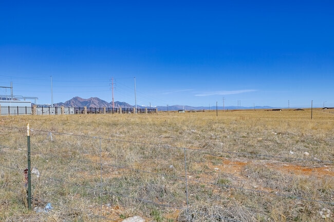
Vacant Land, Arvada, CO 80007


NEARBY LISTINGS FOR SALE OR LEASE
Property Detail
Vacant Land
Denver-Aurora-Lakewood, CO
Candelas Commercial Flg No 2
20-232-01-016
SECTION 23 TOWNSHIP 02 RANGE 70 SUBDIVISIONCD 108022 SUBDIVISIONNAME CANDELAS COMMERCIAL FLG NO 2 BLOCK 003 LOT 0001 SIZE: 211733 VALUE: 4.861
Pasture
Jefferson
X
Colorado
08059C0360F
1
2023
4.86 AC
2024
West Denver
009837
Denver
DEMOGRAPHICS near Vacant Land
1 Mile
3 Mile
5 Mile
2024 Total Population
5,017
17,799
62,115
2029 Population
5,065
17,744
61,222
Pop Growth 2024-2029
+ 0.96%
(0.31%)
(1.44%)
Average Age
36
39
42
2024 Total Households
1,549
5,869
22,838
HH Growth 2024-2029
+ 0.71%
(0.61%)
(1.53%)
Median Household Inc
$170,958
$168,830
$138,181
Avg Household Size
3.20
3.00
2.70
2024 Avg HH Vehicles
2.00
2.00
2.00
Median Home Value
$783,870
$765,270
$687,825
Median Year Built
2011
2010
1995
Nearby Places
Map Layers
Map Styles
 Street
 Aerial
- Restaurants
- Banks
- Shops
- Fitness
- Groceries
PUBLIC TRANSPORTATION
COMMUTER RAIL
Wheat Ridge - Ward Station Track 1 (Union Station to Wheat Ridge Ward Station - Regional Transportation District)
DRIVE
WALK
Distance
Wheat Ridge - Ward Station Track 1 (Union Station to Wheat Ridge Ward Station - Regional Transportation District)
15 min
8.2 mi
Arvada Ridge Station Track 1 (Union Station to Wheat Ridge Ward Station - Regional Transportation District)
DRIVE
WALK
Distance
Arvada Ridge Station Track 1 (Union Station to Wheat Ridge Ward Station - Regional Transportation District)
16 min
9.0 mi
AIRPORT
Denver International
DRIVE
WALK
Distance
Denver International
51 min
36.3 mi
Freight Ports
Tulsa Port Of Catoosa
DRIVE
WALK
Distance
Tulsa Port Of Catoosa
748 min
721.8 mi
Nearby Properties
Address
Land Use
TOTAL SIZE
Lot Size
Zoning
Address
Land Use
TOTAL SIZE
Lot Size
Zoning
819.44 AC
A2
Address
Land Use
TOTAL SIZE
Lot Size
Zoning
3,318.13 AC
A2
Address
Land Use
TOTAL SIZE
Lot Size
Zoning
1,968.53 AC
Address
Land Use
TOTAL SIZE
Lot Size
Zoning
68,300 SF
6 AC
Address
Land Use
TOTAL SIZE
Lot Size
Zoning
110,235 SF
2.32 AC
Address
Land Use
TOTAL SIZE
Lot Size
Zoning
53,051 SF
70.19 AC
I2
Address
Land Use
TOTAL SIZE
Lot Size
Zoning
580.19 AC
Address
Land Use
TOTAL SIZE
Lot Size
Zoning
121,192 SF
12.43 AC
Address
Land Use
TOTAL SIZE
Lot Size
Zoning
95,412 SF
5.32 AC
Address
Land Use
TOTAL SIZE
Lot Size
Zoning
44,797 SF
4.35 AC
Address
Land Use
TOTAL SIZE
Lot Size
Zoning
20,173 SF
142.57 AC
A2
Address
Land Use
TOTAL SIZE
Lot Size
Zoning
53,400 SF
6.40 AC
Address
Land Use
TOTAL SIZE
Lot Size
Zoning
75.88 AC
Address
Land Use
TOTAL SIZE
Lot Size
Zoning
392.69 AC
Address
Land Use
TOTAL SIZE
Lot Size
Zoning
320 AC
A2
Address
Land Use
TOTAL SIZE
Lot Size
Zoning
302.47 AC
MC
Address
Land Use
TOTAL SIZE
Lot Size
Zoning
295.40 AC
Address
Land Use
TOTAL SIZE
Lot Size
Zoning
23,906 SF
1.14 AC
Address
Land Use
TOTAL SIZE
Lot Size
Zoning
37,296 SF
8.45 AC
PD
Address
Land Use
TOTAL SIZE
Lot Size
Zoning
13,180 SF
2.86 AC
Address
Land Use
TOTAL SIZE
Lot Size
Zoning
13,050 SF
1.37 AC
Address
Land Use
TOTAL SIZE
Lot Size
Zoning
10,886 SF
1.47 AC
Address
Land Use
TOTAL SIZE
Lot Size
Zoning
46,071 SF
3.01 AC
PD
Address
Land Use
TOTAL SIZE
Lot Size
Zoning
59.51 AC
Address
Land Use
TOTAL SIZE
Lot Size
Zoning
14,677 SF
2.20 AC
Address
Land Use
TOTAL SIZE
Lot Size
Zoning
224.74 AC
Address
Land Use
TOTAL SIZE
Lot Size
Zoning
959.65 AC
A2
Address
Land Use
TOTAL SIZE
Lot Size
Zoning
29,933 SF
3.04 AC
PD
Address
Land Use
TOTAL SIZE
Lot Size
Zoning
12,789 SF
1.83 AC
Address
Land Use
TOTAL SIZE
Lot Size
Zoning
5,672 SF
1.34 AC
The World's #1 Commercial Real Estate Marketplace
Connect with us
© 2026 CoStar Group
The information above has been obtained from sources believed reliable. While we do not doubt its accuracy we have not verified it and make no guarantee, warranty or representation about it. It is your responsibility to independently confirm its accuracy and completeness. Any projections, opinions, assumptions, or estimates used are for example only and do not represent the current or future performance of the property. The value of this transaction to you depends on tax and other factors which should be evaluated by your tax, financial, and legal advisors. You and your advisors should conduct a careful, independent investigation of the property to determine to your satisfaction the suitability of the property for your needs.