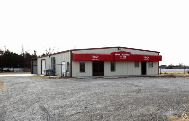
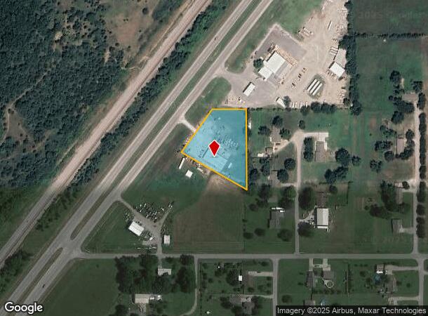
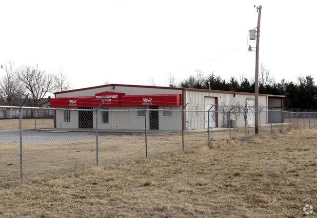
Property Record
17971 S Highway 66, Claremore, OK 74017
NEARBY LISTINGS FOR SALE OR LEASE
-
-
View all Claremore listings for sale on LoopNet.com
Property Detail
17971 S Highway 66
660023205
22N-16E
Storebuilding
TR IN S/2 SW SE DESC AS; COMM SW/C SE SW SE, TH E 164.98', N 295.69' TO POB, TH N 364.28' TO N/L SE SW SE, TH W 143.04' TO PT
X
Rogers
40131C0280H
Oklahoma
2024
1.50 AC
2025
Rogers County
050303
Tulsa
1,850 SF
Tulsa, OK
DEMOGRAPHICS near 17971 S Highway 66
1 Mile
3 Mile
5 Mile
2024 Total Population
548
11,965
29,837
2029 Population
589
13,070
32,577
Pop Growth 2024-2029
+ 7.48%
+ 9.24%
+ 9.18%
Average Age
42
41
40
2024 Total Households
208
4,869
11,534
HH Growth 2024-2029
+ 7.69%
+ 9.34%
+ 9.33%
Median Household Inc
$94,256
$59,629
$61,339
Avg Household Size
2.60
2.40
2.40
2024 Avg HH Vehicles
3.00
2.00
2.00
Median Home Value
$208,182
$168,161
$173,250
Median Year Built
1994
1983
1985
Nearby Places
Map Layers
Map Styles
 Street
 Aerial
- Restaurants
- Banks
- Shops
- Fitness
- Groceries
PUBLIC TRANSPORTATION
AIRPORT
Tulsa International
DRIVE
WALK
Distance
Tulsa International
36 min
23.9 mi
Nearby Properties
Address
Land Use
TOTAL SIZE
Lot Size
Zoning
Address
Land Use
TOTAL SIZE
Lot Size
Zoning
24,886 SF
2.05 AC
Address
Land Use
TOTAL SIZE
Lot Size
Zoning
30,872 SF
29.26 AC
Address
Land Use
TOTAL SIZE
Lot Size
Zoning
2,000 SF
13.81 AC
Address
Land Use
TOTAL SIZE
Lot Size
Zoning
32,000 SF
Address
Land Use
TOTAL SIZE
Lot Size
Zoning
15,680 SF
10.72 AC
Address
Land Use
TOTAL SIZE
Lot Size
Zoning
5,096 SF
7.27 AC
Address
Land Use
TOTAL SIZE
Lot Size
Zoning
51,048 SF
Address
Land Use
TOTAL SIZE
Lot Size
Zoning
14,724 SF
6 AC
Address
Land Use
TOTAL SIZE
Lot Size
Zoning
115,699 SF
5.18 AC
Address
Land Use
TOTAL SIZE
Lot Size
Zoning
450 SF
16.43 AC
Address
Land Use
TOTAL SIZE
Lot Size
Zoning
35,700 SF
Address
Land Use
TOTAL SIZE
Lot Size
Zoning
5,700 SF
1.05 AC
Address
Land Use
TOTAL SIZE
Lot Size
Zoning
75,840 SF
11.10 AC
Address
Land Use
TOTAL SIZE
Lot Size
Zoning
168,245 SF
16.74 AC
Address
Land Use
TOTAL SIZE
Lot Size
Zoning
18,000 SF
Address
Land Use
TOTAL SIZE
Lot Size
Zoning
7,351 SF
0.72 AC
Address
Land Use
TOTAL SIZE
Lot Size
Zoning
5,710 SF
1.72 AC
Address
Land Use
TOTAL SIZE
Lot Size
Zoning
103,996 SF
20.33 AC
Address
Land Use
TOTAL SIZE
Lot Size
Zoning
6,792 SF
27.51 AC
Address
Land Use
TOTAL SIZE
Lot Size
Zoning
7,008 SF
0.95 AC
Address
Land Use
TOTAL SIZE
Lot Size
Zoning
12,544 SF
Address
Land Use
TOTAL SIZE
Lot Size
Zoning
81,816 SF
3.19 AC
Address
Land Use
TOTAL SIZE
Lot Size
Zoning
13,098 SF
1.58 AC
Address
Land Use
TOTAL SIZE
Lot Size
Zoning
6,003 SF
1.49 AC
Address
Land Use
TOTAL SIZE
Lot Size
Zoning
16,278 SF
2.17 AC
Address
Land Use
TOTAL SIZE
Lot Size
Zoning
55,560 SF
10 AC
Address
Land Use
TOTAL SIZE
Lot Size
Zoning
3,364 SF
8.30 AC
Address
Land Use
TOTAL SIZE
Lot Size
Zoning
8,660 SF
6.11 AC
Address
Land Use
TOTAL SIZE
Lot Size
Zoning
12,492 SF
2.45 AC
Address
Land Use
TOTAL SIZE
Lot Size
Zoning
2,250 SF
The World's #1 Commercial Real Estate Marketplace
Connect with us
© 2026 CoStar Group
The information above has been obtained from sources believed reliable. While we do not doubt its accuracy we have not verified it and make no guarantee, warranty or representation about it. It is your responsibility to independently confirm its accuracy and completeness. Any projections, opinions, assumptions, or estimates used are for example only and do not represent the current or future performance of the property. The value of this transaction to you depends on tax and other factors which should be evaluated by your tax, financial, and legal advisors. You and your advisors should conduct a careful, independent investigation of the property to determine to your satisfaction the suitability of the property for your needs.