Property Record
18 S Main St, Topsfield, MA 01983
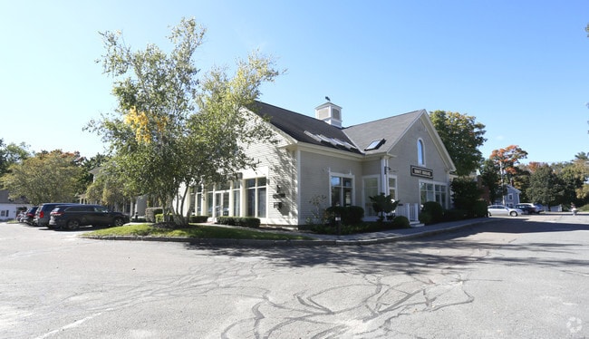

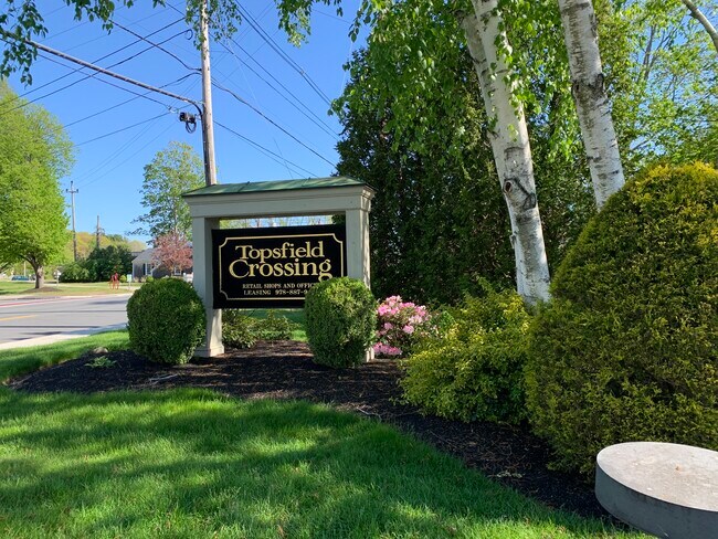
Property Detail
18 S Main St
PEAB M:0007 B:0070
ESSEX
Commercialnec
Massachusetts
BV
1.50 AC
B and X Area of moderate flood hazard, usually the area between the limits of the 100-year and 500-year floods.
Danvers/Beverly
2025
Boston
2025
Boston-Cambridge-Newton, MA-NH
214100
NEARBY LISTINGS FOR SALE OR LEASE
DEMOGRAPHICS near 18 S Main St
1 mile
3 mile
5 mile
2025 Total Population
2,901
13,868
53,880
2030 Population
2,988
14,320
55,633
Pop Growth 2025-2030
+ 3.00%
+ 3.26%
+ 3.25%
Average Age
43
43
43
2025 Total Households
986
4,692
19,248
HH Growth 2025-2030
+ 3.04%
+ 3.35%
+ 3.29%
Median Household Inc
$174,282
$171,365
$139,935
Avg Household Size
2.90
2.80
2.70
2025 Avg HH Vehicles
2.00
2.00
2.00
Median Home Value
$819,896
$819,515
$767,233
Median Year Built
1969
1973
1971
Nearby Places
Map Layers
Map Styles
 Street
 Aerial
Layers
 Traffic
 Biking
Places
Listings with unknown addresses are not visible on the map
- Restaurants
- Banks
- Shops
- Fitness
- Groceries
PUBLIC TRANSPORTATION
COMMUTER RAIL
Hamilton/Wenham (Newburyport/Rockport Line - Massachusetts Bay Transportation Authority Commuter Rail (Purple Line))
Drive
Walk
Distance
Hamilton/Wenham (Newburyport/Rockport Line - Massachusetts Bay Transportation Authority Commuter Rail (Purple Line))
13 min
6.3 mi
North Beverly (Newburyport/Rockport Line - Massachusetts Bay Transportation Authority Commuter Rail (Purple Line))
Drive
Walk
Distance
North Beverly (Newburyport/Rockport Line - Massachusetts Bay Transportation Authority Commuter Rail (Purple Line))
13 min
7.0 mi
AIRPORT
General Edward Lawrence Logan International
Drive
Walk
Distance
General Edward Lawrence Logan International
36 min
22.3 mi
Portsmouth International at Pease
Drive
Walk
Distance
Portsmouth International at Pease
47 min
34.8 mi
Manchester Boston Regional
Drive
Walk
Distance
Manchester Boston Regional
69 min
40.8 mi
SALE & LEASE HISTORY
LISTING DATE
SALE/LEASE

Jun 05, 2024
For Lease
Nearby Properties
Address
Land Use
TOTAL SIZE
Lot Size
Zoning
Address
Land Use
TOTAL SIZE
Lot Size
Zoning
374,769 SF
71.70 AC
Address
Land Use
TOTAL SIZE
Lot Size
Zoning
12.57 AC
IH
Address
Land Use
TOTAL SIZE
Lot Size
Zoning
8.60 AC
I1
Address
Land Use
TOTAL SIZE
Lot Size
Zoning
12.73 AC
IH
Address
Land Use
TOTAL SIZE
Lot Size
Zoning
454 AC
R3
Address
Land Use
TOTAL SIZE
Lot Size
Zoning
198.01 AC
ORA
Address
Land Use
TOTAL SIZE
Lot Size
Zoning
121,000 SF
2.33 AC
I1
Address
Land Use
TOTAL SIZE
Lot Size
Zoning
159 AC
RRA
Address
Land Use
TOTAL SIZE
Lot Size
Zoning
322,183 SF
11.32 AC
HC
Address
Land Use
TOTAL SIZE
Lot Size
Zoning
1,157 SF
7.62 AC
ORA
Address
Land Use
TOTAL SIZE
Lot Size
Zoning
4,035 SF
760.37 AC
IRA
Address
Land Use
TOTAL SIZE
Lot Size
Zoning
57,011 SF
14.14 AC
IRA
Address
Land Use
TOTAL SIZE
Lot Size
Zoning
8.74 AC
IRA
Address
Land Use
TOTAL SIZE
Lot Size
Zoning
39,972 SF
6.26 AC
I1
Address
Land Use
TOTAL SIZE
Lot Size
Zoning
212.80 AC
RRA
Address
Land Use
TOTAL SIZE
Lot Size
Zoning
53,265 SF
11.29 AC
CR
Address
Land Use
TOTAL SIZE
Lot Size
Zoning
40,638 SF
3.90 AC
Address
Land Use
TOTAL SIZE
Lot Size
Zoning
15.20 AC
ORA
Address
Land Use
TOTAL SIZE
Lot Size
Zoning
24.49 AC
R1B
Address
Land Use
TOTAL SIZE
Lot Size
Zoning
35,217 SF
4.15 AC
I1
Address
Land Use
TOTAL SIZE
Lot Size
Zoning
61 AC
ORA
Address
Land Use
TOTAL SIZE
Lot Size
Zoning
7.39 AC
CR
Address
Land Use
TOTAL SIZE
Lot Size
Zoning
4.80 AC
BP
Address
Land Use
TOTAL SIZE
Lot Size
Zoning
6,358 SF
3.37 AC
Address
Land Use
TOTAL SIZE
Lot Size
Zoning
4,000 SF
158.78 AC
ORA
Address
Land Use
TOTAL SIZE
Lot Size
Zoning
130 AC
ORA
Address
Land Use
TOTAL SIZE
Lot Size
Zoning
2,244 SF
60.40 AC
IRA
Address
Land Use
TOTAL SIZE
Lot Size
Zoning
28 AC
RRA
Address
Land Use
TOTAL SIZE
Lot Size
Zoning
28,992 SF
2.89 AC
I1
Address
Land Use
TOTAL SIZE
Lot Size
Zoning
12,024 SF
0.94 AC
CR
The World's #1 Commercial Real Estate Marketplace
Connect with us
© 2026 CoStar Group
The information above has been obtained from sources believed reliable. While we do not doubt its accuracy we have not verified it and make no guarantee, warranty or representation about it. It is your responsibility to independently confirm its accuracy and completeness. Any projections, opinions, assumptions, or estimates used are for example only and do not represent the current or future performance of the property. The value of this transaction to you depends on tax and other factors which should be evaluated by your tax, financial, and legal advisors. You and your advisors should conduct a careful, independent investigation of the property to determine to your satisfaction the suitability of the property for your needs.