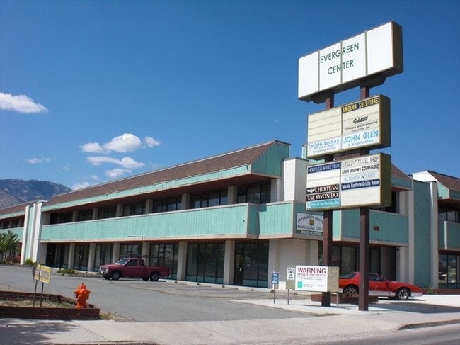
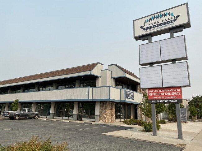
Property Record
1802 N Carson St, Carson City, NV 89701


Property Detail
1802 N Carson St
001-091-08
PARCEL B MAP #427
Commercialnec
Carson City
RC
Nevada
C and X Area of minimal flood hazard, usually depicted on FIRMs as above the 500-year flood level.
b
2025
2.36 AC
2025
Carson City County
000200
Reno/Sparks
52,272 SF
Carson City, NV
NEARBY LISTINGS FOR SALE OR LEASE
DEMOGRAPHICS near 1802 N Carson St
1 mile
3 mile
5 mile
2025 Total Population
13,149
51,621
58,069
2030 Population
13,130
51,433
57,911
Pop Growth 2025-2030
(0.14%)
(0.36%)
(0.27%)
Average Age
43
43
44
2025 Total Households
5,852
21,238
23,440
HH Growth 2025-2030
(0.26%)
(0.42%)
(0.29%)
Median Household Inc
$70,215
$69,271
$71,043
Avg Household Size
2.20
2.30
2.30
2025 Avg HH Vehicles
2.00
2.00
2.00
Median Home Value
$449,015
$433,842
$451,812
Median Year Built
1978
1980
1982
Nearby Places
Map Layers
Map Styles
 Street
 Aerial
Layers
 Traffic
 Biking
Places
Listings with unknown addresses are not visible on the map
- Restaurants
- Banks
- Shops
- Fitness
- Groceries
PUBLIC TRANSPORTATION
AIRPORT
Reno/Tahoe International
Drive
Walk
Distance
Reno/Tahoe International
36 min
27.4 mi
SALE & LEASE HISTORY
LISTING DATE
SALE/LEASE

Sep 25, 2016
For Lease
Oct 16, 2018
For Sale
Mar 17, 2020
For Lease
Jul 19, 2017
For Sale
Jul 11, 2019
For Sale
Feb 19, 2020
For Lease
Feb 17, 2020
For Lease
Nearby Properties
Address
Land Use
TOTAL SIZE
Lot Size
Zoning
Address
Land Use
TOTAL SIZE
Lot Size
Zoning
383,670 SF
31.92 AC
RC
Address
Land Use
TOTAL SIZE
Lot Size
Zoning
428,691 SF
10.40 AC
P
Address
Land Use
TOTAL SIZE
Lot Size
Zoning
208,552 SF
84.87 AC
PR
Address
Land Use
TOTAL SIZE
Lot Size
Zoning
356,776 SF
64.42 AC
P
Address
Land Use
TOTAL SIZE
Lot Size
Zoning
175,233 SF
5.88 AC
PR
Address
Land Use
TOTAL SIZE
Lot Size
Zoning
7,419 SF
0.71 AC
PR
Address
Land Use
TOTAL SIZE
Lot Size
Zoning
272,519 SF
102.35 AC
P
Address
Land Use
TOTAL SIZE
Lot Size
Zoning
144,231 SF
25.73 AC
P
Address
Land Use
TOTAL SIZE
Lot Size
Zoning
3,120 SF
6.12 AC
NB
Address
Land Use
TOTAL SIZE
Lot Size
Zoning
92,560 SF
4.93 AC
MFA
Address
Land Use
TOTAL SIZE
Lot Size
Zoning
96,057 SF
10 AC
LI
Address
Land Use
TOTAL SIZE
Lot Size
Zoning
213,246 SF
19.48 AC
GC-RC
Address
Land Use
TOTAL SIZE
Lot Size
Zoning
157,914 SF
7.15 AC
PR
Address
Land Use
TOTAL SIZE
Lot Size
Zoning
8,000 SF
413.63 AC
PC
Address
Land Use
TOTAL SIZE
Lot Size
Zoning
137,022 SF
5.29 AC
RC
Address
Land Use
TOTAL SIZE
Lot Size
Zoning
109,200 SF
9.35 AC
GC
Address
Land Use
TOTAL SIZE
Lot Size
Zoning
89,408 SF
39.22 AC
P
Address
Land Use
TOTAL SIZE
Lot Size
Zoning
169,086 SF
18.49 AC
RC-P
Address
Land Use
TOTAL SIZE
Lot Size
Zoning
29.98 AC
PC
Address
Land Use
TOTAL SIZE
Lot Size
Zoning
116,494 SF
16.39 AC
P
Address
Land Use
TOTAL SIZE
Lot Size
Zoning
87,992 SF
4.13 AC
P
Address
Land Use
TOTAL SIZE
Lot Size
Zoning
138,001 SF
2.20 AC
P
Address
Land Use
TOTAL SIZE
Lot Size
Zoning
70,843 SF
24.29 AC
PR
Address
Land Use
TOTAL SIZE
Lot Size
Zoning
75,863 SF
3.92 AC
RC
Address
Land Use
TOTAL SIZE
Lot Size
Zoning
111,950 SF
18.20 AC
RC-MHP
Address
Land Use
TOTAL SIZE
Lot Size
Zoning
113,007 SF
52.90 AC
PR
Address
Land Use
TOTAL SIZE
Lot Size
Zoning
4,685 SF
49.08 AC
PR
Address
Land Use
TOTAL SIZE
Lot Size
Zoning
156,408 SF
2.08 AC
MFA-GC
Address
Land Use
TOTAL SIZE
Lot Size
Zoning
160 AC
PR
Address
Land Use
TOTAL SIZE
Lot Size
Zoning
125,780 SF
28.21 AC
P
The World's #1 Commercial Real Estate Marketplace
Connect with us
© 2026 CoStar Group
The information above has been obtained from sources believed reliable. While we do not doubt its accuracy we have not verified it and make no guarantee, warranty or representation about it. It is your responsibility to independently confirm its accuracy and completeness. Any projections, opinions, assumptions, or estimates used are for example only and do not represent the current or future performance of the property. The value of this transaction to you depends on tax and other factors which should be evaluated by your tax, financial, and legal advisors. You and your advisors should conduct a careful, independent investigation of the property to determine to your satisfaction the suitability of the property for your needs.