Property Record
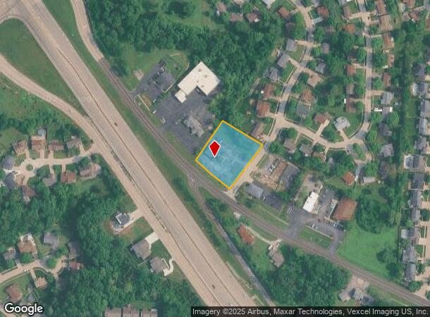
1803 Smizer Station Rd, Fenton, MO 63026


NEARBY LISTINGS FOR SALE OR LEASE
Property Detail
1803 Smizer Station Rd
27P-13-0095
Bentley Manor Plat 2
Officebuilding
BENTLEY MANOR PLAT 2 TRACT A
X
St. Louis
29099C0050F
Missouri
2024
0.99 AC
2025
Fenton
221426
St. Louis
5,000 SF
St. Louis, MO-IL
DEMOGRAPHICS near 1803 Smizer Station Rd
1 Mile
3 Mile
5 Mile
2024 Total Population
6,719
45,216
120,695
2029 Population
6,545
44,356
119,554
Pop Growth 2024-2029
(2.59%)
(1.90%)
(0.95%)
Average Age
42
42
42
2024 Total Households
2,534
18,587
48,115
HH Growth 2024-2029
(2.68%)
(1.92%)
(0.91%)
Median Household Inc
$108,466
$86,145
$91,899
Avg Household Size
2.60
2.40
2.50
2024 Avg HH Vehicles
2.00
2.00
2.00
Median Home Value
$325,576
$272,030
$286,294
Median Year Built
1988
1985
1981
Nearby Places
Map Layers
Map Styles
 Street
 Aerial
- Restaurants
- Banks
- Shops
- Fitness
- Groceries
PUBLIC TRANSPORTATION
AIRPORT
St Louis Lambert International
DRIVE
WALK
Distance
St Louis Lambert International
32 min
27.2 mi
Freight Ports
Port of Shreveport
DRIVE
WALK
Distance
Port of Shreveport
1 min
461.5 mi
SALE & LEASE HISTORY
LISTING DATE
SALE/LEASE

Sep 25, 2016
For Lease
May 10, 2022
For Lease
Mar 15, 2024
For Lease
Mar 05, 2021
For Sale
Jan 17, 2018
For Lease
Nearby Properties
Address
Land Use
TOTAL SIZE
Lot Size
Zoning
Address
Land Use
TOTAL SIZE
Lot Size
Zoning
429,212 SF
53.13 AC
C-8
Address
Land Use
TOTAL SIZE
Lot Size
Zoning
862,067 SF
40.98 AC
C-8
Address
Land Use
TOTAL SIZE
Lot Size
Zoning
633,127 SF
51.20 AC
NU
Address
Land Use
TOTAL SIZE
Lot Size
Zoning
256,956 SF
23.68 AC
21IP-1
Address
Land Use
TOTAL SIZE
Lot Size
Zoning
62.50 AC
NU
Address
Land Use
TOTAL SIZE
Lot Size
Zoning
534,280 SF
23.37 AC
21IP-1
Address
Land Use
TOTAL SIZE
Lot Size
Zoning
105.49 AC
Address
Land Use
TOTAL SIZE
Lot Size
Zoning
284,400 SF
10.72 AC
55RSING
Address
Land Use
TOTAL SIZE
Lot Size
Zoning
460,421 SF
34.91 AC
21BP-2
Address
Land Use
TOTAL SIZE
Lot Size
Zoning
194,252 SF
10.66 AC
21IP-1
Address
Land Use
TOTAL SIZE
Lot Size
Zoning
258,312 SF
16.34 AC
CC2
Address
Land Use
TOTAL SIZE
Lot Size
Zoning
68,441 SF
26.01 AC
58PDC
Address
Land Use
TOTAL SIZE
Lot Size
Zoning
19.25 AC
55INSTU
Address
Land Use
TOTAL SIZE
Lot Size
Zoning
117.18 AC
FPPS
Address
Land Use
TOTAL SIZE
Lot Size
Zoning
139,212 SF
15.58 AC
21C-1
Address
Land Use
TOTAL SIZE
Lot Size
Zoning
112,840 SF
0.54 AC
C-8
Address
Land Use
TOTAL SIZE
Lot Size
Zoning
159,696 SF
10.52 AC
21IP-1
Address
Land Use
TOTAL SIZE
Lot Size
Zoning
157,584 SF
13.60 AC
21IP-1
Address
Land Use
TOTAL SIZE
Lot Size
Zoning
10.41 AC
21IP-1
Address
Land Use
TOTAL SIZE
Lot Size
Zoning
26.56 AC
NU
Address
Land Use
TOTAL SIZE
Lot Size
Zoning
375,522 SF
42.58 AC
C-8
Address
Land Use
TOTAL SIZE
Lot Size
Zoning
148,800 SF
26.31 AC
21IP-1
Address
Land Use
TOTAL SIZE
Lot Size
Zoning
206,018 SF
18.78 AC
R1
Address
Land Use
TOTAL SIZE
Lot Size
Zoning
224,872 SF
34.78 AC
21BP-2
Address
Land Use
TOTAL SIZE
Lot Size
Zoning
129,090 SF
17.78 AC
21C-1
Address
Land Use
TOTAL SIZE
Lot Size
Zoning
8.84 AC
21IP-1
Address
Land Use
TOTAL SIZE
Lot Size
Zoning
246,426 SF
8.87 AC
94R-6
Address
Land Use
TOTAL SIZE
Lot Size
Zoning
182,616 SF
15.86 AC
21IP-1
Address
Land Use
TOTAL SIZE
Lot Size
Zoning
211,612 SF
41.36 AC
PB
Address
Land Use
TOTAL SIZE
Lot Size
Zoning
9.63 AC
21IP-1
The World's #1 Commercial Real Estate Marketplace
Connect with us
© 2025 CoStar Group
The information above has been obtained from sources believed reliable. While we do not doubt its accuracy we have not verified it and make no guarantee, warranty or representation about it. It is your responsibility to independently confirm its accuracy and completeness. Any projections, opinions, assumptions, or estimates used are for example only and do not represent the current or future performance of the property. The value of this transaction to you depends on tax and other factors which should be evaluated by your tax, financial, and legal advisors. You and your advisors should conduct a careful, independent investigation of the property to determine to your satisfaction the suitability of the property for your needs.