Property Record
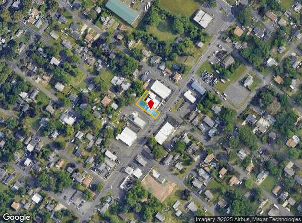
1804 Brownsville Rd, Feasterville Trevose, PA 19053


NEARBY LISTINGS FOR SALE OR LEASE
Property Detail
1804 Brownsville Rd
Philadelphia-Camden-Wilmington, PA-NJ-DE-MD
Trevose Hgts
21-030-041
TREVOSE HGTS 1 SEC 5 LOTS #1-2-12 40X147
Laundromat
Bucks
X
Pennsylvania
42017C0438J
1-2-1
2024
0.14 AC
2025
Lower Bucks County
101405
Philadelphia
1,600 SF
DEMOGRAPHICS near 1804 Brownsville Rd
1 Mile
3 Mile
5 Mile
2024 Total Population
12,169
73,540
241,945
2029 Population
12,154
73,273
241,204
Pop Growth 2024-2029
(0.12%)
(0.36%)
(0.31%)
Average Age
43
43
43
2024 Total Households
4,616
27,665
90,386
HH Growth 2024-2029
(0.22%)
(0.56%)
(0.41%)
Median Household Inc
$91,879
$97,366
$94,609
Avg Household Size
2.60
2.60
2.60
2024 Avg HH Vehicles
2.00
2.00
2.00
Median Home Value
$372,590
$403,712
$393,051
Median Year Built
1966
1972
1971
Nearby Places
Map Layers
Map Styles
 Street
 Aerial
- Restaurants
- Banks
- Shops
- Fitness
- Groceries
PUBLIC TRANSPORTATION
TRANSIT/SUBWAY
Trevose (R3 - Southeastern Pennsylvania Transportation Authority Regional Rail (SEPTA Regional Rail))
DRIVE
WALK
Distance
Trevose (R3 - Southeastern Pennsylvania Transportation Authority Regional Rail (SEPTA Regional Rail))
4 min
19 min
1.0 mi
COMMUTER RAIL
Trevose (R3 - Southeastern Pennsylvania Transportation Authority Regional Rail (SEPTA Regional Rail))
DRIVE
WALK
Distance
Trevose (R3 - Southeastern Pennsylvania Transportation Authority Regional Rail (SEPTA Regional Rail))
3 min
19 min
1.0 mi
Neshaminy Falls (R3 - Southeastern Pennsylvania Transportation Authority Regional Rail (SEPTA Regional Rail))
DRIVE
WALK
Distance
Neshaminy Falls (R3 - Southeastern Pennsylvania Transportation Authority Regional Rail (SEPTA Regional Rail))
3 min
1.3 mi
AIRPORT
Trenton Mercer
DRIVE
WALK
Distance
Trenton Mercer
28 min
17.2 mi
Philadelphia International
DRIVE
WALK
Distance
Philadelphia International
49 min
31.9 mi
Freight Ports
Port of Philadelphia
DRIVE
WALK
Distance
Port of Philadelphia
29 min
18.3 mi
Nearby Properties
Address
Land Use
TOTAL SIZE
Lot Size
Zoning
Address
Land Use
TOTAL SIZE
Lot Size
Zoning
70,995 SF
5.34 AC
RSD1
Address
Land Use
TOTAL SIZE
Lot Size
Zoning
410.98 AC
R2
Address
Land Use
TOTAL SIZE
Lot Size
Zoning
118,001 SF
25.60 AC
I2
Address
Land Use
TOTAL SIZE
Lot Size
Zoning
453,038 SF
34.79 AC
I1
Address
Land Use
TOTAL SIZE
Lot Size
Zoning
300,700 SF
30.41 AC
I1
Address
Land Use
TOTAL SIZE
Lot Size
Zoning
200.39 AC
SPPOP
Address
Land Use
TOTAL SIZE
Lot Size
Zoning
207,500 SF
16.18 AC
I1
Address
Land Use
TOTAL SIZE
Lot Size
Zoning
241,392 SF
24.15 AC
I1
Address
Land Use
TOTAL SIZE
Lot Size
Zoning
179,718 SF
6.61 AC
RM2
Address
Land Use
TOTAL SIZE
Lot Size
Zoning
12,880 SF
1.15 AC
RSD1
Address
Land Use
TOTAL SIZE
Lot Size
Zoning
157,400 SF
7.61 AC
RM2
Address
Land Use
TOTAL SIZE
Lot Size
Zoning
189,541 SF
13.58 AC
RM2
Address
Land Use
TOTAL SIZE
Lot Size
Zoning
154,048 SF
15.74 AC
I1
Address
Land Use
TOTAL SIZE
Lot Size
Zoning
1,200 SF
18.71 AC
RSD1
Address
Land Use
TOTAL SIZE
Lot Size
Zoning
169,109 SF
20.43 AC
I2
Address
Land Use
TOTAL SIZE
Lot Size
Zoning
131,987 SF
10.56 AC
I1
Address
Land Use
TOTAL SIZE
Lot Size
Zoning
116,000 SF
224.30 AC
SPPOP
Address
Land Use
TOTAL SIZE
Lot Size
Zoning
115,000 SF
12.40 AC
I2
Address
Land Use
TOTAL SIZE
Lot Size
Zoning
112,471 SF
3.31 AC
RSD1
Address
Land Use
TOTAL SIZE
Lot Size
Zoning
129,890 SF
22.15 AC
RSA3
Address
Land Use
TOTAL SIZE
Lot Size
Zoning
96,445 SF
12.93 AC
I2
Address
Land Use
TOTAL SIZE
Lot Size
Zoning
100,000 SF
7.27 AC
I1
Address
Land Use
TOTAL SIZE
Lot Size
Zoning
75,497 SF
7.67 AC
CA1
Address
Land Use
TOTAL SIZE
Lot Size
Zoning
155,640 SF
9.62 AC
I1
Address
Land Use
TOTAL SIZE
Lot Size
Zoning
127,251 SF
17.55 AC
L
Address
Land Use
TOTAL SIZE
Lot Size
Zoning
1,135 SF
12.37 AC
SPPOA
Address
Land Use
TOTAL SIZE
Lot Size
Zoning
110,380 SF
4.51 AC
RM2
Address
Land Use
TOTAL SIZE
Lot Size
Zoning
65,900 SF
7.30 AC
I1
Address
Land Use
TOTAL SIZE
Lot Size
Zoning
59,600 SF
5.50 AC
I2
Address
Land Use
TOTAL SIZE
Lot Size
Zoning
50,170 SF
1.84 AC
RM2
The World's #1 Commercial Real Estate Marketplace
Connect with us
© 2026 CoStar Group
The information above has been obtained from sources believed reliable. While we do not doubt its accuracy we have not verified it and make no guarantee, warranty or representation about it. It is your responsibility to independently confirm its accuracy and completeness. Any projections, opinions, assumptions, or estimates used are for example only and do not represent the current or future performance of the property. The value of this transaction to you depends on tax and other factors which should be evaluated by your tax, financial, and legal advisors. You and your advisors should conduct a careful, independent investigation of the property to determine to your satisfaction the suitability of the property for your needs.