Property Record
18068 W 92Nd Ln, Arvada, CO 80007
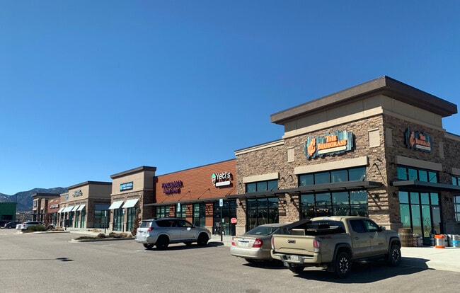

Property Detail
18068 W 92Nd Ln
Denver-Aurora-Centennial, CO
SECTION 22 TOWNSHIP 02 RANGE 70 SUBDIVISIONCD 108022 SUBDIVISIONNAME CANDELAS COMMERCIAL FLG NO 2 BLOCK 001 LOT 0004 SIZE: 44203 TRACT 00A VALUE: 1.015
20-221-01-013
JEFFERSON
Commercialnec
Colorado
B and X Area of moderate flood hazard, usually the area between the limits of the 100-year and 500-year floods.
4
2025
1.01 AC
2025
Northwest
060501
Denver
9,139 SF
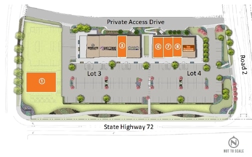
NEARBY LISTINGS FOR SALE OR LEASE
DEMOGRAPHICS near 18068 W 92Nd Ln
1 mile
3 mile
5 mile
2025 Total Population
5,050
17,536
60,086
2030 Population
5,101
17,603
59,693
Pop Growth 2025-2030
+ 1.01%
+ 0.38%
(0.65%)
Average Age
36
39
42
2025 Total Households
1,560
5,780
22,111
HH Growth 2025-2030
+ 0.77%
+ 0.24%
(0.71%)
Median Household Inc
$190,853
$188,148
$153,615
Avg Household Size
3.20
3.00
2.70
2025 Avg HH Vehicles
2.00
2.00
2.00
Median Home Value
$830,081
$849,585
$777,523
Median Year Built
2011
2011
1996
Nearby Places
Map Layers
Map Styles
 Street
 Aerial
Layers
 Traffic
 Biking
Places
Listings with unknown addresses are not visible on the map
- Restaurants
- Banks
- Shops
- Fitness
- Groceries
PUBLIC TRANSPORTATION
COMMUTER RAIL
Drive
Walk
Distance
17 min
8.9 mi
Drive
Walk
Distance
18 min
9.7 mi
AIRPORT
Denver International
Drive
Walk
Distance
Denver International
54 min
37.0 mi
SALE & LEASE HISTORY
LISTING DATE
SALE/LEASE

Jun 24, 2020
For Lease
Dec 18, 2018
For Lease
Nearby Properties
Address
Land Use
TOTAL SIZE
Lot Size
Zoning
Address
Land Use
TOTAL SIZE
Lot Size
Zoning
819.44 AC
A2
Address
Land Use
TOTAL SIZE
Lot Size
Zoning
3,318.13 AC
A2
Address
Land Use
TOTAL SIZE
Lot Size
Zoning
1,968.53 AC
Address
Land Use
TOTAL SIZE
Lot Size
Zoning
44,797 SF
4.35 AC
Address
Land Use
TOTAL SIZE
Lot Size
Zoning
52,931 SF
70.19 AC
I2
Address
Land Use
TOTAL SIZE
Lot Size
Zoning
1,653 SF
575.87 AC
Address
Land Use
TOTAL SIZE
Lot Size
Zoning
580.19 AC
Address
Land Use
TOTAL SIZE
Lot Size
Zoning
121,192 SF
12.43 AC
Address
Land Use
TOTAL SIZE
Lot Size
Zoning
110,235 SF
2.32 AC
Address
Land Use
TOTAL SIZE
Lot Size
Zoning
100,320 SF
7.64 AC
Address
Land Use
TOTAL SIZE
Lot Size
Zoning
95,412 SF
5.32 AC
Address
Land Use
TOTAL SIZE
Lot Size
Zoning
83,030 SF
5.96 AC
Address
Land Use
TOTAL SIZE
Lot Size
Zoning
20,173 SF
142.57 AC
A2
Address
Land Use
TOTAL SIZE
Lot Size
Zoning
75.88 AC
Address
Land Use
TOTAL SIZE
Lot Size
Zoning
392.69 AC
Address
Land Use
TOTAL SIZE
Lot Size
Zoning
320 AC
A2
Address
Land Use
TOTAL SIZE
Lot Size
Zoning
37,296 SF
8.45 AC
PD
Address
Land Use
TOTAL SIZE
Lot Size
Zoning
53,400 SF
6.40 AC
Address
Land Use
TOTAL SIZE
Lot Size
Zoning
302.47 AC
MC
Address
Land Use
TOTAL SIZE
Lot Size
Zoning
18,625 SF
1.14 AC
Address
Land Use
TOTAL SIZE
Lot Size
Zoning
295.40 AC
Address
Land Use
TOTAL SIZE
Lot Size
Zoning
10,886 SF
1.47 AC
Address
Land Use
TOTAL SIZE
Lot Size
Zoning
13,180 SF
2.86 AC
Address
Land Use
TOTAL SIZE
Lot Size
Zoning
46,071 SF
3.01 AC
PD
Address
Land Use
TOTAL SIZE
Lot Size
Zoning
29,932 SF
3.04 AC
PD
Address
Land Use
TOTAL SIZE
Lot Size
Zoning
13,050 SF
1.37 AC
Address
Land Use
TOTAL SIZE
Lot Size
Zoning
59.51 AC
Address
Land Use
TOTAL SIZE
Lot Size
Zoning
46,480 SF
4.24 AC
I2
Address
Land Use
TOTAL SIZE
Lot Size
Zoning
10,202 SF
1.58 AC
Address
Land Use
TOTAL SIZE
Lot Size
Zoning
959.65 AC
A2
The World's #1 Commercial Real Estate Marketplace
Connect with us
© 2026 CoStar Group
The information above has been obtained from sources believed reliable. While we do not doubt its accuracy we have not verified it and make no guarantee, warranty or representation about it. It is your responsibility to independently confirm its accuracy and completeness. Any projections, opinions, assumptions, or estimates used are for example only and do not represent the current or future performance of the property. The value of this transaction to you depends on tax and other factors which should be evaluated by your tax, financial, and legal advisors. You and your advisors should conduct a careful, independent investigation of the property to determine to your satisfaction the suitability of the property for your needs.