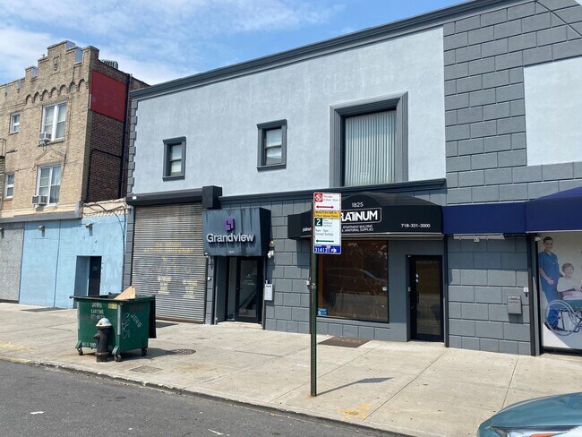
Property Record
1813 65Th St, Brooklyn, NY 11204


NEARBY LISTINGS FOR SALE OR LEASE
Property Detail
1813 65Th St
05547-0063
DOCID-2016030201207002
Officebuilding
Kings
X
New York
3604970351F
63
2024
0.25 AC
2025
South Brooklyn
025200
Long Island (New York)
21,750 SF
New York-Jersey City-White Plains, NY-NJ
DEMOGRAPHICS near 1813 65Th St
1 mile
3 mile
5 mile
2024 Total Population
141,637
996,288
1,762,822
2029 Population
129,367
926,289
1,647,923
Pop Growth 2024-2029
(8.66%)
(7.03%)
(6.52%)
Average Age
37
39
40
2024 Total Households
43,108
338,865
641,590
HH Growth 2024-2029
(9.34%)
(7.34%)
(6.78%)
Median Household Inc
$57,588
$65,743
$70,730
Avg Household Size
3.10
2.80
2.60
2024 Avg HH Vehicles
1.00
1.00
1.00
Median Home Value
$985,040
$843,120
$819,472
Median Year Built
1946
1947
1948
Nearby Places
Map Layers
Map Styles
 Street
 Aerial
Transit
 Traffic
 Biking
Places
Listings with unknown addresses are not visible on the map
- Restaurants
- Banks
- Shops
- Fitness
- Groceries
PUBLIC TRANSPORTATION
TRANSIT/SUBWAY
18 Avenue (N Line) (N - New York MTA Subway (The Subway))
Drive
Walk
Distance
18 Avenue (N Line) (N - New York MTA Subway (The Subway))
1 min
4 min
0.2 mi
20 Avenue (N Line) (N - New York MTA Subway (The Subway))
Drive
Walk
Distance
20 Avenue (N Line) (N - New York MTA Subway (The Subway))
1 min
6 min
0.3 mi
71 Street (D - New York MTA Subway (The Subway), M - New York MTA Subway (The Subway))
Drive
Walk
Distance
71 Street (D - New York MTA Subway (The Subway), M - New York MTA Subway (The Subway))
2 min
13 min
0.7 mi
Bay Parkway (N Line) (N - New York MTA Subway (The Subway))
Drive
Walk
Distance
Bay Parkway (N Line) (N - New York MTA Subway (The Subway))
3 min
13 min
0.7 mi
New Utrecht Avenue (N - New York MTA Subway (The Subway))
Drive
Walk
Distance
New Utrecht Avenue (N - New York MTA Subway (The Subway))
2 min
14 min
0.7 mi
COMMUTER RAIL
Nostrand Avenue Station (Far Rockaway Branch - Long Island Rail Road, Hempstead Branch - Long Island Rail Road, Long Beach Branch - Long Island Rail Road, West Hempstead Branch - Long Island Rail Road)
Drive
Walk
Distance
Nostrand Avenue Station (Far Rockaway Branch - Long Island Rail Road, Hempstead Branch - Long Island Rail Road, Long Beach Branch - Long Island Rail Road, West Hempstead Branch - Long Island Rail Road)
15 min
6.1 mi
Drive
Walk
Distance
14 min
6.2 mi
AIRPORT
John F Kennedy International
Drive
Walk
Distance
John F Kennedy International
26 min
14.9 mi
LaGuardia
Drive
Walk
Distance
LaGuardia
30 min
17.2 mi
Newark Liberty International
Drive
Walk
Distance
Newark Liberty International
35 min
20.7 mi
Freight Ports
NY - Red Hook Container Terminal
Drive
Walk
Distance
NY - Red Hook Container Terminal
11 min
6.1 mi
SALE & LEASE HISTORY
LISTING DATE
SALE/LEASE

Sep 25, 2016
For Lease
Oct 16, 2023
For Lease
Jul 20, 2023
For Lease
Nearby Properties
Address
Land Use
TOTAL SIZE
Lot Size
Zoning
Address
Land Use
TOTAL SIZE
Lot Size
Zoning
92,440 SF
466.23 AC
R5
Address
Land Use
TOTAL SIZE
Lot Size
Zoning
1,524,659 SF
170.96 AC
R4
Address
Land Use
TOTAL SIZE
Lot Size
Zoning
1,078,317 SF
10.45 AC
R4
Address
Land Use
TOTAL SIZE
Lot Size
Zoning
5,800 SF
20.10 AC
R6
Address
Land Use
TOTAL SIZE
Lot Size
Zoning
5,800 SF
20.10 AC
R6
Address
Land Use
TOTAL SIZE
Lot Size
Zoning
5,800 SF
20.10 AC
R6
Address
Land Use
TOTAL SIZE
Lot Size
Zoning
5,800 SF
20.10 AC
R6
Address
Land Use
TOTAL SIZE
Lot Size
Zoning
5,800 SF
20.10 AC
R6
Address
Land Use
TOTAL SIZE
Lot Size
Zoning
5,800 SF
20.10 AC
R6
Address
Land Use
TOTAL SIZE
Lot Size
Zoning
5,800 SF
20.10 AC
R6
Address
Land Use
TOTAL SIZE
Lot Size
Zoning
5,800 SF
20.10 AC
R6
Address
Land Use
TOTAL SIZE
Lot Size
Zoning
5,800 SF
20.10 AC
R6
Address
Land Use
TOTAL SIZE
Lot Size
Zoning
902,000 SF
6.44 AC
M3-1
Address
Land Use
TOTAL SIZE
Lot Size
Zoning
12.39 AC
R6
Address
Land Use
TOTAL SIZE
Lot Size
Zoning
965,600 SF
6.65 AC
R5
Address
Land Use
TOTAL SIZE
Lot Size
Zoning
460,000 SF
3.21 AC
R6
Address
Land Use
TOTAL SIZE
Lot Size
Zoning
1,073,920 SF
16.53 AC
R6
Address
Land Use
TOTAL SIZE
Lot Size
Zoning
305,093 SF
0.60 AC
C1-9
Address
Land Use
TOTAL SIZE
Lot Size
Zoning
335,800 SF
1.51 AC
R6
Address
Land Use
TOTAL SIZE
Lot Size
Zoning
54.78 AC
PARK
Address
Land Use
TOTAL SIZE
Lot Size
Zoning
340,837 SF
0.61 AC
C1-9
Address
Land Use
TOTAL SIZE
Lot Size
Zoning
785,450 SF
14.22 AC
R6
Address
Land Use
TOTAL SIZE
Lot Size
Zoning
1,324,592 SF
5.13 AC
M3-1
Address
Land Use
TOTAL SIZE
Lot Size
Zoning
397,354 SF
0.61 AC
C5-2
Address
Land Use
TOTAL SIZE
Lot Size
Zoning
340,068 SF
0.58 AC
C2-8
Address
Land Use
TOTAL SIZE
Lot Size
Zoning
340,068 SF
0.58 AC
C2-8
Address
Land Use
TOTAL SIZE
Lot Size
Zoning
1,800,000 SF
12.39 AC
R6
Address
Land Use
TOTAL SIZE
Lot Size
Zoning
1,736,700 SF
20.10 AC
R6
Address
Land Use
TOTAL SIZE
Lot Size
Zoning
753,367 SF
5.11 AC
R6
Address
Land Use
TOTAL SIZE
Lot Size
Zoning
623,806 SF
4.68 AC
R6
The World's #1 Commercial Real Estate Marketplace
Connect with us
© 2026 CoStar Group
The information above has been obtained from sources believed reliable. While we do not doubt its accuracy we have not verified it and make no guarantee, warranty or representation about it. It is your responsibility to independently confirm its accuracy and completeness. Any projections, opinions, assumptions, or estimates used are for example only and do not represent the current or future performance of the property. The value of this transaction to you depends on tax and other factors which should be evaluated by your tax, financial, and legal advisors. You and your advisors should conduct a careful, independent investigation of the property to determine to your satisfaction the suitability of the property for your needs.