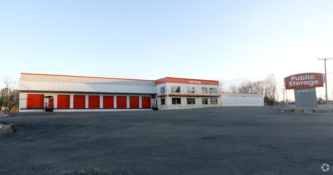
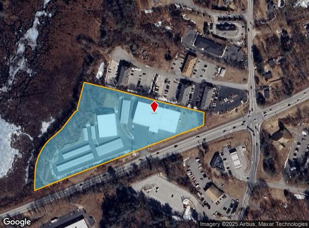
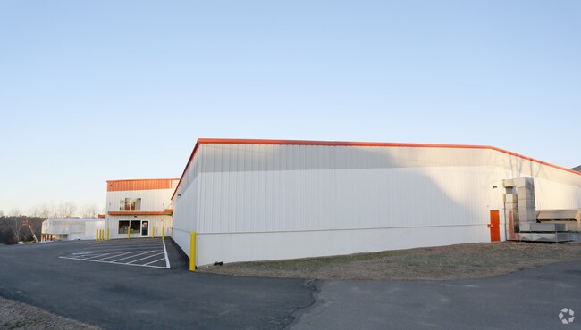
Property Record
184 State Route 111, Hampstead, NH 03841
NEARBY LISTINGS FOR SALE OR LEASE
Property Detail
184 State Route 111
Commercialnec
Rockingham
A
New Hampshire
25009C0075F
6.43 AC
2024
Rockingham
2024
Boston
104102
Boston-Cambridge-Newton, MA-NH
33,757 SF
HMSD-000006-000018
DEMOGRAPHICS near 184 State Route 111
1 Mile
3 Mile
5 Mile
2024 Total Population
1,670
17,454
45,221
2029 Population
1,731
18,003
46,670
Pop Growth 2024-2029
+ 3.65%
+ 3.15%
+ 3.20%
Average Age
47
45
44
2024 Total Households
669
6,789
17,183
HH Growth 2024-2029
+ 3.59%
+ 3.00%
+ 3.11%
Median Household Inc
$118,286
$116,020
$113,911
Avg Household Size
2.50
2.50
2.60
2024 Avg HH Vehicles
2.00
2.00
2.00
Median Home Value
$442,207
$433,762
$420,045
Median Year Built
1981
1982
1982
Nearby Places
Map Layers
Map Styles
 Street
 Aerial
- Restaurants
- Banks
- Shops
- Fitness
- Groceries
PUBLIC TRANSPORTATION
COMMUTER RAIL
Haverhill (Haverhill Line - Massachusetts Bay Transportation Authority Commuter Rail (Purple Line))
DRIVE
WALK
Distance
Haverhill (Haverhill Line - Massachusetts Bay Transportation Authority Commuter Rail (Purple Line))
19 min
8.7 mi
Bradford (Haverhill Line - Massachusetts Bay Transportation Authority Commuter Rail (Purple Line))
DRIVE
WALK
Distance
Bradford (Haverhill Line - Massachusetts Bay Transportation Authority Commuter Rail (Purple Line))
20 min
9.1 mi
AIRPORT
Manchester Boston Regional
DRIVE
WALK
Distance
Manchester Boston Regional
39 min
22.5 mi
Portsmouth International at Pease
DRIVE
WALK
Distance
Portsmouth International at Pease
54 min
37.0 mi
General Edward Lawrence Logan International
DRIVE
WALK
Distance
General Edward Lawrence Logan International
60 min
42.8 mi
Freight Ports
Port of Boston
DRIVE
WALK
Distance
Port of Boston
61 min
42.6 mi
Nearby Properties
Address
Land Use
TOTAL SIZE
Lot Size
Zoning
Address
Land Use
TOTAL SIZE
Lot Size
Zoning
82,926 SF
40.38 AC
A-RES
Address
Land Use
TOTAL SIZE
Lot Size
Zoning
55,819 SF
382.76 AC
RR2SCR
Address
Land Use
TOTAL SIZE
Lot Size
Zoning
89,227 SF
89.88 AC
A-RES
Address
Land Use
TOTAL SIZE
Lot Size
Zoning
67,705 SF
10.93 AC
TC- TO
Address
Land Use
TOTAL SIZE
Lot Size
Zoning
12,187 SF
18.51 AC
A-RES
Address
Land Use
TOTAL SIZE
Lot Size
Zoning
58,661 SF
9.53 AC
A-RES
Address
Land Use
TOTAL SIZE
Lot Size
Zoning
18,019 SF
10 AC
C2 C
Address
Land Use
TOTAL SIZE
Lot Size
Zoning
50,210 SF
10.93 AC
C1 C
Address
Land Use
TOTAL SIZE
Lot Size
Zoning
863 SF
14.79 AC
B-RES
Address
Land Use
TOTAL SIZE
Lot Size
Zoning
1,358 SF
74.43 AC
D-MHPM
Address
Land Use
TOTAL SIZE
Lot Size
Zoning
1,691 SF
112.47 AC
D-MHPM
Address
Land Use
TOTAL SIZE
Lot Size
Zoning
115,964 SF
8.17 AC
C2 C
Address
Land Use
TOTAL SIZE
Lot Size
Zoning
231.50 AC
B-RES
Address
Land Use
TOTAL SIZE
Lot Size
Zoning
5,508 SF
1.80 AC
C2 C
Address
Land Use
TOTAL SIZE
Lot Size
Zoning
15,396 SF
1.80 AC
C2 C
Address
Land Use
TOTAL SIZE
Lot Size
Zoning
480 SF
A-RES
Address
Land Use
TOTAL SIZE
Lot Size
Zoning
4,932 SF
15.62 AC
A-RES
Address
Land Use
TOTAL SIZE
Lot Size
Zoning
16,368 SF
7.67 AC
C1 C
Address
Land Use
TOTAL SIZE
Lot Size
Zoning
71,420 SF
18.50 AC
C2 C
Address
Land Use
TOTAL SIZE
Lot Size
Zoning
33,519 SF
6.70 AC
C2 C
Address
Land Use
TOTAL SIZE
Lot Size
Zoning
28,698 SF
6.29 AC
C1 C
Address
Land Use
TOTAL SIZE
Lot Size
Zoning
4,003 SF
7.97 AC
A-RES
Address
Land Use
TOTAL SIZE
Lot Size
Zoning
30.36 AC
GC
Address
Land Use
TOTAL SIZE
Lot Size
Zoning
32,533 SF
9.46 AC
C2 C
Address
Land Use
TOTAL SIZE
Lot Size
Zoning
23,160 SF
2.82 AC
GC
Address
Land Use
TOTAL SIZE
Lot Size
Zoning
10,559 SF
1.52 AC
C1 C
Address
Land Use
TOTAL SIZE
Lot Size
Zoning
12,796 SF
7.09 AC
A-RES
Address
Land Use
TOTAL SIZE
Lot Size
Zoning
3,843 SF
9.37 AC
TC- TO
Address
Land Use
TOTAL SIZE
Lot Size
Zoning
35,870 SF
4.32 AC
LCSD
The World's #1 Commercial Real Estate Marketplace
Connect with us
© 2025 CoStar Group
The information above has been obtained from sources believed reliable. While we do not doubt its accuracy we have not verified it and make no guarantee, warranty or representation about it. It is your responsibility to independently confirm its accuracy and completeness. Any projections, opinions, assumptions, or estimates used are for example only and do not represent the current or future performance of the property. The value of this transaction to you depends on tax and other factors which should be evaluated by your tax, financial, and legal advisors. You and your advisors should conduct a careful, independent investigation of the property to determine to your satisfaction the suitability of the property for your needs.