Property Record
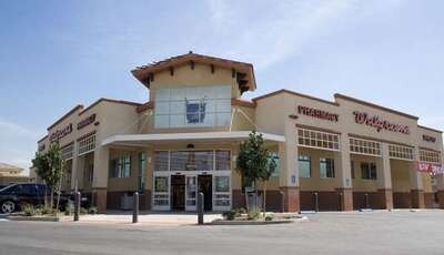
1849 W Sunset Blvd, Saint George, UT 84770


Property Detail
1849 W Sunset Blvd
0446628
S: 23 T: 42S R: 16W BEG AT PT ON ELY R/W/L OF DIXIE DOWNS ROAD, SD PT BEING S00*2752 W 788.28 FT ALG SEC/L & S89*3203 E 52.00 FT FM NW COR SEC 23 T42S R16W; TH NELY 61.15 FT ALG ARC OF 38.00 FT RAD CUR RGT (CTR BEARS S89*3208 E LNG CHD BEARS N46*3402
Commercialnec
Washington
C3
Utah
B and X Area of moderate flood hazard, usually the area between the limits of the 100-year and 500-year floods.
1i
2024
1.42 AC
2025
Cedar City & St George
270601
Other Market Areas
14,414 SF
St. George, UT
NEARBY LISTINGS FOR SALE OR LEASE
DEMOGRAPHICS near 1849 W Sunset Blvd
1 mile
3 mile
5 mile
2025 Total Population
16,325
45,306
86,716
2030 Population
17,726
49,969
95,159
Pop Growth 2025-2030
+ 8.58%
+ 10.29%
+ 9.74%
Average Age
38
41
41
2025 Total Households
5,767
16,330
31,174
HH Growth 2025-2030
+ 8.74%
+ 10.73%
+ 10.12%
Median Household Inc
$69,468
$75,040
$75,007
Avg Household Size
2.80
2.70
2.70
2025 Avg HH Vehicles
2.00
2.00
2.00
Median Home Value
$470,475
$484,482
$493,193
Median Year Built
1996
1998
1998
Nearby Places
Map Layers
Map Styles
 Street
 Aerial
Layers
 Traffic
 Biking
Places
Listings with unknown addresses are not visible on the map
- Restaurants
- Banks
- Shops
- Fitness
- Groceries
PUBLIC TRANSPORTATION
AIRPORT
St George Regional
Drive
Walk
Distance
St George Regional
9 min
3.8 mi
Nearby Properties
Address
Land Use
TOTAL SIZE
Lot Size
Zoning
Address
Land Use
TOTAL SIZE
Lot Size
Zoning
252,737 SF
3.95 AC
C-4
Address
Land Use
TOTAL SIZE
Lot Size
Zoning
175,817 SF
30.20 AC
Address
Land Use
TOTAL SIZE
Lot Size
Zoning
9,037 SF
188.69 AC
C2
Address
Land Use
TOTAL SIZE
Lot Size
Zoning
137,941 SF
4.75 AC
Address
Land Use
TOTAL SIZE
Lot Size
Zoning
141,567 SF
1.31 AC
C-4
Address
Land Use
TOTAL SIZE
Lot Size
Zoning
280,428 SF
1.96 AC
C-4
Address
Land Use
TOTAL SIZE
Lot Size
Zoning
68,899 SF
7.36 AC
C3
Address
Land Use
TOTAL SIZE
Lot Size
Zoning
198,324 SF
4.55 AC
Address
Land Use
TOTAL SIZE
Lot Size
Zoning
57,312 SF
3.14 AC
PDCOM
Address
Land Use
TOTAL SIZE
Lot Size
Zoning
115,588 SF
7.61 AC
R3
Address
Land Use
TOTAL SIZE
Lot Size
Zoning
6,642 SF
67.70 AC
R110
Address
Land Use
TOTAL SIZE
Lot Size
Zoning
67,139 SF
1.25 AC
Address
Land Use
TOTAL SIZE
Lot Size
Zoning
158,638 SF
4.67 AC
C-3
Address
Land Use
TOTAL SIZE
Lot Size
Zoning
67,892 SF
4.99 AC
Address
Land Use
TOTAL SIZE
Lot Size
Zoning
68,433 SF
0.38 AC
Address
Land Use
TOTAL SIZE
Lot Size
Zoning
61,825 SF
5.20 AC
Address
Land Use
TOTAL SIZE
Lot Size
Zoning
48,597 SF
0.42 AC
Address
Land Use
TOTAL SIZE
Lot Size
Zoning
254,253 SF
17.33 AC
Address
Land Use
TOTAL SIZE
Lot Size
Zoning
68,244 SF
7.48 AC
C-3
Address
Land Use
TOTAL SIZE
Lot Size
Zoning
106,168 SF
11.56 AC
C-3
Address
Land Use
TOTAL SIZE
Lot Size
Zoning
66,280 SF
6.72 AC
Address
Land Use
TOTAL SIZE
Lot Size
Zoning
152,357 SF
1.42 AC
Address
Land Use
TOTAL SIZE
Lot Size
Zoning
51,069 SF
4.10 AC
C3
Address
Land Use
TOTAL SIZE
Lot Size
Zoning
55,769 SF
4.63 AC
C3
Address
Land Use
TOTAL SIZE
Lot Size
Zoning
37,978 SF
8.45 AC
C-3
Address
Land Use
TOTAL SIZE
Lot Size
Zoning
61,950 SF
3.96 AC
C-3
Address
Land Use
TOTAL SIZE
Lot Size
Zoning
31,656 SF
3.08 AC
PD
Address
Land Use
TOTAL SIZE
Lot Size
Zoning
44,192 SF
2.04 AC
C-2
Address
Land Use
TOTAL SIZE
Lot Size
Zoning
30,896 SF
0.45 AC
C-4
Address
Land Use
TOTAL SIZE
Lot Size
Zoning
33,602 SF
1.10 AC
The World's #1 Commercial Real Estate Marketplace
Connect with us
© 2026 CoStar Group
The information above has been obtained from sources believed reliable. While we do not doubt its accuracy we have not verified it and make no guarantee, warranty or representation about it. It is your responsibility to independently confirm its accuracy and completeness. Any projections, opinions, assumptions, or estimates used are for example only and do not represent the current or future performance of the property. The value of this transaction to you depends on tax and other factors which should be evaluated by your tax, financial, and legal advisors. You and your advisors should conduct a careful, independent investigation of the property to determine to your satisfaction the suitability of the property for your needs.