Property Record
18700 E Us 24 Hwy, Independence, MO 64058

Property Detail
18700 E Us 24 Hwy
Kansas City, MO-KS
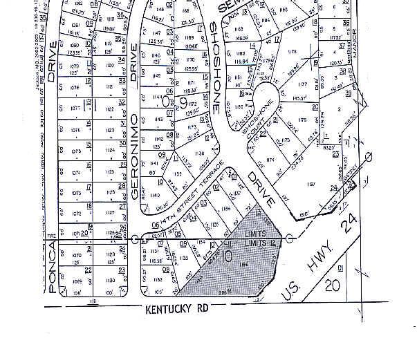
FAR VIEW HEIGHTS---PT LOT 1196 & PT SW 1/4 SEC-20 TWP-50 RNG -31 DAF: BEG NLY MOST COR SD LOT 1196 TH S 48 DEG 28 MIN W A LG TH NLY LI SD LOT 404.78 TO N ROW LI KENTUCKY RD TH DUE E
16-230-10-12-00-0-00-000
JACKSON
Storebuilding
Missouri
B and X Area of moderate flood hazard, usually the area between the limits of the 100-year and 500-year floods.
1196
2024
1.22 AC
2025
East Jackson County
015100
Kansas City
2,520 SF
NEARBY LISTINGS FOR SALE OR LEASE
DEMOGRAPHICS near 18700 E Us 24 Hwy
1 mile
3 mile
5 mile
2025 Total Population
11,829
26,019
66,639
2030 Population
11,797
26,090
67,001
Pop Growth 2025-2030
(0.27%)
+ 0.27%
+ 0.54%
Average Age
38
38
40
2025 Total Households
4,147
9,511
26,555
HH Growth 2025-2030
(0.29%)
+ 0.28%
+ 0.50%
Median Household Inc
$72,210
$68,550
$61,686
Avg Household Size
2.80
2.70
2.40
2025 Avg HH Vehicles
2.00
2.00
2.00
Median Home Value
$195,137
$188,593
$185,635
Median Year Built
1973
1973
1970
Nearby Places
Map Layers
Map Styles
 Street
 Aerial
Layers
 Traffic
 Biking
Places
Listings with unknown addresses are not visible on the map
- Restaurants
- Banks
- Shops
- Fitness
- Groceries
PUBLIC TRANSPORTATION
COMMUTER RAIL
Independence Amtrak Station (Lincoln Service Missouri River Runner - Amtrak, Missouri River Runner - Amtrak)
Drive
Walk
Distance
Independence Amtrak Station (Lincoln Service Missouri River Runner - Amtrak, Missouri River Runner - Amtrak)
13 min
5.8 mi
AIRPORT
Kansas City International
Drive
Walk
Distance
Kansas City International
42 min
29.3 mi
Freight Ports
Tulsa Port Of Catoosa
Drive
Walk
Distance
Tulsa Port Of Catoosa
285 min
254.3 mi
Nearby Properties
Address
Land Use
TOTAL SIZE
Lot Size
Zoning
Address
Land Use
TOTAL SIZE
Lot Size
Zoning
1 SF
1.44 AC
Address
Land Use
TOTAL SIZE
Lot Size
Zoning
Address
Land Use
TOTAL SIZE
Lot Size
Zoning
111,445 SF
8 AC
Address
Land Use
TOTAL SIZE
Lot Size
Zoning
155,098 SF
94.87 AC
Address
Land Use
TOTAL SIZE
Lot Size
Zoning
104,740 SF
7.25 AC
Address
Land Use
TOTAL SIZE
Lot Size
Zoning
158,109 SF
2.77 AC
Address
Land Use
TOTAL SIZE
Lot Size
Zoning
7,948 SF
186.06 AC
Address
Land Use
TOTAL SIZE
Lot Size
Zoning
47,978 SF
10.20 AC
Address
Land Use
TOTAL SIZE
Lot Size
Zoning
4,200,000 SF
0.66 AC
Address
Land Use
TOTAL SIZE
Lot Size
Zoning
70,053 SF
2.98 AC
Address
Land Use
TOTAL SIZE
Lot Size
Zoning
15,015 SF
1.96 AC
Address
Land Use
TOTAL SIZE
Lot Size
Zoning
138,554 SF
15.62 AC
Address
Land Use
TOTAL SIZE
Lot Size
Zoning
Address
Land Use
TOTAL SIZE
Lot Size
Zoning
111,555 SF
5.54 AC
Address
Land Use
TOTAL SIZE
Lot Size
Zoning
59,939 SF
9.10 AC
Address
Land Use
TOTAL SIZE
Lot Size
Zoning
55,675 SF
11.50 AC
Address
Land Use
TOTAL SIZE
Lot Size
Zoning
45,727 SF
9.50 AC
Address
Land Use
TOTAL SIZE
Lot Size
Zoning
38,765 SF
7 AC
Address
Land Use
TOTAL SIZE
Lot Size
Zoning
118.35 AC
Address
Land Use
TOTAL SIZE
Lot Size
Zoning
60,505 SF
128.04 AC
Address
Land Use
TOTAL SIZE
Lot Size
Zoning
5,832 SF
2.37 AC
Address
Land Use
TOTAL SIZE
Lot Size
Zoning
38,783 SF
9.20 AC
Address
Land Use
TOTAL SIZE
Lot Size
Zoning
27,183 SF
6.25 AC
Address
Land Use
TOTAL SIZE
Lot Size
Zoning
17,040 SF
1.87 AC
Address
Land Use
TOTAL SIZE
Lot Size
Zoning
42,812 SF
1.70 AC
Address
Land Use
TOTAL SIZE
Lot Size
Zoning
46,250 SF
12.90 AC
Address
Land Use
TOTAL SIZE
Lot Size
Zoning
19,610 SF
3.15 AC
Address
Land Use
TOTAL SIZE
Lot Size
Zoning
11,040 SF
154.50 AC
Address
Land Use
TOTAL SIZE
Lot Size
Zoning
45.40 AC
Address
Land Use
TOTAL SIZE
Lot Size
Zoning
32,900 SF
10 AC
The World's #1 Commercial Real Estate Marketplace
Connect with us
© 2026 CoStar Group
The information above has been obtained from sources believed reliable. While we do not doubt its accuracy we have not verified it and make no guarantee, warranty or representation about it. It is your responsibility to independently confirm its accuracy and completeness. Any projections, opinions, assumptions, or estimates used are for example only and do not represent the current or future performance of the property. The value of this transaction to you depends on tax and other factors which should be evaluated by your tax, financial, and legal advisors. You and your advisors should conduct a careful, independent investigation of the property to determine to your satisfaction the suitability of the property for your needs.