Property Record
190 N North Beacon St, Brighton, MA 02135
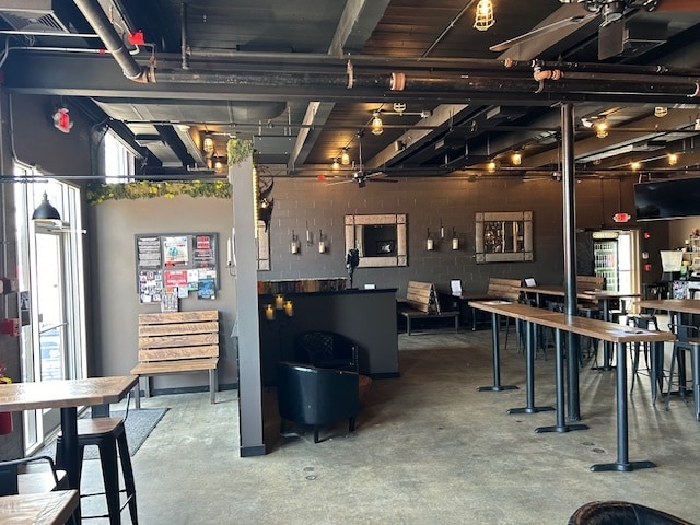

Current Lease Availabilities
NEARBY LISTINGS FOR SALE OR LEASE
Property Detail
190 N North Beacon St
BRIG-000000-000022-002156
George Sparhawk
Storebuilding
Suffolk
X
Massachusetts
25021C0032E
0.23 AC
2025
Allston/Brighton
2025
Boston
000601
Boston-Cambridge-Newton, MA-NH
4,550 SF
DEMOGRAPHICS near 190 N North Beacon St
1 Mile
3 Mile
5 Mile
2024 Total Population
48,906
352,257
870,836
2029 Population
46,858
343,973
847,144
Pop Growth 2024-2029
(4.19%)
(2.35%)
(2.72%)
Average Age
36
36
38
2024 Total Households
21,792
146,541
365,428
HH Growth 2024-2029
(4.52%)
(2.55%)
(2.95%)
Median Household Inc
$75,783
$103,423
$104,069
Avg Household Size
2.10
2.10
2.10
2024 Avg HH Vehicles
1.00
1.00
1.00
Median Home Value
$647,613
$932,823
$872,520
Median Year Built
1961
1949
1949
Nearby Places
Map Layers
Map Styles
 Street
 Aerial
- Restaurants
- Banks
- Shops
- Fitness
- Groceries
PUBLIC TRANSPORTATION
TRANSIT/SUBWAY
Warren Street Station (Green Line - B - Massachusetts Bay Transportation Authority Subway (The T))
DRIVE
WALK
Distance
Warren Street Station (Green Line - B - Massachusetts Bay Transportation Authority Subway (The T))
4 min
15 min
0.8 mi
Allston Street Station (Green Line - B - Massachusetts Bay Transportation Authority Subway (The T))
DRIVE
WALK
Distance
Allston Street Station (Green Line - B - Massachusetts Bay Transportation Authority Subway (The T))
4 min
16 min
0.8 mi
Griggs Street/Long Avenue Station (Green Line - B - Massachusetts Bay Transportation Authority Subway (The T))
DRIVE
WALK
Distance
Griggs Street/Long Avenue Station (Green Line - B - Massachusetts Bay Transportation Authority Subway (The T))
4 min
19 min
1.0 mi
Griggs Street Station (Green Line - B - Massachusetts Bay Transportation Authority Subway (The T))
DRIVE
WALK
Distance
Griggs Street Station (Green Line - B - Massachusetts Bay Transportation Authority Subway (The T))
4 min
19 min
1.0 mi
COMMUTER RAIL
Yawkey (Framingham/Worcester Line - Massachusetts Bay Transportation Authority Commuter Rail (Purple Line))
DRIVE
WALK
Distance
Yawkey (Framingham/Worcester Line - Massachusetts Bay Transportation Authority Commuter Rail (Purple Line))
7 min
2.9 mi
Porter Square (Fitchburg/South Acton Line - Massachusetts Bay Transportation Authority Commuter Rail (Purple Line))
DRIVE
WALK
Distance
Porter Square (Fitchburg/South Acton Line - Massachusetts Bay Transportation Authority Commuter Rail (Purple Line))
13 min
3.8 mi
AIRPORT
General Edward Lawrence Logan International
DRIVE
WALK
Distance
General Edward Lawrence Logan International
15 min
8.8 mi
Freight Ports
Port of Boston
DRIVE
WALK
Distance
Port of Boston
1 min
6.4 mi
Nearby Properties
Address
Land Use
TOTAL SIZE
Lot Size
Zoning
Address
Land Use
TOTAL SIZE
Lot Size
Zoning
439,500 SF
9.21 AC
E
Address
Land Use
TOTAL SIZE
Lot Size
Zoning
125,571 SF
3.25 AC
C-3
Address
Land Use
TOTAL SIZE
Lot Size
Zoning
150,192 SF
10.27 AC
E
Address
Land Use
TOTAL SIZE
Lot Size
Zoning
596,972 SF
7.32 AC
E
Address
Land Use
TOTAL SIZE
Lot Size
Zoning
530,200 SF
62.08 AC
E
Address
Land Use
TOTAL SIZE
Lot Size
Zoning
142,458 SF
1.67 AC
C-3
Address
Land Use
TOTAL SIZE
Lot Size
Zoning
304,349 SF
1.72 AC
Address
Land Use
TOTAL SIZE
Lot Size
Zoning
3.52 AC
C-3
Address
Land Use
TOTAL SIZE
Lot Size
Zoning
419,722 SF
2.03 AC
RC
Address
Land Use
TOTAL SIZE
Lot Size
Zoning
283,554 SF
2.76 AC
O-2A
Address
Land Use
TOTAL SIZE
Lot Size
Zoning
54,500 SF
4.01 AC
O-2A
Address
Land Use
TOTAL SIZE
Lot Size
Zoning
2.81 AC
O-2
Address
Land Use
TOTAL SIZE
Lot Size
Zoning
254,208 SF
3.83 AC
E
Address
Land Use
TOTAL SIZE
Lot Size
Zoning
4,355 SF
13.12 AC
E
Address
Land Use
TOTAL SIZE
Lot Size
Zoning
237,935 SF
1.27 AC
C-3
Address
Land Use
TOTAL SIZE
Lot Size
Zoning
336,518 SF
6.15 AC
I-3
Address
Land Use
TOTAL SIZE
Lot Size
Zoning
2.87 AC
O-2A
Address
Land Use
TOTAL SIZE
Lot Size
Zoning
155,818 SF
5.33 AC
OS
Address
Land Use
TOTAL SIZE
Lot Size
Zoning
220,671 SF
2.52 AC
I-2
Address
Land Use
TOTAL SIZE
Lot Size
Zoning
506,534 SF
2.75 AC
C
Address
Land Use
TOTAL SIZE
Lot Size
Zoning
213,834 SF
1.48 AC
SD-4
Address
Land Use
TOTAL SIZE
Lot Size
Zoning
136,025 SF
6.91 AC
C3
Address
Land Use
TOTAL SIZE
Lot Size
Zoning
2.25 AC
SD-12
Address
Land Use
TOTAL SIZE
Lot Size
Zoning
224,115 SF
2.35 AC
O-2A
Address
Land Use
TOTAL SIZE
Lot Size
Zoning
174,764 SF
1.83 AC
C-3
Address
Land Use
TOTAL SIZE
Lot Size
Zoning
176,625 SF
5.76 AC
I-3
Address
Land Use
TOTAL SIZE
Lot Size
Zoning
17,788 SF
8.32 AC
C-1
Address
Land Use
TOTAL SIZE
Lot Size
Zoning
443,356 SF
2.40 AC
C
Address
Land Use
TOTAL SIZE
Lot Size
Zoning
249,135 SF
1.99 AC
RC
Address
Land Use
TOTAL SIZE
Lot Size
Zoning
110,299 SF
0.82 AC
C-3
The World's #1 Commercial Real Estate Marketplace
Connect with us
© 2025 CoStar Group
The information above has been obtained from sources believed reliable. While we do not doubt its accuracy we have not verified it and make no guarantee, warranty or representation about it. It is your responsibility to independently confirm its accuracy and completeness. Any projections, opinions, assumptions, or estimates used are for example only and do not represent the current or future performance of the property. The value of this transaction to you depends on tax and other factors which should be evaluated by your tax, financial, and legal advisors. You and your advisors should conduct a careful, independent investigation of the property to determine to your satisfaction the suitability of the property for your needs.