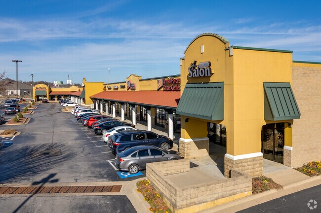
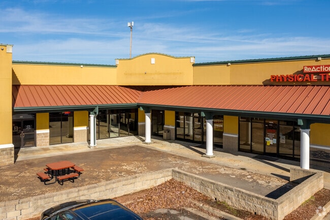
Property Record
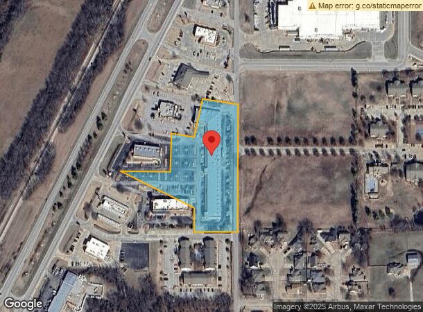
1900 S Highway 66, Claremore, OK 74019
NEARBY LISTINGS FOR SALE OR LEASE
Property Detail
1900 S Highway 66
660017532
21N-16E
Stripcommercialcenter
TR BEG AT SE/C OF S/2 SE/4 NE/4; TH S89-48-00W 208.90'; TH N00-12- 00W 90.13'; TH N62-57-00W 410.95'; TH N27-03-00E 400.01';
X
Rogers
40131C0270H
Oklahoma
2025
3.95 AC
2025
Rogers County
050101
Tulsa
32,080 SF
Tulsa, OK
DEMOGRAPHICS near 1900 S Highway 66
1 Mile
3 Mile
5 Mile
2024 Total Population
3,484
25,413
38,781
2029 Population
3,814
27,852
42,413
Pop Growth 2024-2029
+ 9.47%
+ 9.60%
+ 9.37%
Average Age
35
38
40
2024 Total Households
1,351
9,665
14,653
HH Growth 2024-2029
+ 9.47%
+ 9.76%
+ 9.50%
Median Household Inc
$54,358
$55,833
$61,906
Avg Household Size
2.50
2.40
2.50
2024 Avg HH Vehicles
2.00
2.00
2.00
Median Home Value
$160,509
$161,050
$174,961
Median Year Built
1995
1986
1988
Nearby Places
Map Layers
Map Styles
 Street
 Aerial
- Restaurants
- Banks
- Shops
- Fitness
- Groceries
PUBLIC TRANSPORTATION
AIRPORT
Tulsa International
DRIVE
WALK
Distance
Tulsa International
27 min
18.2 mi
Freight Ports
DRIVE
WALK
Distance
16 min
10.4 mi
Nearby Properties
Address
Land Use
TOTAL SIZE
Lot Size
Zoning
Address
Land Use
TOTAL SIZE
Lot Size
Zoning
35,022 SF
3.94 AC
Address
Land Use
TOTAL SIZE
Lot Size
Zoning
4,944 SF
28.82 AC
Address
Land Use
TOTAL SIZE
Lot Size
Zoning
108,802 SF
11.52 AC
Address
Land Use
TOTAL SIZE
Lot Size
Zoning
110,792 SF
8.46 AC
Address
Land Use
TOTAL SIZE
Lot Size
Zoning
8,632 SF
5.88 AC
Address
Land Use
TOTAL SIZE
Lot Size
Zoning
48,708 SF
1.68 AC
Address
Land Use
TOTAL SIZE
Lot Size
Zoning
1,560 SF
6.97 AC
Address
Land Use
TOTAL SIZE
Lot Size
Zoning
173,000 SF
18.49 AC
Address
Land Use
TOTAL SIZE
Lot Size
Zoning
60,037 SF
6.84 AC
Address
Land Use
TOTAL SIZE
Lot Size
Zoning
7,182 SF
1.15 AC
Address
Land Use
TOTAL SIZE
Lot Size
Zoning
14,724 SF
6 AC
Address
Land Use
TOTAL SIZE
Lot Size
Zoning
115,699 SF
5.18 AC
Address
Land Use
TOTAL SIZE
Lot Size
Zoning
42,147 SF
1.33 AC
Address
Land Use
TOTAL SIZE
Lot Size
Zoning
8,500 SF
33.42 AC
Address
Land Use
TOTAL SIZE
Lot Size
Zoning
4,320 SF
17.20 AC
Address
Land Use
TOTAL SIZE
Lot Size
Zoning
6,400 SF
0.28 AC
Address
Land Use
TOTAL SIZE
Lot Size
Zoning
89,000 SF
Address
Land Use
TOTAL SIZE
Lot Size
Zoning
44,160 SF
4.11 AC
Address
Land Use
TOTAL SIZE
Lot Size
Zoning
5,700 SF
1.05 AC
Address
Land Use
TOTAL SIZE
Lot Size
Zoning
418 SF
7.50 AC
Address
Land Use
TOTAL SIZE
Lot Size
Zoning
1,400 SF
0.10 AC
Address
Land Use
TOTAL SIZE
Lot Size
Zoning
1,960 SF
18.81 AC
Address
Land Use
TOTAL SIZE
Lot Size
Zoning
10,112 SF
2.37 AC
Address
Land Use
TOTAL SIZE
Lot Size
Zoning
28,548 SF
0.99 AC
Address
Land Use
TOTAL SIZE
Lot Size
Zoning
8,400 SF
26.68 AC
Address
Land Use
TOTAL SIZE
Lot Size
Zoning
18,250 SF
1.38 AC
Address
Land Use
TOTAL SIZE
Lot Size
Zoning
106,657 SF
5.70 AC
Address
Land Use
TOTAL SIZE
Lot Size
Zoning
89,664 SF
5.77 AC
Address
Land Use
TOTAL SIZE
Lot Size
Zoning
7,351 SF
0.72 AC
The World's #1 Commercial Real Estate Marketplace
Connect with us
© 2025 CoStar Group
The information above has been obtained from sources believed reliable. While we do not doubt its accuracy we have not verified it and make no guarantee, warranty or representation about it. It is your responsibility to independently confirm its accuracy and completeness. Any projections, opinions, assumptions, or estimates used are for example only and do not represent the current or future performance of the property. The value of this transaction to you depends on tax and other factors which should be evaluated by your tax, financial, and legal advisors. You and your advisors should conduct a careful, independent investigation of the property to determine to your satisfaction the suitability of the property for your needs.