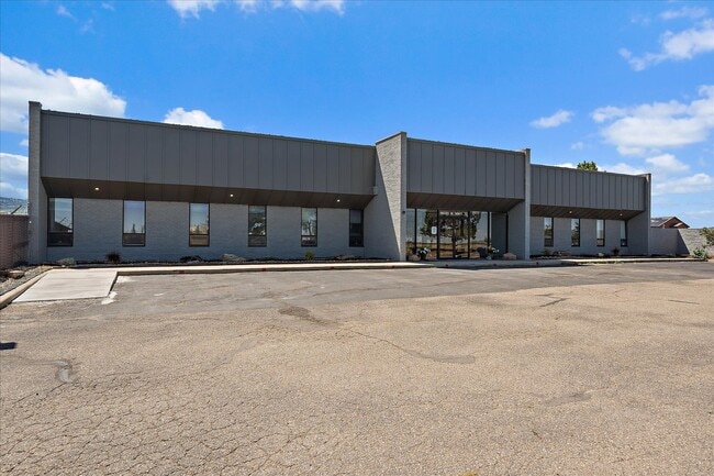
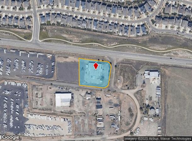
Property Record
19000 Highway 72, Arvada, CO 80007
Current Lease Availabilities
NEARBY LISTINGS FOR SALE OR LEASE
-
-
View all Arvada listings for lease on LoopNet.com
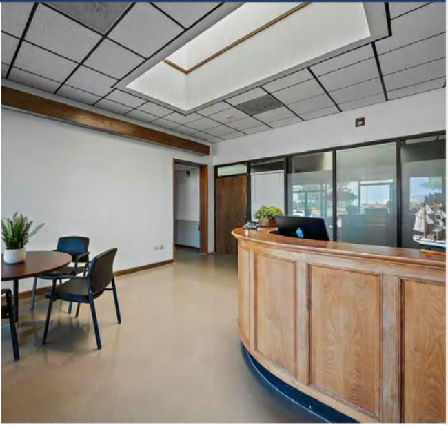
Property Detail
19000 Highway 72
Denver-Aurora-Centennial, CO
Northwest Industrial
20-224-01-005
SECTION 22 TOWNSHIP 02 RANGE 70 QTR SE SUBDIVISIONCD 560200 SUBDIVISIONNAME NORTHWEST INDUSTRIAL BLOCK 00B LOT 0012 SIZE: 74487 TRACT VALUE: 1.710
Industrialgeneral
Jefferson
X
Colorado
08059C0177G
12
2023
1.71 AC
2024
West Denver
009837
Denver
12,615 SF
DEMOGRAPHICS near 19000 Highway 72
1 Mile
3 Mile
5 Mile
2024 Total Population
5,724
14,626
49,609
2029 Population
5,764
14,565
49,090
Pop Growth 2024-2029
+ 0.70%
(0.42%)
(1.05%)
Average Age
35
38
41
2024 Total Households
1,763
4,721
18,118
HH Growth 2024-2029
+ 0.57%
(0.61%)
(1.02%)
Median Household Inc
$169,699
$169,566
$140,847
Avg Household Size
3.20
3.10
2.70
2024 Avg HH Vehicles
2.00
2.00
2.00
Median Home Value
$778,321
$776,305
$709,135
Median Year Built
2011
2011
1999
Nearby Places
Map Layers
Map Styles
 Street
 Aerial
- Restaurants
- Banks
- Shops
- Fitness
- Groceries
PUBLIC TRANSPORTATION
COMMUTER RAIL
DRIVE
WALK
Distance
17 min
8.8 mi
DRIVE
WALK
Distance
17 min
9.6 mi
AIRPORT
Denver International
DRIVE
WALK
Distance
Denver International
53 min
37.0 mi
Nearby Properties
Address
Land Use
TOTAL SIZE
Lot Size
Zoning
Address
Land Use
TOTAL SIZE
Lot Size
Zoning
819.44 AC
A2
Address
Land Use
TOTAL SIZE
Lot Size
Zoning
3,318.13 AC
A2
Address
Land Use
TOTAL SIZE
Lot Size
Zoning
1,968.53 AC
Address
Land Use
TOTAL SIZE
Lot Size
Zoning
110,235 SF
2.32 AC
Address
Land Use
TOTAL SIZE
Lot Size
Zoning
53,051 SF
70.19 AC
I2
Address
Land Use
TOTAL SIZE
Lot Size
Zoning
1,653 SF
575.87 AC
Address
Land Use
TOTAL SIZE
Lot Size
Zoning
580.19 AC
Address
Land Use
TOTAL SIZE
Lot Size
Zoning
121,192 SF
12.43 AC
Address
Land Use
TOTAL SIZE
Lot Size
Zoning
95,412 SF
5.32 AC
Address
Land Use
TOTAL SIZE
Lot Size
Zoning
44,797 SF
4.35 AC
Address
Land Use
TOTAL SIZE
Lot Size
Zoning
20,173 SF
142.57 AC
A2
Address
Land Use
TOTAL SIZE
Lot Size
Zoning
53,400 SF
6.40 AC
Address
Land Use
TOTAL SIZE
Lot Size
Zoning
75.88 AC
Address
Land Use
TOTAL SIZE
Lot Size
Zoning
392.69 AC
Address
Land Use
TOTAL SIZE
Lot Size
Zoning
320 AC
A2
Address
Land Use
TOTAL SIZE
Lot Size
Zoning
302.47 AC
MC
Address
Land Use
TOTAL SIZE
Lot Size
Zoning
295.40 AC
Address
Land Use
TOTAL SIZE
Lot Size
Zoning
37,296 SF
8.45 AC
PD
Address
Land Use
TOTAL SIZE
Lot Size
Zoning
13,180 SF
2.86 AC
Address
Land Use
TOTAL SIZE
Lot Size
Zoning
13,050 SF
1.37 AC
Address
Land Use
TOTAL SIZE
Lot Size
Zoning
10,886 SF
1.47 AC
Address
Land Use
TOTAL SIZE
Lot Size
Zoning
46,071 SF
3.01 AC
PD
Address
Land Use
TOTAL SIZE
Lot Size
Zoning
59.51 AC
Address
Land Use
TOTAL SIZE
Lot Size
Zoning
14,677 SF
2.20 AC
Address
Land Use
TOTAL SIZE
Lot Size
Zoning
959.65 AC
A2
Address
Land Use
TOTAL SIZE
Lot Size
Zoning
29,933 SF
3.04 AC
PD
Address
Land Use
TOTAL SIZE
Lot Size
Zoning
12,789 SF
1.83 AC
Address
Land Use
TOTAL SIZE
Lot Size
Zoning
5,672 SF
1.34 AC
Address
Land Use
TOTAL SIZE
Lot Size
Zoning
11,567 SF
1.37 AC
Address
Land Use
TOTAL SIZE
Lot Size
Zoning
40,600 SF
4.24 AC
I2
The World's #1 Commercial Real Estate Marketplace
Connect with us
© 2026 CoStar Group
The information above has been obtained from sources believed reliable. While we do not doubt its accuracy we have not verified it and make no guarantee, warranty or representation about it. It is your responsibility to independently confirm its accuracy and completeness. Any projections, opinions, assumptions, or estimates used are for example only and do not represent the current or future performance of the property. The value of this transaction to you depends on tax and other factors which should be evaluated by your tax, financial, and legal advisors. You and your advisors should conduct a careful, independent investigation of the property to determine to your satisfaction the suitability of the property for your needs.