Property Record
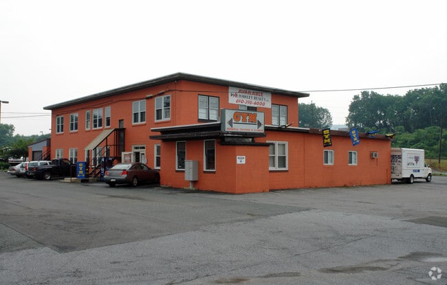
1901 S 12Th St, Allentown, PA 18103


NEARBY LISTINGS FOR SALE OR LEASE
Property Detail
1901 S 12Th St
640601426560-1
LOTS: 004
Stripcommercialcenter
Lehigh
X
Pennsylvania
42077C0253F
4
2025
8.49 AC
2025
Lehigh Valley
001501
Philadelphia
116,502 SF
Allentown-Bethlehem-Easton, PA-NJ
DEMOGRAPHICS near 1901 S 12Th St
1 Mile
3 Mile
5 Mile
2024 Total Population
13,106
130,669
230,063
2029 Population
13,274
131,670
231,826
Pop Growth 2024-2029
+ 1.28%
+ 0.77%
+ 0.77%
Average Age
36
37
39
2024 Total Households
4,933
48,141
87,283
HH Growth 2024-2029
+ 1.26%
+ 0.86%
+ 0.80%
Median Household Inc
$57,113
$50,604
$59,346
Avg Household Size
2.60
2.50
2.50
2024 Avg HH Vehicles
2.00
1.00
2.00
Median Home Value
$160,049
$178,196
$224,804
Median Year Built
1958
1953
1961
Nearby Places
Map Layers
Map Styles
 Street
 Aerial
- Restaurants
- Banks
- Shops
- Fitness
- Groceries
PUBLIC TRANSPORTATION
AIRPORT
Lehigh Valley International
DRIVE
WALK
Distance
Lehigh Valley International
16 min
8.2 mi
Freight Ports
Port of Philadelphia
DRIVE
WALK
Distance
Port of Philadelphia
84 min
52.0 mi
SALE & LEASE HISTORY
LISTING DATE
SALE/LEASE

May 21, 2020
For Lease
Nearby Properties
Address
Land Use
TOTAL SIZE
Lot Size
Zoning
Address
Land Use
TOTAL SIZE
Lot Size
Zoning
504,141 SF
44.47 AC
R2
Address
Land Use
TOTAL SIZE
Lot Size
Zoning
302,304 SF
5.15 AC
B-2
Address
Land Use
TOTAL SIZE
Lot Size
Zoning
353,441 SF
4.34 AC
I-G
Address
Land Use
TOTAL SIZE
Lot Size
Zoning
187,337 SF
2.11 AC
I-G
Address
Land Use
TOTAL SIZE
Lot Size
Zoning
356,283 SF
2 AC
I-G
Address
Land Use
TOTAL SIZE
Lot Size
Zoning
300,783 SF
0.64 AC
B-2
Address
Land Use
TOTAL SIZE
Lot Size
Zoning
295,502 SF
0.77 AC
B-2
Address
Land Use
TOTAL SIZE
Lot Size
Zoning
229,379 SF
1.16 AC
I-G
Address
Land Use
TOTAL SIZE
Lot Size
Zoning
135,668 SF
5 AC
R3
Address
Land Use
TOTAL SIZE
Lot Size
Zoning
314,421 SF
2.22 AC
I-G
Address
Land Use
TOTAL SIZE
Lot Size
Zoning
112,456 SF
5 AC
R3
Address
Land Use
TOTAL SIZE
Lot Size
Zoning
113,608 SF
6.43 AC
I-G
Address
Land Use
TOTAL SIZE
Lot Size
Zoning
124,954 SF
1.23 AC
B-2
Address
Land Use
TOTAL SIZE
Lot Size
Zoning
155,344 SF
B-2
Address
Land Use
TOTAL SIZE
Lot Size
Zoning
266,354 SF
2.56 AC
R-H
Address
Land Use
TOTAL SIZE
Lot Size
Zoning
165,557 SF
0.48 AC
B-2
Address
Land Use
TOTAL SIZE
Lot Size
Zoning
139,462 SF
1.30 AC
B-2
Address
Land Use
TOTAL SIZE
Lot Size
Zoning
113,162 SF
3.02 AC
B/LI
Address
Land Use
TOTAL SIZE
Lot Size
Zoning
85,440 SF
2.10 AC
I-G
Address
Land Use
TOTAL SIZE
Lot Size
Zoning
139,812 SF
0.14 AC
B-2
Address
Land Use
TOTAL SIZE
Lot Size
Zoning
208,086 SF
3.13 AC
R-H
Address
Land Use
TOTAL SIZE
Lot Size
Zoning
42,250 SF
3.33 AC
I-G
Address
Land Use
TOTAL SIZE
Lot Size
Zoning
48,816 SF
197.98 AC
I-2
Address
Land Use
TOTAL SIZE
Lot Size
Zoning
71,838 SF
0.48 AC
I-G
Address
Land Use
TOTAL SIZE
Lot Size
Zoning
19,850 SF
15.01 AC
R3
Address
Land Use
TOTAL SIZE
Lot Size
Zoning
133,912 SF
0.79 AC
I-3
Address
Land Use
TOTAL SIZE
Lot Size
Zoning
1.76 AC
B-2
Address
Land Use
TOTAL SIZE
Lot Size
Zoning
219,048 SF
1.48 AC
B-2
Address
Land Use
TOTAL SIZE
Lot Size
Zoning
128,106 SF
10.14 AC
C1
Address
Land Use
TOTAL SIZE
Lot Size
Zoning
19,581 SF
15.99 AC
R-MP
The World's #1 Commercial Real Estate Marketplace
Connect with us
© 2025 CoStar Group
The information above has been obtained from sources believed reliable. While we do not doubt its accuracy we have not verified it and make no guarantee, warranty or representation about it. It is your responsibility to independently confirm its accuracy and completeness. Any projections, opinions, assumptions, or estimates used are for example only and do not represent the current or future performance of the property. The value of this transaction to you depends on tax and other factors which should be evaluated by your tax, financial, and legal advisors. You and your advisors should conduct a careful, independent investigation of the property to determine to your satisfaction the suitability of the property for your needs.