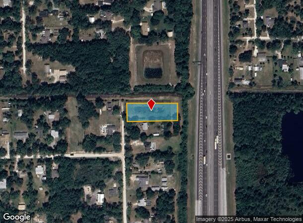
Property Record
1909 Unknown St, Cocoa, FL 32926

NEARBY LISTINGS FOR SALE OR LEASE
Property Detail
1909 Unknown St
Palm Bay-Melbourne-Titusville, FL
Canaveral Groves Replat Unit 3 Sheet 4
24-35-09-01-00025.0-0017.00
CANAVERAL GROVES REPLAT UNIT 3 SHEET 4 LOT 17 BLK 25
Stateproperty
Brevard
X
Florida
12009C0325G
17
0
1 AC
2025
Brevard County
062115
Orlando
DEMOGRAPHICS near 1909 Unknown St
1 Mile
3 Mile
5 Mile
2024 Total Population
1,991
10,763
47,602
2029 Population
2,152
11,710
51,818
Pop Growth 2024-2029
+ 8.09%
+ 8.80%
+ 8.86%
Average Age
45
46
43
2024 Total Households
760
4,253
19,145
HH Growth 2024-2029
+ 7.76%
+ 8.63%
+ 8.70%
Median Household Inc
$59,294
$82,733
$65,757
Avg Household Size
2.60
2.40
2.40
2024 Avg HH Vehicles
2.00
2.00
2.00
Median Home Value
$290,562
$273,839
$236,733
Median Year Built
1992
1991
1986
Nearby Places
Map Layers
Map Styles
 Street
 Aerial
- Restaurants
- Banks
- Shops
- Fitness
- Groceries
PUBLIC TRANSPORTATION
AIRPORT
Melbourne Orlando International
DRIVE
WALK
Distance
Melbourne Orlando International
47 min
31.3 mi
Freight Ports
Port Canaveral
DRIVE
WALK
Distance
Port Canaveral
28 min
16.4 mi
SALE & LEASE HISTORY
LISTING DATE
SALE/LEASE

Jun 01, 2017
For Sale
Nearby Properties
Address
Land Use
TOTAL SIZE
Lot Size
Zoning
Address
Land Use
TOTAL SIZE
Lot Size
Zoning
335,014 SF
185.59 AC
M2
Address
Land Use
TOTAL SIZE
Lot Size
Zoning
212.10 AC
PUD
Address
Land Use
TOTAL SIZE
Lot Size
Zoning
73,476 SF
31.58 AC
BU1
Address
Land Use
TOTAL SIZE
Lot Size
Zoning
144,430 SF
14.02 AC
M2
Address
Land Use
TOTAL SIZE
Lot Size
Zoning
52,398 SF
9.68 AC
M2
Address
Land Use
TOTAL SIZE
Lot Size
Zoning
65,645 SF
107.50 AC
GML
Address
Land Use
TOTAL SIZE
Lot Size
Zoning
65,316 SF
956.57 AC
GML(H)
Address
Land Use
TOTAL SIZE
Lot Size
Zoning
37,125 SF
6.40 AC
M2
Address
Land Use
TOTAL SIZE
Lot Size
Zoning
27,271 SF
10 AC
M2
Address
Land Use
TOTAL SIZE
Lot Size
Zoning
64,221 SF
20.23 AC
M2
Address
Land Use
TOTAL SIZE
Lot Size
Zoning
19,051 SF
1.92 AC
M2
Address
Land Use
TOTAL SIZE
Lot Size
Zoning
39,290 SF
3 AC
M2
Address
Land Use
TOTAL SIZE
Lot Size
Zoning
10.47 AC
M2
Address
Land Use
TOTAL SIZE
Lot Size
Zoning
41.73 AC
CG
Address
Land Use
TOTAL SIZE
Lot Size
Zoning
29.34 AC
M2
Address
Land Use
TOTAL SIZE
Lot Size
Zoning
19,805 SF
3.75 AC
Address
Land Use
TOTAL SIZE
Lot Size
Zoning
25,400 SF
1.94 AC
M2
Address
Land Use
TOTAL SIZE
Lot Size
Zoning
4,996 SF
111.92 AC
GMLP
Address
Land Use
TOTAL SIZE
Lot Size
Zoning
10,780 SF
2.29 AC
GU
Address
Land Use
TOTAL SIZE
Lot Size
Zoning
16,200 SF
0.97 AC
M2
Address
Land Use
TOTAL SIZE
Lot Size
Zoning
24,400 SF
1.16 AC
M2
Address
Land Use
TOTAL SIZE
Lot Size
Zoning
9,024 SF
2.22 AC
TU-2
Address
Land Use
TOTAL SIZE
Lot Size
Zoning
12,413 SF
4.88 AC
CG
Address
Land Use
TOTAL SIZE
Lot Size
Zoning
16,350 SF
3.98 AC
M2
Address
Land Use
TOTAL SIZE
Lot Size
Zoning
4.82 AC
M2
Address
Land Use
TOTAL SIZE
Lot Size
Zoning
13,962 SF
3.23 AC
M2
Address
Land Use
TOTAL SIZE
Lot Size
Zoning
6,187 SF
1.04 AC
GML
Address
Land Use
TOTAL SIZE
Lot Size
Zoning
4,864 SF
9.94 AC
AU
Address
Land Use
TOTAL SIZE
Lot Size
Zoning
8,250 SF
0.56 AC
M2
Address
Land Use
TOTAL SIZE
Lot Size
Zoning
10,560 SF
0.49 AC
M2
The World's #1 Commercial Real Estate Marketplace
Connect with us
© 2025 CoStar Group
The information above has been obtained from sources believed reliable. While we do not doubt its accuracy we have not verified it and make no guarantee, warranty or representation about it. It is your responsibility to independently confirm its accuracy and completeness. Any projections, opinions, assumptions, or estimates used are for example only and do not represent the current or future performance of the property. The value of this transaction to you depends on tax and other factors which should be evaluated by your tax, financial, and legal advisors. You and your advisors should conduct a careful, independent investigation of the property to determine to your satisfaction the suitability of the property for your needs.