Property Record
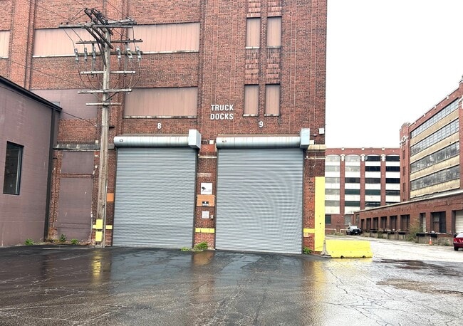
1919 W Pershing Rd, Chicago, IL 60609


Property Detail
1919 W Pershing Rd
20-06-200-002-0000
(PARTITION) BETWEEN (HEIRS) OF (BEERS) ESTATE SUB OF W110ACS OF NE SEC 06-38-14
Commercialnec
Cook
M1-1
Illinois
B and X Area of moderate flood hazard, usually the area between the limits of the 100-year and 500-year floods.
1.04 AC
2023
South Chicago
2025
Chicago
610300
Chicago-Naperville-Elgin, IL-IN
258,400 SF
NEARBY LISTINGS FOR SALE OR LEASE
DEMOGRAPHICS near 1919 W Pershing Rd
1 mile
3 mile
5 mile
2025 Total Population
24,617
284,362
831,244
2030 Population
22,896
270,039
815,605
Pop Growth 2025-2030
(6.99%)
(5.04%)
(1.88%)
Average Age
37
37
37
2025 Total Households
8,005
93,954
318,461
HH Growth 2025-2030
(7.38%)
(5.23%)
(1.43%)
Median Household Inc
$65,169
$57,753
$64,286
Avg Household Size
3.00
2.80
2.50
2025 Avg HH Vehicles
1.00
1.00
1.00
Median Home Value
$276,931
$273,291
$291,006
Median Year Built
1947
1948
1954
Nearby Places
Map Layers
Map Styles
 Street
 Aerial
Layers
 Traffic
 Biking
Places
Listings with unknown addresses are not visible on the map
- Restaurants
- Banks
- Shops
- Fitness
- Groceries
PUBLIC TRANSPORTATION
TRANSIT/SUBWAY
35Th/Archer Station (Orange Line - Chicago Transit Authority "L" Trains (The "L"))
Drive
Walk
Distance
35Th/Archer Station (Orange Line - Chicago Transit Authority "L" Trains (The "L"))
2 min
14 min
0.7 mi
COMMUTER RAIL
35Th St. - Lou Jones (Rock Island - Metra)
Drive
Walk
Distance
35Th St. - Lou Jones (Rock Island - Metra)
6 min
2.9 mi
Western Avenue Station (Bnsf) (Burlington Northern-Santa Fe Railway Line - Northeast Illinois Regional Commuter Railroad (Metra))
Drive
Walk
Distance
Western Avenue Station (Bnsf) (Burlington Northern-Santa Fe Railway Line - Northeast Illinois Regional Commuter Railroad (Metra))
6 min
3.0 mi
AIRPORT
Chicago Midway International
Drive
Walk
Distance
Chicago Midway International
10 min
5.1 mi
Chicago O'Hare International
Drive
Walk
Distance
Chicago O'Hare International
35 min
21.3 mi
Freight Ports
Port Milwaukee
Drive
Walk
Distance
Port Milwaukee
113 min
89.5 mi
SALE & LEASE HISTORY
LISTING DATE
SALE/LEASE

Sep 25, 2016
For Lease
Jun 03, 2025
For Lease
Nearby Properties
Address
Land Use
TOTAL SIZE
Lot Size
Zoning
Address
Land Use
TOTAL SIZE
Lot Size
Zoning
474,979 SF
29.67 AC
PD 553
Address
Land Use
TOTAL SIZE
Lot Size
Zoning
3.17 AC
PD 96
Address
Land Use
TOTAL SIZE
Lot Size
Zoning
4.71 AC
PD 1196
Address
Land Use
TOTAL SIZE
Lot Size
Zoning
4.11 AC
M2-3
Address
Land Use
TOTAL SIZE
Lot Size
Zoning
2.98 AC
PD 1196
Address
Land Use
TOTAL SIZE
Lot Size
Zoning
460,333 SF
2.62 AC
C2-3
Address
Land Use
TOTAL SIZE
Lot Size
Zoning
136,720 SF
0.54 AC
PD 1
Address
Land Use
TOTAL SIZE
Lot Size
Zoning
134,800 SF
2.53 AC
PD 1273
Address
Land Use
TOTAL SIZE
Lot Size
Zoning
Address
Land Use
TOTAL SIZE
Lot Size
Zoning
27.31 AC
PD 1424
Address
Land Use
TOTAL SIZE
Lot Size
Zoning
133,354 SF
PD 1198
Address
Land Use
TOTAL SIZE
Lot Size
Zoning
169,435 SF
11.35 AC
PD 307
Address
Land Use
TOTAL SIZE
Lot Size
Zoning
307,277 SF
9.90 AC
PMD 11
Address
Land Use
TOTAL SIZE
Lot Size
Zoning
72,893 SF
4.43 AC
PD 90
Address
Land Use
TOTAL SIZE
Lot Size
Zoning
475,000 SF
14.01 AC
PMD 8
Address
Land Use
TOTAL SIZE
Lot Size
Zoning
3.66 AC
M2-3
Address
Land Use
TOTAL SIZE
Lot Size
Zoning
0.84 AC
B1-3
Address
Land Use
TOTAL SIZE
Lot Size
Zoning
633,057 SF
34.96 AC
PMD 8
Address
Land Use
TOTAL SIZE
Lot Size
Zoning
0.27 AC
PD 1
Address
Land Use
TOTAL SIZE
Lot Size
Zoning
43,896 SF
5.18 AC
M2-1
Address
Land Use
TOTAL SIZE
Lot Size
Zoning
240,400 SF
1.34 AC
PMD 11
Address
Land Use
TOTAL SIZE
Lot Size
Zoning
201,750 SF
0.66 AC
PD 96
Address
Land Use
TOTAL SIZE
Lot Size
Zoning
260,481 SF
12.93 AC
PD 463
Address
Land Use
TOTAL SIZE
Lot Size
Zoning
283,180 SF
1.41 AC
M2-3
Address
Land Use
TOTAL SIZE
Lot Size
Zoning
38,214 SF
0.92 AC
C2-3
Address
Land Use
TOTAL SIZE
Lot Size
Zoning
1.09 AC
B2-2
Address
Land Use
TOTAL SIZE
Lot Size
Zoning
55,440 SF
1.16 AC
C2-3
Address
Land Use
TOTAL SIZE
Lot Size
Zoning
430,548 SF
13.12 AC
PMD 11
Address
Land Use
TOTAL SIZE
Lot Size
Zoning
1,023,467 SF
21.45 AC
PD 1424
Address
Land Use
TOTAL SIZE
Lot Size
Zoning
156,199 SF
The World's #1 Commercial Real Estate Marketplace
Connect with us
© 2026 CoStar Group
The information above has been obtained from sources believed reliable. While we do not doubt its accuracy we have not verified it and make no guarantee, warranty or representation about it. It is your responsibility to independently confirm its accuracy and completeness. Any projections, opinions, assumptions, or estimates used are for example only and do not represent the current or future performance of the property. The value of this transaction to you depends on tax and other factors which should be evaluated by your tax, financial, and legal advisors. You and your advisors should conduct a careful, independent investigation of the property to determine to your satisfaction the suitability of the property for your needs.