Property Record
19380 Interstate 45, Spring, TX 77373
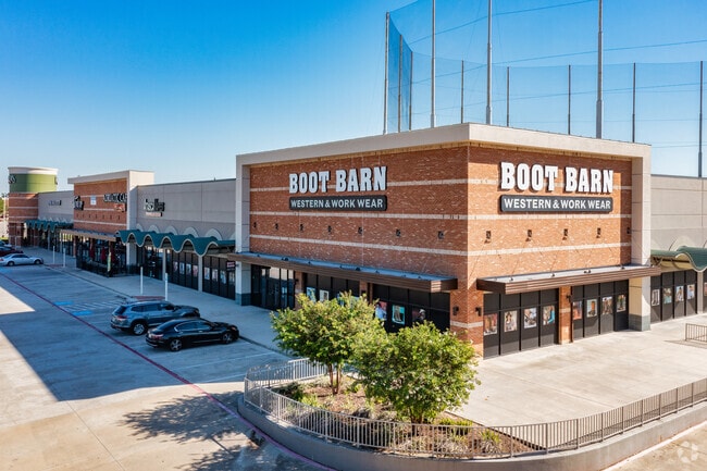


Property Detail
19380 Interstate 45
1274220010006
RES A1-B BLK 1 CENTER AT SPRING PARK FOREST
Storebuilding
HARRIS
B and X Area of moderate flood hazard, usually the area between the limits of the 100-year and 500-year floods.
Texas
2024
4.07 AC
2025
Spring Creek
241302
Houston
33,675 SF
Houston-Pasadena-The Woodlands, TX
NEARBY LISTINGS FOR SALE OR LEASE
-
-
-
-
-
-
-
-
-
-
-
-
No Photo
-
-
-
View all Spring listings for sale on LoopNet.com
DEMOGRAPHICS near 19380 Interstate 45
1 mile
3 mile
5 mile
2025 Total Population
8,935
106,986
263,797
2030 Population
9,563
114,026
284,681
Pop Growth 2025-2030
+ 7.03%
+ 6.58%
+ 7.92%
Average Age
39
36
36
2025 Total Households
3,087
38,258
91,400
HH Growth 2025-2030
+ 7.16%
+ 6.79%
+ 8.12%
Median Household Inc
$91,418
$76,498
$80,922
Avg Household Size
2.80
2.70
2.80
2025 Avg HH Vehicles
2.00
2.00
2.00
Median Home Value
$273,363
$263,529
$272,577
Median Year Built
1999
1994
1999
Nearby Places
Map Layers
Map Styles
 Street
 Aerial
Layers
 Traffic
 Biking
Places
Listings with unknown addresses are not visible on the map
- Restaurants
- Banks
- Shops
- Fitness
- Groceries
PUBLIC TRANSPORTATION
AIRPORT
George Bush Intcntl/Houston
Drive
Walk
Distance
George Bush Intcntl/Houston
21 min
16.1 mi
William P Hobby
Drive
Walk
Distance
William P Hobby
45 min
35.0 mi
SALE & LEASE HISTORY
LISTING DATE
SALE/LEASE

Sep 29, 2022
For Sale
Sep 25, 2016
For Lease
May 26, 2022
For Sale
Mar 24, 2017
For Lease
Jun 23, 2021
For Sale
Jun 18, 2021
For Sale
Jul 21, 2022
For Sale
Aug 13, 2024
For Sale
Nearby Properties
Address
Land Use
TOTAL SIZE
Lot Size
Zoning
Address
Land Use
TOTAL SIZE
Lot Size
Zoning
734,137 SF
11.37 AC
Address
Land Use
TOTAL SIZE
Lot Size
Zoning
338,220 SF
10.26 AC
Address
Land Use
TOTAL SIZE
Lot Size
Zoning
364,860 SF
14.96 AC
Address
Land Use
TOTAL SIZE
Lot Size
Zoning
377,266 SF
17.44 AC
Address
Land Use
TOTAL SIZE
Lot Size
Zoning
341,336 SF
14.03 AC
Address
Land Use
TOTAL SIZE
Lot Size
Zoning
360,340 SF
14.29 AC
Address
Land Use
TOTAL SIZE
Lot Size
Zoning
341,961 SF
28.25 AC
Address
Land Use
TOTAL SIZE
Lot Size
Zoning
434,400 SF
23.55 AC
Address
Land Use
TOTAL SIZE
Lot Size
Zoning
304,096 SF
14.80 AC
Address
Land Use
TOTAL SIZE
Lot Size
Zoning
409,480 SF
27.32 AC
Address
Land Use
TOTAL SIZE
Lot Size
Zoning
282,661 SF
17.81 AC
Address
Land Use
TOTAL SIZE
Lot Size
Zoning
288,721 SF
Address
Land Use
TOTAL SIZE
Lot Size
Zoning
290,353 SF
10.79 AC
Address
Land Use
TOTAL SIZE
Lot Size
Zoning
291,073 SF
11.70 AC
Address
Land Use
TOTAL SIZE
Lot Size
Zoning
366,954 SF
18.88 AC
Address
Land Use
TOTAL SIZE
Lot Size
Zoning
362,720 SF
20.23 AC
Address
Land Use
TOTAL SIZE
Lot Size
Zoning
271,432 SF
35.81 AC
Address
Land Use
TOTAL SIZE
Lot Size
Zoning
472,399 SF
20.63 AC
Address
Land Use
TOTAL SIZE
Lot Size
Zoning
136,748 SF
30.29 AC
Address
Land Use
TOTAL SIZE
Lot Size
Zoning
294,925 SF
21.79 AC
Address
Land Use
TOTAL SIZE
Lot Size
Zoning
291,504 SF
17.17 AC
Address
Land Use
TOTAL SIZE
Lot Size
Zoning
280,318 SF
14.66 AC
Address
Land Use
TOTAL SIZE
Lot Size
Zoning
174,349 SF
9.95 AC
Address
Land Use
TOTAL SIZE
Lot Size
Zoning
463,081 SF
25.65 AC
Address
Land Use
TOTAL SIZE
Lot Size
Zoning
283,283 SF
15.14 AC
Address
Land Use
TOTAL SIZE
Lot Size
Zoning
259,000 SF
14.73 AC
Address
Land Use
TOTAL SIZE
Lot Size
Zoning
259,000 SF
15.73 AC
Address
Land Use
TOTAL SIZE
Lot Size
Zoning
95,649 SF
18.88 AC
Address
Land Use
TOTAL SIZE
Lot Size
Zoning
255,901 SF
11.01 AC
Address
Land Use
TOTAL SIZE
Lot Size
Zoning
158,081 SF
23.46 AC
The World's #1 Commercial Real Estate Marketplace
Connect with us
© 2026 CoStar Group
The information above has been obtained from sources believed reliable. While we do not doubt its accuracy we have not verified it and make no guarantee, warranty or representation about it. It is your responsibility to independently confirm its accuracy and completeness. Any projections, opinions, assumptions, or estimates used are for example only and do not represent the current or future performance of the property. The value of this transaction to you depends on tax and other factors which should be evaluated by your tax, financial, and legal advisors. You and your advisors should conduct a careful, independent investigation of the property to determine to your satisfaction the suitability of the property for your needs.