Property Record
1941 Nw 97Th Ave, Doral, FL 33172


NEARBY LISTINGS FOR SALE OR LEASE
Property Detail
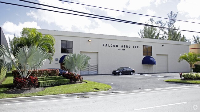
1941 Nw 97Th Ave
Miami-Miami Beach-Kendall, FL
Lago Industrial
35-3033-009-0120
LAGO INDUSTRIAL PB 114-75 LOT 11 BLK 1 LOT SIZE 22720 GROSS SQ FT OR 14428-535 1189 4 F/A/U 30-3033-009-0120
Foodprocessing
Miami/Dade
AE
Florida
12086C0286L
11
2024
0.52 AC
2025
Miami Airport West
009010
South Florida
8,450 SF
DEMOGRAPHICS near 1941 Nw 97Th Ave
1 Mile
3 Mile
5 Mile
2024 Total Population
5,161
154,811
358,985
2029 Population
5,046
152,568
350,392
Pop Growth 2024-2029
(2.23%)
(1.45%)
(2.39%)
Average Age
38
41
42
2024 Total Households
1,744
53,103
119,698
HH Growth 2024-2029
(2.64%)
(1.79%)
(2.79%)
Median Household Inc
$71,353
$59,655
$60,931
Avg Household Size
2.90
2.80
2.80
2024 Avg HH Vehicles
2.00
2.00
2.00
Median Home Value
$452,162
$335,398
$384,485
Median Year Built
1995
1987
1980
Nearby Places
Map Layers
Map Styles
 Street
 Aerial
- Restaurants
- Banks
- Shops
- Fitness
- Groceries
PUBLIC TRANSPORTATION
COMMUTER RAIL
Palmetto (Metrorail Green Line - Miami-Dade Transit (Metrorail/Metromover))
DRIVE
WALK
Distance
Palmetto (Metrorail Green Line - Miami-Dade Transit (Metrorail/Metromover))
12 min
5.5 mi
Okeechobee (Metrorail Green Line - Miami-Dade Transit (Metrorail/Metromover))
DRIVE
WALK
Distance
Okeechobee (Metrorail Green Line - Miami-Dade Transit (Metrorail/Metromover))
14 min
7.1 mi
AIRPORT
Miami International
DRIVE
WALK
Distance
Miami International
12 min
4.7 mi
Fort Lauderdale/Hollywood International
DRIVE
WALK
Distance
Fort Lauderdale/Hollywood International
44 min
32.8 mi
Freight Ports
Port of Miami
DRIVE
WALK
Distance
Port of Miami
24 min
13.8 mi
SALE & LEASE HISTORY
LISTING DATE
SALE/LEASE

Oct 27, 2022
For Sale
May 16, 2024
For Lease
Mar 21, 2024
For Lease
Jan 11, 2023
For Lease
Aug 31, 2023
For Lease
Nearby Properties
Address
Land Use
TOTAL SIZE
Lot Size
Zoning
Address
Land Use
TOTAL SIZE
Lot Size
Zoning
2,512,642 SF
100.78 AC
6400
Address
Land Use
TOTAL SIZE
Lot Size
Zoning
4,384,261 SF
343.66 AC
6400
Address
Land Use
TOTAL SIZE
Lot Size
Zoning
1,071,874 SF
6.73 AC
4802
Address
Land Use
TOTAL SIZE
Lot Size
Zoning
851,502 SF
11.73 AC
6119
Address
Land Use
TOTAL SIZE
Lot Size
Zoning
784,416 SF
1.72 AC
6480
Address
Land Use
TOTAL SIZE
Lot Size
Zoning
1,680,493 SF
23.71 AC
4100
Address
Land Use
TOTAL SIZE
Lot Size
Zoning
481,242 SF
13.61 AC
6400
Address
Land Use
TOTAL SIZE
Lot Size
Zoning
465,663 SF
11.29 AC
4100
Address
Land Use
TOTAL SIZE
Lot Size
Zoning
666,015 SF
4 AC
6119
Address
Land Use
TOTAL SIZE
Lot Size
Zoning
582,921 SF
4.51 AC
6119
Address
Land Use
TOTAL SIZE
Lot Size
Zoning
585,943 SF
22.41 AC
3800
Address
Land Use
TOTAL SIZE
Lot Size
Zoning
671,088 SF
19.84 AC
6400
Address
Land Use
TOTAL SIZE
Lot Size
Zoning
475,423 SF
14.56 AC
9450
Address
Land Use
TOTAL SIZE
Lot Size
Zoning
929,765 SF
453.69 AC
6119
Address
Land Use
TOTAL SIZE
Lot Size
Zoning
899,162 SF
9.89 AC
7700
Address
Land Use
TOTAL SIZE
Lot Size
Zoning
418,532 SF
17.95 AC
7300
Address
Land Use
TOTAL SIZE
Lot Size
Zoning
448,531 SF
37 AC
6400
Address
Land Use
TOTAL SIZE
Lot Size
Zoning
608,139 SF
5.80 AC
6119
Address
Land Use
TOTAL SIZE
Lot Size
Zoning
868,154 SF
1.71 AC
6480
Address
Land Use
TOTAL SIZE
Lot Size
Zoning
612,289 SF
3.38 AC
6119
Address
Land Use
TOTAL SIZE
Lot Size
Zoning
540,427 SF
26.86 AC
3700
Address
Land Use
TOTAL SIZE
Lot Size
Zoning
762,624 SF
1.70 AC
6480
Address
Land Use
TOTAL SIZE
Lot Size
Zoning
145.77 AC
7700
Address
Land Use
TOTAL SIZE
Lot Size
Zoning
755,156 SF
29.44 AC
7100
Address
Land Use
TOTAL SIZE
Lot Size
Zoning
352,663 SF
0.65 AC
6119
Address
Land Use
TOTAL SIZE
Lot Size
Zoning
438,387 SF
16.20 AC
3900
Address
Land Use
TOTAL SIZE
Lot Size
Zoning
359,107 SF
9.58 AC
9450
Address
Land Use
TOTAL SIZE
Lot Size
Zoning
428,212 SF
17.56 AC
3900
Address
Land Use
TOTAL SIZE
Lot Size
Zoning
468,218 SF
17.06 AC
7100
Address
Land Use
TOTAL SIZE
Lot Size
Zoning
468,411 SF
21.36 AC
7100
The World's #1 Commercial Real Estate Marketplace
Connect with us
© 2025 CoStar Group
The information above has been obtained from sources believed reliable. While we do not doubt its accuracy we have not verified it and make no guarantee, warranty or representation about it. It is your responsibility to independently confirm its accuracy and completeness. Any projections, opinions, assumptions, or estimates used are for example only and do not represent the current or future performance of the property. The value of this transaction to you depends on tax and other factors which should be evaluated by your tax, financial, and legal advisors. You and your advisors should conduct a careful, independent investigation of the property to determine to your satisfaction the suitability of the property for your needs.