Property Record
19505 Wied Rd, Spring, TX 77388


NEARBY LISTINGS FOR SALE OR LEASE
Property Detail
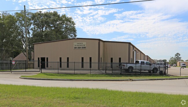
19505 Wied Rd
0451740000052
Abst 870 B B West
Warehouse
TRS 7 & 7B ABST 870 B B WEST
X
Harris
48339C0700F
Texas
2024
5.12 AC
2025
North Fwy/Tomball Pky
553403
Houston
65,425 SF
Houston-Pasadena-The Woodlands, TX
DEMOGRAPHICS near 19505 Wied Rd
1 Mile
3 Mile
5 Mile
2024 Total Population
12,958
99,112
244,176
2029 Population
13,076
100,964
250,557
Pop Growth 2024-2029
+ 0.91%
+ 1.87%
+ 2.61%
Average Age
38
37
37
2024 Total Households
4,495
34,758
86,476
HH Growth 2024-2029
+ 0.91%
+ 1.87%
+ 2.69%
Median Household Inc
$79,354
$82,644
$74,648
Avg Household Size
2.80
2.80
2.80
2024 Avg HH Vehicles
2.00
2.00
2.00
Median Home Value
$266,638
$252,176
$248,891
Median Year Built
1997
1992
1995
Nearby Places
Map Layers
Map Styles
 Street
 Aerial
- Restaurants
- Banks
- Shops
- Fitness
- Groceries
PUBLIC TRANSPORTATION
AIRPORT
George Bush Intcntl/Houston
DRIVE
WALK
Distance
George Bush Intcntl/Houston
25 min
17.4 mi
Freight Ports
Port of Houston
DRIVE
WALK
Distance
Port of Houston
47 min
32.7 mi
SALE & LEASE HISTORY
LISTING DATE
SALE/LEASE

Mar 01, 2021
For Lease
Nearby Properties
Address
Land Use
TOTAL SIZE
Lot Size
Zoning
Address
Land Use
TOTAL SIZE
Lot Size
Zoning
382,636 SF
25.51 AC
Address
Land Use
TOTAL SIZE
Lot Size
Zoning
320,507 SF
25.29 AC
Address
Land Use
TOTAL SIZE
Lot Size
Zoning
338,220 SF
10.26 AC
Address
Land Use
TOTAL SIZE
Lot Size
Zoning
394,700 SF
17.34 AC
Address
Land Use
TOTAL SIZE
Lot Size
Zoning
364,860 SF
14.96 AC
Address
Land Use
TOTAL SIZE
Lot Size
Zoning
341,336 SF
14.03 AC
Address
Land Use
TOTAL SIZE
Lot Size
Zoning
343,806 SF
17.76 AC
Address
Land Use
TOTAL SIZE
Lot Size
Zoning
360,340 SF
14.29 AC
Address
Land Use
TOTAL SIZE
Lot Size
Zoning
341,961 SF
28.25 AC
Address
Land Use
TOTAL SIZE
Lot Size
Zoning
434,400 SF
23.55 AC
Address
Land Use
TOTAL SIZE
Lot Size
Zoning
304,096 SF
14.80 AC
Address
Land Use
TOTAL SIZE
Lot Size
Zoning
282,661 SF
17.81 AC
Address
Land Use
TOTAL SIZE
Lot Size
Zoning
266,594 SF
10.71 AC
Address
Land Use
TOTAL SIZE
Lot Size
Zoning
290,353 SF
10.79 AC
Address
Land Use
TOTAL SIZE
Lot Size
Zoning
413,131 SF
12.52 AC
Address
Land Use
TOTAL SIZE
Lot Size
Zoning
291,073 SF
11.70 AC
Address
Land Use
TOTAL SIZE
Lot Size
Zoning
366,954 SF
18.88 AC
Address
Land Use
TOTAL SIZE
Lot Size
Zoning
241,113 SF
6.29 AC
Address
Land Use
TOTAL SIZE
Lot Size
Zoning
136,748 SF
30.29 AC
Address
Land Use
TOTAL SIZE
Lot Size
Zoning
297,961 SF
18.04 AC
Address
Land Use
TOTAL SIZE
Lot Size
Zoning
173,371 SF
5.17 AC
Address
Land Use
TOTAL SIZE
Lot Size
Zoning
174,349 SF
9.95 AC
Address
Land Use
TOTAL SIZE
Lot Size
Zoning
463,081 SF
25.65 AC
Address
Land Use
TOTAL SIZE
Lot Size
Zoning
255,901 SF
11.01 AC
Address
Land Use
TOTAL SIZE
Lot Size
Zoning
158,081 SF
23.46 AC
Address
Land Use
TOTAL SIZE
Lot Size
Zoning
114,917 SF
18.61 AC
Address
Land Use
TOTAL SIZE
Lot Size
Zoning
249,134 SF
11.85 AC
Address
Land Use
TOTAL SIZE
Lot Size
Zoning
148,506 SF
Address
Land Use
TOTAL SIZE
Lot Size
Zoning
365,298 SF
15.28 AC
Address
Land Use
TOTAL SIZE
Lot Size
Zoning
218,967 SF
14.11 AC
The World's #1 Commercial Real Estate Marketplace
Connect with us
© 2026 CoStar Group
The information above has been obtained from sources believed reliable. While we do not doubt its accuracy we have not verified it and make no guarantee, warranty or representation about it. It is your responsibility to independently confirm its accuracy and completeness. Any projections, opinions, assumptions, or estimates used are for example only and do not represent the current or future performance of the property. The value of this transaction to you depends on tax and other factors which should be evaluated by your tax, financial, and legal advisors. You and your advisors should conduct a careful, independent investigation of the property to determine to your satisfaction the suitability of the property for your needs.