Property Record
1951 Bernice Rd, Lansing, IL 60438


Save to a Folder
{{folder.Name}}
{{folder.ListingIds.length}} Properties
{{folder.ListingIds.length}} Property
Create a New Folder
Property Detail
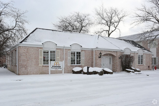
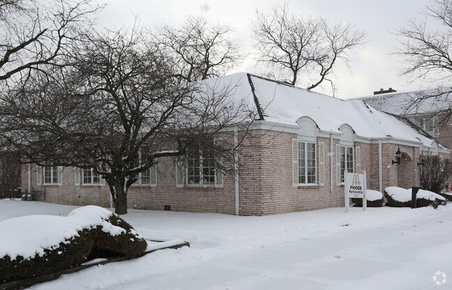
1951 Bernice Rd
Chicago-Naperville-Elgin, IL-IN
UNITS 1-A & 1-B IN LES QUARTER OFFI CE CONDO IN SW4 OF SEC25 T36N R14E 3P
29-25-301-059-1001
Cook
Taxexempt
Illinois
B and X Area of moderate flood hazard, usually the area between the limits of the 100-year and 500-year floods.
1
2023
2.04 AC
2025
Near South Cook
827901
Chicago
3,860 SF
NEARBY LISTINGS FOR SALE OR LEASE
DEMOGRAPHICS near 1951 Bernice Rd
1 mile
3 mile
5 mile
2025 Total Population
6,365
90,986
242,981
2030 Population
6,424
91,695
245,669
Pop Growth 2025-2030
+ 0.93%
+ 0.78%
+ 1.11%
Average Age
44
42
41
2025 Total Households
2,420
34,913
90,478
HH Growth 2025-2030
+ 0.70%
+ 0.54%
+ 0.90%
Median Household Inc
$75,957
$68,816
$64,034
Avg Household Size
2.50
2.50
2.60
2025 Avg HH Vehicles
2.00
2.00
2.00
Median Home Value
$252,877
$177,977
$174,143
Median Year Built
1974
1966
1963
Nearby Places
Map Layers
Map Styles
 Street
 Aerial
Layers
 Traffic
 Biking
Places
Listings with unknown addresses are not visible on the map
- Restaurants
- Banks
- Shops
- Fitness
- Groceries
PUBLIC TRANSPORTATION
COMMUTER RAIL
Hegewisch Station (South Shore Line - Northern Indiana Commuter Transportation District (South Shore Line))
Drive
Walk
Distance
Hegewisch Station (South Shore Line - Northern Indiana Commuter Transportation District (South Shore Line))
13 min
6.2 mi
Drive
Walk
Distance
15 min
6.8 mi
AIRPORT
Chicago Midway International
Drive
Walk
Distance
Chicago Midway International
37 min
22.8 mi
Chicago O'Hare International
Drive
Walk
Distance
Chicago O'Hare International
79 min
44.7 mi
Nearby Properties
Address
Land Use
TOTAL SIZE
Lot Size
Zoning
Address
Land Use
TOTAL SIZE
Lot Size
Zoning
24.56 AC
Address
Land Use
TOTAL SIZE
Lot Size
Zoning
Address
Land Use
TOTAL SIZE
Lot Size
Zoning
149,623 SF
4.93 AC
Address
Land Use
TOTAL SIZE
Lot Size
Zoning
5.01 AC
Address
Land Use
TOTAL SIZE
Lot Size
Zoning
119,082 SF
Address
Land Use
TOTAL SIZE
Lot Size
Zoning
48,134 SF
5.33 AC
Address
Land Use
TOTAL SIZE
Lot Size
Zoning
30,895 SF
3 AC
R33
Address
Land Use
TOTAL SIZE
Lot Size
Zoning
69,894 SF
7.60 AC
Address
Land Use
TOTAL SIZE
Lot Size
Zoning
56,458 SF
2.17 AC
Address
Land Use
TOTAL SIZE
Lot Size
Zoning
450,777 SF
25.25 AC
Address
Land Use
TOTAL SIZE
Lot Size
Zoning
60,864 SF
5.55 AC
Address
Land Use
TOTAL SIZE
Lot Size
Zoning
7.31 AC
Address
Land Use
TOTAL SIZE
Lot Size
Zoning
66,118 SF
11.02 AC
Address
Land Use
TOTAL SIZE
Lot Size
Zoning
454,999 SF
27.43 AC
Address
Land Use
TOTAL SIZE
Lot Size
Zoning
40,489 SF
6.43 AC
Address
Land Use
TOTAL SIZE
Lot Size
Zoning
Address
Land Use
TOTAL SIZE
Lot Size
Zoning
11,118 SF
1.11 AC
Address
Land Use
TOTAL SIZE
Lot Size
Zoning
28,228 SF
4.63 AC
Address
Land Use
TOTAL SIZE
Lot Size
Zoning
40,168 SF
0.01 AC
Address
Land Use
TOTAL SIZE
Lot Size
Zoning
398,668 SF
13.92 AC
Address
Land Use
TOTAL SIZE
Lot Size
Zoning
44,189 SF
3.09 AC
Address
Land Use
TOTAL SIZE
Lot Size
Zoning
23,370 SF
0.52 AC
Address
Land Use
TOTAL SIZE
Lot Size
Zoning
Address
Land Use
TOTAL SIZE
Lot Size
Zoning
27,606 SF
2.87 AC
Address
Land Use
TOTAL SIZE
Lot Size
Zoning
39,259 SF
2.63 AC
Address
Land Use
TOTAL SIZE
Lot Size
Zoning
89,853 SF
2.68 AC
Address
Land Use
TOTAL SIZE
Lot Size
Zoning
159,145 SF
15.36 AC
Address
Land Use
TOTAL SIZE
Lot Size
Zoning
165,530 SF
1.82 AC
Address
Land Use
TOTAL SIZE
Lot Size
Zoning
29,749 SF
3.87 AC
Address
Land Use
TOTAL SIZE
Lot Size
Zoning
142,376 SF
24 AC
The World's #1 Commercial Real Estate Marketplace
Connect with us
© 2026 CoStar Group
The information above has been obtained from sources believed reliable. While we do not doubt its accuracy we have not verified it and make no guarantee, warranty or representation about it. It is your responsibility to independently confirm its accuracy and completeness. Any projections, opinions, assumptions, or estimates used are for example only and do not represent the current or future performance of the property. The value of this transaction to you depends on tax and other factors which should be evaluated by your tax, financial, and legal advisors. You and your advisors should conduct a careful, independent investigation of the property to determine to your satisfaction the suitability of the property for your needs.