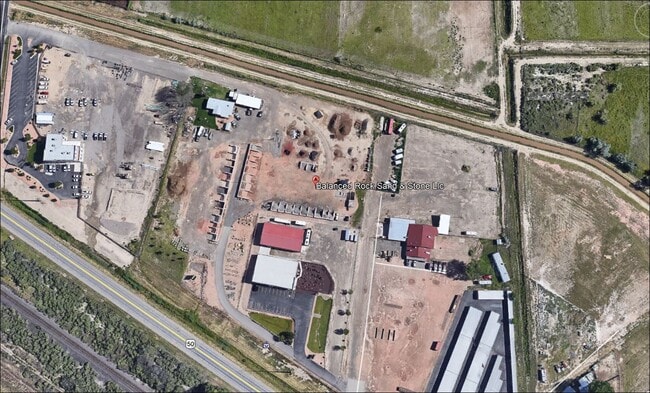
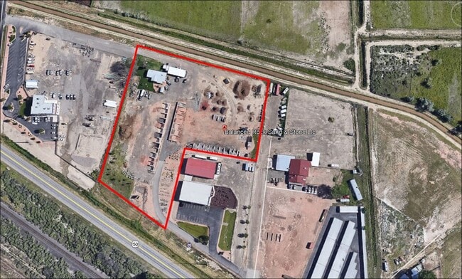
Property Record
1954 Highway 6 And 50, Fruita, CO 81521

Property Detail
1954 Highway 6 And 50
2697-271-08-001
LOT 1 COW TOWN 3 SUBDIVISION PHASE I REPLAT SEC 27 1N 2W - 5.17AC
Storebuilding
Mesa
GC
Colorado
B and X Area of moderate flood hazard, usually the area between the limits of the 100-year and 500-year floods.
1
2025
1.96 AC
2025
Colorado Northwest Area
001502
Other Market Areas
1,782 SF
Grand Junction, CO
NEARBY LISTINGS FOR SALE OR LEASE
DEMOGRAPHICS near 1954 Highway 6 And 50
1 mile
3 mile
5 mile
2025 Total Population
575
14,005
28,271
2030 Population
589
14,470
29,096
Pop Growth 2025-2030
+ 2.43%
+ 3.32%
+ 2.92%
Average Age
43
42
43
2025 Total Households
209
5,353
11,011
HH Growth 2025-2030
+ 2.87%
+ 3.47%
+ 3.07%
Median Household Inc
$92,045
$73,443
$83,964
Avg Household Size
2.70
2.60
2.50
2025 Avg HH Vehicles
2.00
2.00
2.00
Median Home Value
$572,785
$419,721
$454,438
Median Year Built
1998
1997
1997
Nearby Places
Map Layers
Map Styles
 Street
 Aerial
Layers
 Traffic
 Biking
Places
Listings with unknown addresses are not visible on the map
- Restaurants
- Banks
- Shops
- Fitness
- Groceries
PUBLIC TRANSPORTATION
COMMUTER RAIL
Grand Junction Amtrak Station (California Zephyr - Amtrak)
Drive
Walk
Distance
Grand Junction Amtrak Station (California Zephyr - Amtrak)
14 min
8.4 mi
AIRPORT
Grand Junction Regional
Drive
Walk
Distance
Grand Junction Regional
14 min
9.9 mi
Freight Ports
Port of Long Beach
Drive
Walk
Distance
Port of Long Beach
808 min
781.2 mi
SALE & LEASE HISTORY
LISTING DATE
SALE/LEASE

Sep 24, 2020
For Sale
Feb 01, 2023
For Sale
Nearby Properties
Address
Land Use
TOTAL SIZE
Lot Size
Zoning
Address
Land Use
TOTAL SIZE
Lot Size
Zoning
188,386 SF
39.06 AC
CSR
Address
Land Use
TOTAL SIZE
Lot Size
Zoning
97,809 SF
22.16 AC
Address
Land Use
TOTAL SIZE
Lot Size
Zoning
70,671 SF
12.63 AC
Address
Land Use
TOTAL SIZE
Lot Size
Zoning
57,933 SF
10 AC
CSR
Address
Land Use
TOTAL SIZE
Lot Size
Zoning
60,000 SF
11.50 AC
Address
Land Use
TOTAL SIZE
Lot Size
Zoning
80,543 SF
31.70 AC
AFT
Address
Land Use
TOTAL SIZE
Lot Size
Zoning
21,300 SF
17.89 AC
I-1
Address
Land Use
TOTAL SIZE
Lot Size
Zoning
22,544 SF
10.87 AC
I-1
Address
Land Use
TOTAL SIZE
Lot Size
Zoning
60,000 SF
5.72 AC
I-1
Address
Land Use
TOTAL SIZE
Lot Size
Zoning
83,593 SF
4.33 AC
PD
Address
Land Use
TOTAL SIZE
Lot Size
Zoning
50,790 SF
9,964.10 AC
TC
Address
Land Use
TOTAL SIZE
Lot Size
Zoning
12,400 SF
3,702.22 AC
C-2
Address
Land Use
TOTAL SIZE
Lot Size
Zoning
251,521 SF
0.02 AC
Address
Land Use
TOTAL SIZE
Lot Size
Zoning
16,677 SF
6.75 AC
Address
Land Use
TOTAL SIZE
Lot Size
Zoning
27,000 SF
14.94 AC
GC
Address
Land Use
TOTAL SIZE
Lot Size
Zoning
22,712 SF
3.65 AC
CRS
Address
Land Use
TOTAL SIZE
Lot Size
Zoning
16,257 SF
0.66 AC
Address
Land Use
TOTAL SIZE
Lot Size
Zoning
39,496 SF
2.39 AC
Address
Land Use
TOTAL SIZE
Lot Size
Zoning
31,236 SF
1.20 AC
TCDD
Address
Land Use
TOTAL SIZE
Lot Size
Zoning
24,495 SF
2.03 AC
Address
Land Use
TOTAL SIZE
Lot Size
Zoning
28,900 SF
4.70 AC
PD
Address
Land Use
TOTAL SIZE
Lot Size
Zoning
27,063 SF
3.49 AC
I-1
Address
Land Use
TOTAL SIZE
Lot Size
Zoning
14,406 SF
1.77 AC
DCRD
Address
Land Use
TOTAL SIZE
Lot Size
Zoning
31,010 SF
2.25 AC
GC
Address
Land Use
TOTAL SIZE
Lot Size
Zoning
26,732 SF
4.75 AC
Address
Land Use
TOTAL SIZE
Lot Size
Zoning
22,787 SF
9.45 AC
I-1
Address
Land Use
TOTAL SIZE
Lot Size
Zoning
19,707 SF
5.99 AC
I-1
Address
Land Use
TOTAL SIZE
Lot Size
Zoning
24,605 SF
1.45 AC
Address
Land Use
TOTAL SIZE
Lot Size
Zoning
21,174 SF
2.92 AC
I-1
Address
Land Use
TOTAL SIZE
Lot Size
Zoning
12,332 SF
9.70 AC
PD
The World's #1 Commercial Real Estate Marketplace
Connect with us
© 2026 CoStar Group
The information above has been obtained from sources believed reliable. While we do not doubt its accuracy we have not verified it and make no guarantee, warranty or representation about it. It is your responsibility to independently confirm its accuracy and completeness. Any projections, opinions, assumptions, or estimates used are for example only and do not represent the current or future performance of the property. The value of this transaction to you depends on tax and other factors which should be evaluated by your tax, financial, and legal advisors. You and your advisors should conduct a careful, independent investigation of the property to determine to your satisfaction the suitability of the property for your needs.