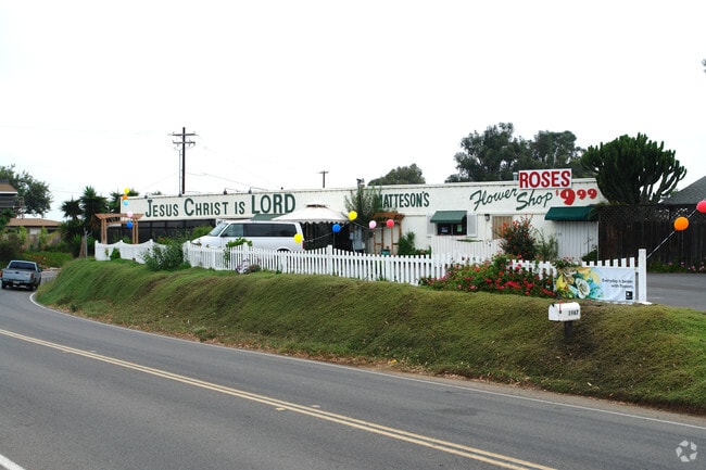
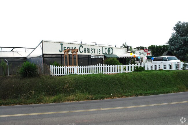
Property Record
1967 N Vulcan Ave, Encinitas, CA 92024


Property Detail
1967 N Vulcan Ave
216-052-01
SEC 33-12-4W S H (EX ST)DOC22-446941 IN
Multifamilydwelling
San Diego
N-R3
California
B and X Area of moderate flood hazard, usually the area between the limits of the 100-year and 500-year floods.
1.95 AC
2024
Cardiff/Encinitas
2025
San Diego
017701
San Diego-Chula Vista-Carlsbad, CA
88,188 SF
NEARBY LISTINGS FOR SALE OR LEASE
DEMOGRAPHICS near 1967 N Vulcan Ave
1 mile
3 mile
5 mile
2025 Total Population
6,941
54,105
137,584
2030 Population
7,077
54,690
138,443
Pop Growth 2025-2030
+ 1.96%
+ 1.08%
+ 0.62%
Average Age
44
44
43
2025 Total Households
3,009
21,931
53,516
HH Growth 2025-2030
+ 1.99%
+ 1.06%
+ 0.59%
Median Household Inc
$158,242
$161,295
$161,938
Avg Household Size
2.30
2.40
2.50
2025 Avg HH Vehicles
2.00
2.00
2.00
Median Home Value
$1,115,832
$1,105,806
$1,104,273
Median Year Built
1982
1989
1985
Nearby Places
Map Layers
Map Styles
 Street
 Aerial
Layers
 Traffic
 Biking
Places
Listings with unknown addresses are not visible on the map
- Restaurants
- Banks
- Shops
- Fitness
- Groceries
PUBLIC TRANSPORTATION
COMMUTER RAIL
Encinitas (Coaster - San Diego North County Transit District (Coaster/Sprinter/Breeze))
Drive
Walk
Distance
Encinitas (Coaster - San Diego North County Transit District (Coaster/Sprinter/Breeze))
7 min
3.1 mi
Carlsbad Poinsettia (Coaster - San Diego North County Transit District (Coaster/Sprinter/Breeze))
Drive
Walk
Distance
Carlsbad Poinsettia (Coaster - San Diego North County Transit District (Coaster/Sprinter/Breeze))
7 min
3.3 mi
AIRPORT
San Diego International
Drive
Walk
Distance
San Diego International
35 min
27.1 mi
Freight Ports
Port of San Diego
Drive
Walk
Distance
Port of San Diego
40 min
31.5 mi
Nearby Properties
Address
Land Use
TOTAL SIZE
Lot Size
Zoning
Address
Land Use
TOTAL SIZE
Lot Size
Zoning
55.06 AC
P-C
Address
Land Use
TOTAL SIZE
Lot Size
Zoning
18.19 AC
P-C
Address
Land Use
TOTAL SIZE
Lot Size
Zoning
30.88 AC
P-C
Address
Land Use
TOTAL SIZE
Lot Size
Zoning
12.62 AC
P-C
Address
Land Use
TOTAL SIZE
Lot Size
Zoning
4.32 AC
N-LVSC
Address
Land Use
TOTAL SIZE
Lot Size
Zoning
21.15 AC
P-C
Address
Land Use
TOTAL SIZE
Lot Size
Zoning
18.34 AC
P-C
Address
Land Use
TOTAL SIZE
Lot Size
Zoning
12.44 AC
P/SP
Address
Land Use
TOTAL SIZE
Lot Size
Zoning
4.77 AC
ER-MU1
Address
Land Use
TOTAL SIZE
Lot Size
Zoning
5.45 AC
C-T
Address
Land Use
TOTAL SIZE
Lot Size
Zoning
14.73 AC
C-L
Address
Land Use
TOTAL SIZE
Lot Size
Zoning
91,431 SF
8.69 AC
C-2
Address
Land Use
TOTAL SIZE
Lot Size
Zoning
11.10 AC
RD-M-Q
Address
Land Use
TOTAL SIZE
Lot Size
Zoning
3.17 AC
C-T
Address
Land Use
TOTAL SIZE
Lot Size
Zoning
6.61 AC
P-C
Address
Land Use
TOTAL SIZE
Lot Size
Zoning
55,656 SF
13.04 AC
R-1-Q
Address
Land Use
TOTAL SIZE
Lot Size
Zoning
9.76 AC
M
Address
Land Use
TOTAL SIZE
Lot Size
Zoning
6.25 AC
P-C
Address
Land Use
TOTAL SIZE
Lot Size
Zoning
9.15 AC
RD-M-Q
Address
Land Use
TOTAL SIZE
Lot Size
Zoning
89,000 SF
8.61 AC
O
Address
Land Use
TOTAL SIZE
Lot Size
Zoning
12.67 AC
P-C
Address
Land Use
TOTAL SIZE
Lot Size
Zoning
71,962 SF
5.33 AC
P/SP
Address
Land Use
TOTAL SIZE
Lot Size
Zoning
50,039 SF
0.75 AC
O
Address
Land Use
TOTAL SIZE
Lot Size
Zoning
76,444 SF
4.59 AC
P-C
Address
Land Use
TOTAL SIZE
Lot Size
Zoning
5.91 AC
RD-M
Address
Land Use
TOTAL SIZE
Lot Size
Zoning
8,000 SF
9.20 AC
RD-M
Address
Land Use
TOTAL SIZE
Lot Size
Zoning
86,940 SF
3.85 AC
P-M
Address
Land Use
TOTAL SIZE
Lot Size
Zoning
4.78 AC
C-T-Q
Address
Land Use
TOTAL SIZE
Lot Size
Zoning
14.26 AC
P-C
The World's #1 Commercial Real Estate Marketplace
Connect with us
© 2026 CoStar Group
The information above has been obtained from sources believed reliable. While we do not doubt its accuracy we have not verified it and make no guarantee, warranty or representation about it. It is your responsibility to independently confirm its accuracy and completeness. Any projections, opinions, assumptions, or estimates used are for example only and do not represent the current or future performance of the property. The value of this transaction to you depends on tax and other factors which should be evaluated by your tax, financial, and legal advisors. You and your advisors should conduct a careful, independent investigation of the property to determine to your satisfaction the suitability of the property for your needs.