Property Record
1985 N Summit Ave, Pasadena, CA 91103

Property Detail
1985 N Summit Ave
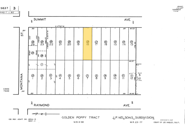
5837-003-018
GOLDEN POPPY TRACT LOT 18
Multifamilydwelling
LOS ANGELES
PSR1
California
B and X Area of moderate flood hazard, usually the area between the limits of the 100-year and 500-year floods.
18
2024
0.20 AC
2025
La Pintoresca Park
461502
Los Angeles
3,776 SF
Los Angeles-Long Beach-Glendale, CA
NEARBY LISTINGS FOR SALE OR LEASE
DEMOGRAPHICS near 1985 N Summit Ave
1 mile
3 mile
5 mile
2025 Total Population
27,683
142,668
287,954
2030 Population
27,273
141,603
285,765
Pop Growth 2025-2030
(1.48%)
(0.75%)
(0.76%)
Average Age
41
42
43
2025 Total Households
8,555
56,040
111,151
HH Growth 2025-2030
(1.77%)
(0.81%)
(0.90%)
Median Household Inc
$94,548
$106,442
$120,636
Avg Household Size
2.90
2.40
2.50
2025 Avg HH Vehicles
2.00
2.00
2.00
Median Home Value
$915,176
$1,043,020
$1,080,320
Median Year Built
1947
1956
1955
Nearby Places
Map Layers
Map Styles
 Street
 Aerial
Transit
 Traffic
 Biking
Places
Listings with unknown addresses are not visible on the map
- Restaurants
- Banks
- Shops
- Fitness
- Groceries
PUBLIC TRANSPORTATION
AIRPORT
Bob Hope
Drive
Walk
Distance
Bob Hope
28 min
18.3 mi
Long Beach (Daugherty Field)
Drive
Walk
Distance
Long Beach (Daugherty Field)
47 min
29.9 mi
Los Angeles International
Drive
Walk
Distance
Los Angeles International
46 min
30.5 mi
Freight Ports
Port of Long Beach
Drive
Walk
Distance
Port of Long Beach
50 min
31.8 mi
Nearby Properties
Address
Land Use
TOTAL SIZE
Lot Size
Zoning
Address
Land Use
TOTAL SIZE
Lot Size
Zoning
643,699 SF
9.73 AC
PSC-
Address
Land Use
TOTAL SIZE
Lot Size
Zoning
1,067,590 SF
7.22 AC
PSC-
Address
Land Use
TOTAL SIZE
Lot Size
Zoning
346,537 SF
3.33 AC
PSC-
Address
Land Use
TOTAL SIZE
Lot Size
Zoning
262,988 SF
1.42 AC
PSR*
Address
Land Use
TOTAL SIZE
Lot Size
Zoning
278,741 SF
1.21 AC
PSC*
Address
Land Use
TOTAL SIZE
Lot Size
Zoning
407,027 SF
3.91 AC
PSC-
Address
Land Use
TOTAL SIZE
Lot Size
Zoning
291,667 SF
0.83 AC
PSC-
Address
Land Use
TOTAL SIZE
Lot Size
Zoning
255,411 SF
0.81 AC
PSC-
Address
Land Use
TOTAL SIZE
Lot Size
Zoning
231,187 SF
1.47 AC
PSC-
Address
Land Use
TOTAL SIZE
Lot Size
Zoning
588,972 SF
2.59 AC
PSC-
Address
Land Use
TOTAL SIZE
Lot Size
Zoning
236,801 SF
1.67 AC
PSC-
Address
Land Use
TOTAL SIZE
Lot Size
Zoning
246,000 SF
5.67 AC
PSC-
Address
Land Use
TOTAL SIZE
Lot Size
Zoning
749,874 SF
4.74 AC
PSC-
Address
Land Use
TOTAL SIZE
Lot Size
Zoning
233,424 SF
1.67 AC
PSC-
Address
Land Use
TOTAL SIZE
Lot Size
Zoning
335,753 SF
8.19 AC
LCA1
Address
Land Use
TOTAL SIZE
Lot Size
Zoning
255,343 SF
0.80 AC
PSC-
Address
Land Use
TOTAL SIZE
Lot Size
Zoning
266,947 SF
10.91 AC
PSC2
Address
Land Use
TOTAL SIZE
Lot Size
Zoning
91,145 SF
1.21 AC
PSC-
Address
Land Use
TOTAL SIZE
Lot Size
Zoning
100,653 SF
1.41 AC
PSC-
Address
Land Use
TOTAL SIZE
Lot Size
Zoning
139,416 SF
10.27 AC
PSR*
Address
Land Use
TOTAL SIZE
Lot Size
Zoning
220,402 SF
1.35 AC
PSC-
Address
Land Use
TOTAL SIZE
Lot Size
Zoning
203,067 SF
0.62 AC
PSC-
Address
Land Use
TOTAL SIZE
Lot Size
Zoning
383,924 SF
2.10 AC
PSC-
Address
Land Use
TOTAL SIZE
Lot Size
Zoning
217,778 SF
1.81 AC
PSC-
Address
Land Use
TOTAL SIZE
Lot Size
Zoning
161,825 SF
4.04 AC
PSC*
Address
Land Use
TOTAL SIZE
Lot Size
Zoning
225,995 SF
10.86 AC
PSC2*
Address
Land Use
TOTAL SIZE
Lot Size
Zoning
345,558 SF
2.88 AC
PSC-
Address
Land Use
TOTAL SIZE
Lot Size
Zoning
158,307 SF
2.23 AC
PSC-
Address
Land Use
TOTAL SIZE
Lot Size
Zoning
133,502 SF
1.18 AC
PSC
Address
Land Use
TOTAL SIZE
Lot Size
Zoning
148,214 SF
1.33 AC
PSC-
The World's #1 Commercial Real Estate Marketplace
Connect with us
© 2026 CoStar Group
The information above has been obtained from sources believed reliable. While we do not doubt its accuracy we have not verified it and make no guarantee, warranty or representation about it. It is your responsibility to independently confirm its accuracy and completeness. Any projections, opinions, assumptions, or estimates used are for example only and do not represent the current or future performance of the property. The value of this transaction to you depends on tax and other factors which should be evaluated by your tax, financial, and legal advisors. You and your advisors should conduct a careful, independent investigation of the property to determine to your satisfaction the suitability of the property for your needs.