Property Record
1995 E Coalton Rd, Superior, CO 80027
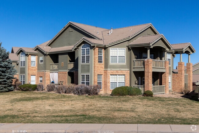

Property Detail
1995 E Coalton Rd
1575293-04-006
TRACT B ROCK CREEK RANCH FLG 17A CROSSCREEK
Multifamilydwelling
Boulder
B and X Area of moderate flood hazard, usually the area between the limits of the 100-year and 500-year floods.
Colorado
2024
27.58 AC
2025
Southwest Boulder County
060601
Denver
493,314 SF
Boulder, CO
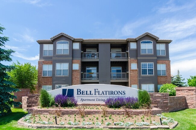
NEARBY LISTINGS FOR SALE OR LEASE
DEMOGRAPHICS near 1995 E Coalton Rd
1 mile
3 mile
5 mile
2024 Total Population
10,670
36,122
116,125
2029 Population
10,899
36,862
117,535
Pop Growth 2024-2029
+ 2.15%
+ 2.05%
+ 1.21%
Average Age
38
40
40
2024 Total Households
4,475
15,803
47,715
HH Growth 2024-2029
+ 3.24%
+ 2.92%
+ 1.59%
Median Household Inc
$122,804
$114,621
$113,323
Avg Household Size
2.30
2.20
2.40
2024 Avg HH Vehicles
2.00
2.00
2.00
Median Home Value
$836,986
$797,626
$733,148
Median Year Built
1998
1998
1993
Nearby Places
Map Layers
Map Styles
 Street
 Aerial
Transit
 Traffic
 Biking
Places
Listings with unknown addresses are not visible on the map
- Restaurants
- Banks
- Shops
- Fitness
- Groceries
PUBLIC TRANSPORTATION
AIRPORT
Denver International
Drive
Walk
Distance
Denver International
40 min
34.7 mi
Freight Ports
Tulsa Port Of Catoosa
Drive
Walk
Distance
Tulsa Port Of Catoosa
743 min
720.9 mi
Nearby Properties
Address
Land Use
TOTAL SIZE
Lot Size
Zoning
Address
Land Use
TOTAL SIZE
Lot Size
Zoning
776,625 SF
41.29 AC
PUD
Address
Land Use
TOTAL SIZE
Lot Size
Zoning
206.60 AC
A
Address
Land Use
TOTAL SIZE
Lot Size
Zoning
305,331 SF
14.41 AC
PUD
Address
Land Use
TOTAL SIZE
Lot Size
Zoning
411,485 SF
24.79 AC
Address
Land Use
TOTAL SIZE
Lot Size
Zoning
117,775 SF
34.58 AC
GA; PUD
Address
Land Use
TOTAL SIZE
Lot Size
Zoning
57.62 AC
Address
Land Use
TOTAL SIZE
Lot Size
Zoning
211,191 SF
30.46 AC
Address
Land Use
TOTAL SIZE
Lot Size
Zoning
254,500 SF
13.42 AC
PUD
Address
Land Use
TOTAL SIZE
Lot Size
Zoning
279.72 AC
A
Address
Land Use
TOTAL SIZE
Lot Size
Zoning
49.69 AC
Address
Land Use
TOTAL SIZE
Lot Size
Zoning
34.84 AC
Address
Land Use
TOTAL SIZE
Lot Size
Zoning
41.05 AC
Address
Land Use
TOTAL SIZE
Lot Size
Zoning
98.12 AC
A
Address
Land Use
TOTAL SIZE
Lot Size
Zoning
279,770 SF
34.13 AC
Address
Land Use
TOTAL SIZE
Lot Size
Zoning
233.17 AC
A
Address
Land Use
TOTAL SIZE
Lot Size
Zoning
42.46 AC
A
Address
Land Use
TOTAL SIZE
Lot Size
Zoning
320,771 SF
18.60 AC
PUD
Address
Land Use
TOTAL SIZE
Lot Size
Zoning
254,500 SF
13 AC
PUD
Address
Land Use
TOTAL SIZE
Lot Size
Zoning
130,769 SF
18.61 AC
PUD
Address
Land Use
TOTAL SIZE
Lot Size
Zoning
104.21 AC
A
Address
Land Use
TOTAL SIZE
Lot Size
Zoning
643,992 SF
13.24 AC
PUD
Address
Land Use
TOTAL SIZE
Lot Size
Zoning
75.36 AC
A
Address
Land Use
TOTAL SIZE
Lot Size
Zoning
76.13 AC
A
Address
Land Use
TOTAL SIZE
Lot Size
Zoning
212,852 SF
12.82 AC
Address
Land Use
TOTAL SIZE
Lot Size
Zoning
187,920 SF
10.57 AC
PUD
Address
Land Use
TOTAL SIZE
Lot Size
Zoning
153,430 SF
12.16 AC
Address
Land Use
TOTAL SIZE
Lot Size
Zoning
281,167 SF
19.52 AC
Address
Land Use
TOTAL SIZE
Lot Size
Zoning
19.16 AC
Address
Land Use
TOTAL SIZE
Lot Size
Zoning
25.01 AC
Address
Land Use
TOTAL SIZE
Lot Size
Zoning
81.89 AC
A
The World's #1 Commercial Real Estate Marketplace
Connect with us
© 2026 CoStar Group
The information above has been obtained from sources believed reliable. While we do not doubt its accuracy we have not verified it and make no guarantee, warranty or representation about it. It is your responsibility to independently confirm its accuracy and completeness. Any projections, opinions, assumptions, or estimates used are for example only and do not represent the current or future performance of the property. The value of this transaction to you depends on tax and other factors which should be evaluated by your tax, financial, and legal advisors. You and your advisors should conduct a careful, independent investigation of the property to determine to your satisfaction the suitability of the property for your needs.