Property Record
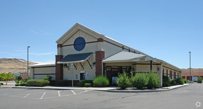
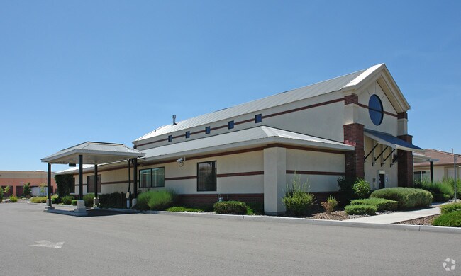
1995 E Prater Way, Sparks, NV 89434


Property Detail
1995 E Prater Way
037-350-10
REV PM 5141 LOT A
Commercialnec
WASHOE
PO
Nevada
B and X Area of moderate flood hazard, usually the area between the limits of the 100-year and 500-year floods.
a
0
2 AC
2026
Northeast Sparks
003111
Reno/Sparks
15,431 SF
Reno, NV
NEARBY LISTINGS FOR SALE OR LEASE
DEMOGRAPHICS near 1995 E Prater Way
1 mile
3 mile
5 mile
2025 Total Population
10,173
58,679
140,694
2030 Population
10,554
59,897
144,440
Pop Growth 2025-2030
+ 3.75%
+ 2.08%
+ 2.66%
Average Age
43
41
40
2025 Total Households
4,401
23,111
54,193
HH Growth 2025-2030
+ 4.32%
+ 2.34%
+ 2.85%
Median Household Inc
$89,469
$87,325
$76,830
Avg Household Size
2.30
2.50
2.50
2025 Avg HH Vehicles
2.00
2.00
2.00
Median Home Value
$488,475
$460,710
$449,186
Median Year Built
1990
1985
1987
Nearby Places
Map Layers
Map Styles
 Street
 Aerial
Transit
 Traffic
 Biking
Places
Listings with unknown addresses are not visible on the map
- Restaurants
- Banks
- Shops
- Fitness
- Groceries
PUBLIC TRANSPORTATION
COMMUTER RAIL
Reno (California Zephyr - Amtrak)
Drive
Walk
Distance
Reno (California Zephyr - Amtrak)
12 min
8.0 mi
AIRPORT
Reno/Tahoe International
Drive
Walk
Distance
Reno/Tahoe International
31 min
11.8 mi
Freight Ports
Port of Stockton
Drive
Walk
Distance
Port of Stockton
216 min
186.1 mi
Nearby Properties
Address
Land Use
TOTAL SIZE
Lot Size
Zoning
Address
Land Use
TOTAL SIZE
Lot Size
Zoning
385,812 SF
16.47 AC
NUD
Address
Land Use
TOTAL SIZE
Lot Size
Zoning
6,641 SF
247.42 AC
PF
Address
Land Use
TOTAL SIZE
Lot Size
Zoning
356,160 SF
12.05 AC
MUD
Address
Land Use
TOTAL SIZE
Lot Size
Zoning
347,564 SF
10.23 AC
MUD
Address
Land Use
TOTAL SIZE
Lot Size
Zoning
365,962 SF
3.54 AC
PD
Address
Land Use
TOTAL SIZE
Lot Size
Zoning
617,081 SF
2.62 AC
MUD
Address
Land Use
TOTAL SIZE
Lot Size
Zoning
279,596 SF
10.94 AC
NUD
Address
Land Use
TOTAL SIZE
Lot Size
Zoning
246,076 SF
16.43 AC
PD
Address
Land Use
TOTAL SIZE
Lot Size
Zoning
622,628 SF
2.91 AC
MUD
Address
Land Use
TOTAL SIZE
Lot Size
Zoning
79,748 SF
8.98 AC
NUD
Address
Land Use
TOTAL SIZE
Lot Size
Zoning
232,481 SF
9.45 AC
PD
Address
Land Use
TOTAL SIZE
Lot Size
Zoning
248,124 SF
19.35 AC
PD
Address
Land Use
TOTAL SIZE
Lot Size
Zoning
273,101 SF
15.96 AC
MF-3/PUD
Address
Land Use
TOTAL SIZE
Lot Size
Zoning
237,680 SF
16.65 AC
PD
Address
Land Use
TOTAL SIZE
Lot Size
Zoning
150,712 SF
16.90 AC
PO
Address
Land Use
TOTAL SIZE
Lot Size
Zoning
242,907 SF
4.18 AC
NUD
Address
Land Use
TOTAL SIZE
Lot Size
Zoning
203,367 SF
1 AC
MUD
Address
Land Use
TOTAL SIZE
Lot Size
Zoning
378.16 AC
GR
Address
Land Use
TOTAL SIZE
Lot Size
Zoning
1,269,958 SF
54.19 AC
I
Address
Land Use
TOTAL SIZE
Lot Size
Zoning
396,497 SF
20.80 AC
PD
Address
Land Use
TOTAL SIZE
Lot Size
Zoning
622,571 SF
25.69 AC
I
Address
Land Use
TOTAL SIZE
Lot Size
Zoning
133,992 SF
19.86 AC
TC
Address
Land Use
TOTAL SIZE
Lot Size
Zoning
136,331 SF
0.93 AC
MUD
Address
Land Use
TOTAL SIZE
Lot Size
Zoning
270,772 SF
32.96 AC
I
Address
Land Use
TOTAL SIZE
Lot Size
Zoning
127,618 SF
7.63 AC
I
Address
Land Use
TOTAL SIZE
Lot Size
Zoning
221,512 SF
15.32 AC
MUD
Address
Land Use
TOTAL SIZE
Lot Size
Zoning
514,464 SF
20.30 AC
I
Address
Land Use
TOTAL SIZE
Lot Size
Zoning
205,400 SF
11.44 AC
PD
Address
Land Use
TOTAL SIZE
Lot Size
Zoning
138,438 SF
0.81 AC
MUD
Address
Land Use
TOTAL SIZE
Lot Size
Zoning
143,597 SF
12.19 AC
NUD
The World's #1 Commercial Real Estate Marketplace
Connect with us
© 2026 CoStar Group
The information above has been obtained from sources believed reliable. While we do not doubt its accuracy we have not verified it and make no guarantee, warranty or representation about it. It is your responsibility to independently confirm its accuracy and completeness. Any projections, opinions, assumptions, or estimates used are for example only and do not represent the current or future performance of the property. The value of this transaction to you depends on tax and other factors which should be evaluated by your tax, financial, and legal advisors. You and your advisors should conduct a careful, independent investigation of the property to determine to your satisfaction the suitability of the property for your needs.