Property Record
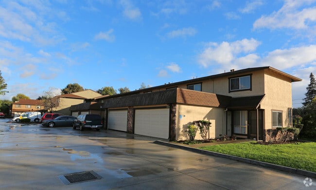
19974 Anita Ave, Castro Valley, CA 94546


NEARBY LISTINGS FOR SALE OR LEASE
Property Detail
19974 Anita Ave
Oakland-Hayward-Berkeley, CA
Anita L Stanton
084A-0120-014-03
LOT: 00003 BLK: 0014 AR: 084A PAGE: 0120
Multifamilydwelling
Alameda
X
California
06001C0279G
26&27
2024
1.40 AC
2025
East Outer Fremont
430900
East Bay/Oakland
25,903 SF
DEMOGRAPHICS near 19974 Anita Ave
1 Mile
3 Mile
5 Mile
2024 Total Population
25,999
168,307
334,338
2029 Population
25,166
162,608
322,943
Pop Growth 2024-2029
(3.20%)
(3.39%)
(3.41%)
Average Age
41
40
41
2024 Total Households
9,271
56,608
109,930
HH Growth 2024-2029
(3.39%)
(3.56%)
(3.60%)
Median Household Inc
$106,747
$97,030
$97,528
Avg Household Size
2.70
2.90
2.90
2024 Avg HH Vehicles
2.00
2.00
2.00
Median Home Value
$822,791
$802,599
$777,858
Median Year Built
1960
1966
1965
Nearby Places
Map Layers
Map Styles
 Street
 Aerial
- Restaurants
- Banks
- Shops
- Fitness
- Groceries
PUBLIC TRANSPORTATION
TRANSIT/SUBWAY
Castro Valley Station (Dublin/Pleasanton - Millbrae - Bay Area Rapid Transit (BART))
DRIVE
WALK
Distance
Castro Valley Station (Dublin/Pleasanton - Millbrae - Bay Area Rapid Transit (BART))
4 min
20 min
1.1 mi
COMMUTER RAIL
DRIVE
WALK
Distance
9 min
3.7 mi
DRIVE
WALK
Distance
9 min
3.7 mi
AIRPORT
Metro Oakland International
DRIVE
WALK
Distance
Metro Oakland International
15 min
10.1 mi
San Francisco International
DRIVE
WALK
Distance
San Francisco International
37 min
25.8 mi
Norman Y Mineta San Jose International
DRIVE
WALK
Distance
Norman Y Mineta San Jose International
42 min
30.3 mi
Freight Ports
Port of Oakland
DRIVE
WALK
Distance
Port of Oakland
20 min
14.6 mi
Nearby Properties
Address
Land Use
TOTAL SIZE
Lot Size
Zoning
Address
Land Use
TOTAL SIZE
Lot Size
Zoning
4.90 AC
Address
Land Use
TOTAL SIZE
Lot Size
Zoning
437,104 SF
0.73 AC
Address
Land Use
TOTAL SIZE
Lot Size
Zoning
2.48 AC
Address
Land Use
TOTAL SIZE
Lot Size
Zoning
470,929 SF
31.62 AC
Address
Land Use
TOTAL SIZE
Lot Size
Zoning
1.50 AC
Address
Land Use
TOTAL SIZE
Lot Size
Zoning
187,926 SF
1.19 AC
Address
Land Use
TOTAL SIZE
Lot Size
Zoning
297,592 SF
11.65 AC
Address
Land Use
TOTAL SIZE
Lot Size
Zoning
310,072 SF
14.96 AC
Address
Land Use
TOTAL SIZE
Lot Size
Zoning
228,736 SF
5.95 AC
Address
Land Use
TOTAL SIZE
Lot Size
Zoning
169,371 SF
4.63 AC
Address
Land Use
TOTAL SIZE
Lot Size
Zoning
625,101 SF
35.95 AC
Address
Land Use
TOTAL SIZE
Lot Size
Zoning
105,730 SF
5.32 AC
Address
Land Use
TOTAL SIZE
Lot Size
Zoning
89,968 SF
5 AC
Address
Land Use
TOTAL SIZE
Lot Size
Zoning
119,800 SF
5.72 AC
Address
Land Use
TOTAL SIZE
Lot Size
Zoning
178,560 SF
8.76 AC
Address
Land Use
TOTAL SIZE
Lot Size
Zoning
93,258 SF
6.24 AC
Address
Land Use
TOTAL SIZE
Lot Size
Zoning
57,497 SF
4.92 AC
Address
Land Use
TOTAL SIZE
Lot Size
Zoning
120,441 SF
1.34 AC
Address
Land Use
TOTAL SIZE
Lot Size
Zoning
152,950 SF
4.96 AC
Address
Land Use
TOTAL SIZE
Lot Size
Zoning
115,648 SF
11.19 AC
Address
Land Use
TOTAL SIZE
Lot Size
Zoning
92,534 SF
3.04 AC
Address
Land Use
TOTAL SIZE
Lot Size
Zoning
69,488 SF
2.09 AC
Address
Land Use
TOTAL SIZE
Lot Size
Zoning
25,000 SF
1.24 AC
Address
Land Use
TOTAL SIZE
Lot Size
Zoning
147,525 SF
8.18 AC
Address
Land Use
TOTAL SIZE
Lot Size
Zoning
124,513 SF
7.52 AC
Address
Land Use
TOTAL SIZE
Lot Size
Zoning
61,330 SF
5.78 AC
Address
Land Use
TOTAL SIZE
Lot Size
Zoning
42,359 SF
3.79 AC
Address
Land Use
TOTAL SIZE
Lot Size
Zoning
120,912 SF
10.63 AC
Address
Land Use
TOTAL SIZE
Lot Size
Zoning
61,355 SF
4.31 AC
Address
Land Use
TOTAL SIZE
Lot Size
Zoning
52,110 SF
2.06 AC
The World's #1 Commercial Real Estate Marketplace
Connect with us
© 2026 CoStar Group
The information above has been obtained from sources believed reliable. While we do not doubt its accuracy we have not verified it and make no guarantee, warranty or representation about it. It is your responsibility to independently confirm its accuracy and completeness. Any projections, opinions, assumptions, or estimates used are for example only and do not represent the current or future performance of the property. The value of this transaction to you depends on tax and other factors which should be evaluated by your tax, financial, and legal advisors. You and your advisors should conduct a careful, independent investigation of the property to determine to your satisfaction the suitability of the property for your needs.