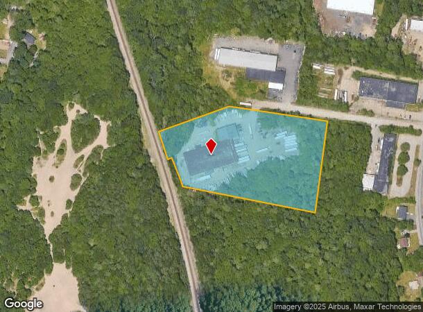
Property Record
2 Kleen Way, Holbrook, MA 02343

NEARBY LISTINGS FOR SALE OR LEASE
Property Detail
2 Kleen Way
HOLB-000032-000000-000069-000003
Norfolk
Manufacturinglight
Massachusetts
AE
69-3-0
25021C0219F
5.08 AC
2025
Route 24
2025
Boston
421100
Boston-Cambridge-Newton, MA-NH
24,720 SF
DEMOGRAPHICS near 2 Kleen Way
1 Mile
3 Mile
5 Mile
2024 Total Population
7,090
61,669
200,685
2029 Population
7,035
61,130
198,890
Pop Growth 2024-2029
(0.78%)
(0.87%)
(0.89%)
Average Age
42
41
41
2024 Total Households
2,585
22,166
72,778
HH Growth 2024-2029
(0.85%)
(0.97%)
(0.96%)
Median Household Inc
$87,377
$91,257
$88,343
Avg Household Size
2.70
2.70
2.60
2024 Avg HH Vehicles
2.00
2.00
2.00
Median Home Value
$393,133
$401,359
$433,891
Median Year Built
1958
1961
1962
Nearby Places
Map Layers
Map Styles
 Street
 Aerial
- Restaurants
- Banks
- Shops
- Fitness
- Groceries
PUBLIC TRANSPORTATION
COMMUTER RAIL
Holbrook/Randolph (Middleborough/Lakeville Line - Massachusetts Bay Transportation Authority Commuter Rail (Purple Line))
DRIVE
WALK
Distance
Holbrook/Randolph (Middleborough/Lakeville Line - Massachusetts Bay Transportation Authority Commuter Rail (Purple Line))
4 min
1.5 mi
Montello (Middleborough/Lakeville Line - Massachusetts Bay Transportation Authority Commuter Rail (Purple Line))
DRIVE
WALK
Distance
Montello (Middleborough/Lakeville Line - Massachusetts Bay Transportation Authority Commuter Rail (Purple Line))
7 min
3.3 mi
AIRPORT
General Edward Lawrence Logan International
DRIVE
WALK
Distance
General Edward Lawrence Logan International
33 min
19.9 mi
Rhode Island Tf Green International
DRIVE
WALK
Distance
Rhode Island Tf Green International
72 min
45.4 mi
Freight Ports
Port of Boston
DRIVE
WALK
Distance
Port of Boston
31 min
17.7 mi
Nearby Properties
Address
Land Use
TOTAL SIZE
Lot Size
Zoning
Address
Land Use
TOTAL SIZE
Lot Size
Zoning
235,150 SF
36.67 AC
R1
Address
Land Use
TOTAL SIZE
Lot Size
Zoning
13.08 AC
HB
Address
Land Use
TOTAL SIZE
Lot Size
Zoning
403,163 SF
24.58 AC
I
Address
Land Use
TOTAL SIZE
Lot Size
Zoning
167,076 SF
16 AC
A
Address
Land Use
TOTAL SIZE
Lot Size
Zoning
10.10 AC
CSBD
Address
Land Use
TOTAL SIZE
Lot Size
Zoning
86,564 SF
8.45 AC
GBHD
Address
Land Use
TOTAL SIZE
Lot Size
Zoning
379,908 SF
15.14 AC
Address
Land Use
TOTAL SIZE
Lot Size
Zoning
199,072 SF
10.07 AC
HB
Address
Land Use
TOTAL SIZE
Lot Size
Zoning
76,223 SF
19.83 AC
B
Address
Land Use
TOTAL SIZE
Lot Size
Zoning
114,176 SF
11.69 AC
RH
Address
Land Use
TOTAL SIZE
Lot Size
Zoning
2,600 SF
334.97 AC
R1C
Address
Land Use
TOTAL SIZE
Lot Size
Zoning
299,062 SF
22.73 AC
R2
Address
Land Use
TOTAL SIZE
Lot Size
Zoning
34.45 AC
HB
Address
Land Use
TOTAL SIZE
Lot Size
Zoning
289,562 SF
13.59 AC
Address
Land Use
TOTAL SIZE
Lot Size
Zoning
126,237 SF
20.42 AC
R3
Address
Land Use
TOTAL SIZE
Lot Size
Zoning
285,036 SF
20.45 AC
R3
Address
Land Use
TOTAL SIZE
Lot Size
Zoning
1,204 SF
15.08 AC
R1C
Address
Land Use
TOTAL SIZE
Lot Size
Zoning
121,424 SF
11.11 AC
HB
Address
Land Use
TOTAL SIZE
Lot Size
Zoning
10.83 AC
Address
Land Use
TOTAL SIZE
Lot Size
Zoning
2,077 SF
5.68 AC
R2
Address
Land Use
TOTAL SIZE
Lot Size
Zoning
190,000 SF
11.42 AC
Address
Land Use
TOTAL SIZE
Lot Size
Zoning
1.95 AC
A
Address
Land Use
TOTAL SIZE
Lot Size
Zoning
3.82 AC
A
Address
Land Use
TOTAL SIZE
Lot Size
Zoning
1,452 SF
28.90 AC
R1C
Address
Land Use
TOTAL SIZE
Lot Size
Zoning
142,562 SF
6.98 AC
I
Address
Land Use
TOTAL SIZE
Lot Size
Zoning
235,752 SF
18.58 AC
I
Address
Land Use
TOTAL SIZE
Lot Size
Zoning
10.86 AC
NB
Address
Land Use
TOTAL SIZE
Lot Size
Zoning
88,174 SF
11.82 AC
HB
Address
Land Use
TOTAL SIZE
Lot Size
Zoning
265,013 SF
16.31 AC
I
Address
Land Use
TOTAL SIZE
Lot Size
Zoning
119,130 SF
14.29 AC
HB
The World's #1 Commercial Real Estate Marketplace
Connect with us
© 2025 CoStar Group
The information above has been obtained from sources believed reliable. While we do not doubt its accuracy we have not verified it and make no guarantee, warranty or representation about it. It is your responsibility to independently confirm its accuracy and completeness. Any projections, opinions, assumptions, or estimates used are for example only and do not represent the current or future performance of the property. The value of this transaction to you depends on tax and other factors which should be evaluated by your tax, financial, and legal advisors. You and your advisors should conduct a careful, independent investigation of the property to determine to your satisfaction the suitability of the property for your needs.