Property Record
2 Old Indian Trl, Middlefield, CT 06455
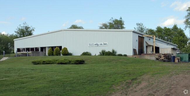

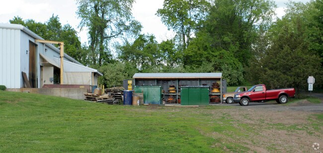
Property Detail
2 Old Indian Trl
MFLD-000021-000000-000027-000005
Lower Ct River Vly
Industrialgeneral
Connecticut
IPD2
27-5
B and X Area of moderate flood hazard, usually the area between the limits of the 100-year and 500-year floods.
1.71 AC
2025
NW Middlesex/Mid'town
2025
Hartford
580100
Hartford-West Hartford-East Hartford, CT
10,990 SF
NEARBY LISTINGS FOR SALE OR LEASE
DEMOGRAPHICS near 2 Old Indian Trl
1 mile
3 mile
5 mile
2025 Total Population
1,074
11,320
48,398
2030 Population
1,070
11,343
48,615
Pop Growth 2025-2030
(0.37%)
+ 0.20%
+ 0.45%
Average Age
44
45
42
2025 Total Households
435
4,599
18,996
HH Growth 2025-2030
(0.23%)
+ 0.24%
+ 0.36%
Median Household Inc
$104,529
$118,530
$87,469
Avg Household Size
2.50
2.40
2.30
2025 Avg HH Vehicles
2.00
2.00
2.00
Median Home Value
$367,812
$380,331
$328,971
Median Year Built
1971
1974
1968
Nearby Places
Map Layers
Map Styles
 Street
 Aerial
Layers
 Traffic
 Biking
Places
Listings with unknown addresses are not visible on the map
- Restaurants
- Banks
- Shops
- Fitness
- Groceries
PUBLIC TRANSPORTATION
COMMUTER RAIL
Drive
Walk
Distance
18 min
9.4 mi
AIRPORT
Tweed/New Haven
Drive
Walk
Distance
Tweed/New Haven
44 min
25.0 mi
Bradley International
Drive
Walk
Distance
Bradley International
60 min
37.2 mi
Freight Ports
Port of New Haven
Drive
Walk
Distance
Port of New Haven
39 min
23.9 mi
Nearby Properties
Address
Land Use
TOTAL SIZE
Lot Size
Zoning
Address
Land Use
TOTAL SIZE
Lot Size
Zoning
197,789 SF
31.92 AC
R-15
Address
Land Use
TOTAL SIZE
Lot Size
Zoning
108,540 SF
22.99 AC
R-15
Address
Land Use
TOTAL SIZE
Lot Size
Zoning
10.10 AC
M
Address
Land Use
TOTAL SIZE
Lot Size
Zoning
54,264 SF
15 AC
PRD
Address
Land Use
TOTAL SIZE
Lot Size
Zoning
124,940 SF
49.46 AC
FARM -
Address
Land Use
TOTAL SIZE
Lot Size
Zoning
20.60 AC
I-4
Address
Land Use
TOTAL SIZE
Lot Size
Zoning
49,299 SF
19.98 AC
IPD1
Address
Land Use
TOTAL SIZE
Lot Size
Zoning
19,186 SF
103.50 AC
R-15
Address
Land Use
TOTAL SIZE
Lot Size
Zoning
40,938 SF
14.53 AC
FARM -
Address
Land Use
TOTAL SIZE
Lot Size
Zoning
36,106 SF
14.73 AC
MD
Address
Land Use
TOTAL SIZE
Lot Size
Zoning
32.52 AC
AG2
Address
Land Use
TOTAL SIZE
Lot Size
Zoning
62,967 SF
9.40 AC
MAIN S
Address
Land Use
TOTAL SIZE
Lot Size
Zoning
59,557 SF
12.24 AC
I-4
Address
Land Use
TOTAL SIZE
Lot Size
Zoning
30.51 AC
MAIN S
Address
Land Use
TOTAL SIZE
Lot Size
Zoning
32,375 SF
18.94 AC
FARM -
Address
Land Use
TOTAL SIZE
Lot Size
Zoning
267.22 AC
RU40
Address
Land Use
TOTAL SIZE
Lot Size
Zoning
4.35 AC
R-15
Address
Land Use
TOTAL SIZE
Lot Size
Zoning
93,345 SF
50.98 AC
FARM -
Address
Land Use
TOTAL SIZE
Lot Size
Zoning
36.01 AC
I-4
Address
Land Use
TOTAL SIZE
Lot Size
Zoning
3.27 AC
HEAVY
Address
Land Use
TOTAL SIZE
Lot Size
Zoning
18,892 SF
0.79 AC
R-15
Address
Land Use
TOTAL SIZE
Lot Size
Zoning
12.62 AC
HEAVY
Address
Land Use
TOTAL SIZE
Lot Size
Zoning
264 AC
HEAVY
Address
Land Use
TOTAL SIZE
Lot Size
Zoning
183.67 AC
AG2
Address
Land Use
TOTAL SIZE
Lot Size
Zoning
15,661 SF
1.07 AC
HD2
Address
Land Use
TOTAL SIZE
Lot Size
Zoning
6.40 AC
I-4
Address
Land Use
TOTAL SIZE
Lot Size
Zoning
18.08 AC
MAIN S
Address
Land Use
TOTAL SIZE
Lot Size
Zoning
1.98 AC
R-30
Address
Land Use
TOTAL SIZE
Lot Size
Zoning
17,049 SF
4.01 AC
HD2
Address
Land Use
TOTAL SIZE
Lot Size
Zoning
36,885 SF
5.41 AC
I-4
The World's #1 Commercial Real Estate Marketplace
Connect with us
© 2026 CoStar Group
The information above has been obtained from sources believed reliable. While we do not doubt its accuracy we have not verified it and make no guarantee, warranty or representation about it. It is your responsibility to independently confirm its accuracy and completeness. Any projections, opinions, assumptions, or estimates used are for example only and do not represent the current or future performance of the property. The value of this transaction to you depends on tax and other factors which should be evaluated by your tax, financial, and legal advisors. You and your advisors should conduct a careful, independent investigation of the property to determine to your satisfaction the suitability of the property for your needs.