Property Record
2 Production Dr, Brookfield, CT 06804
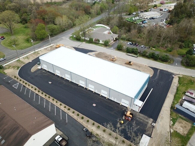


Property Detail
2 Production Dr
BROO-000005C-000000-000021
FAIRFIELD
Industrialgeneral
Connecticut
C-GN
21
C and X Area of minimal flood hazard, usually depicted on FIRMs as above the 500-year flood level.
1.77 AC
2025
Brookfield
2025
Westchester/So Connecticut
205100
Bridgeport-Stamford-Danbury, CT
18,150 SF
NEARBY LISTINGS FOR SALE OR LEASE
DEMOGRAPHICS near 2 Production Dr
1 mile
3 mile
5 mile
2025 Total Population
2,472
18,621
50,310
2030 Population
2,581
19,473
52,240
Pop Growth 2025-2030
+ 4.41%
+ 4.58%
+ 3.84%
Average Age
44
44
44
2025 Total Households
969
7,105
19,287
HH Growth 2025-2030
+ 4.54%
+ 4.62%
+ 3.81%
Median Household Inc
$143,885
$134,573
$129,292
Avg Household Size
2.50
2.60
2.50
2025 Avg HH Vehicles
2.00
2.00
2.00
Median Home Value
$495,807
$517,965
$464,998
Median Year Built
1973
1972
1974
Nearby Places
Map Layers
Map Styles
 Street
 Aerial
Transit
 Traffic
 Biking
Places
Listings with unknown addresses are not visible on the map
- Restaurants
- Banks
- Shops
- Fitness
- Groceries
PUBLIC TRANSPORTATION
COMMUTER RAIL
Bethel Station (New Haven Line - Metro-North Commuter Railroad Company (Metro-North))
Drive
Walk
Distance
Bethel Station (New Haven Line - Metro-North Commuter Railroad Company (Metro-North))
20 min
9.5 mi
Danbury Station (New Haven Line - Metro-North Commuter Railroad Company (Metro-North))
Drive
Walk
Distance
Danbury Station (New Haven Line - Metro-North Commuter Railroad Company (Metro-North))
15 min
9.8 mi
Freight Ports
Port of New Haven
Drive
Walk
Distance
Port of New Haven
56 min
36.4 mi
SALE & LEASE HISTORY
LISTING DATE
SALE/LEASE

May 06, 2025
For Lease
Nearby Properties
Address
Land Use
TOTAL SIZE
Lot Size
Zoning
Address
Land Use
TOTAL SIZE
Lot Size
Zoning
45.66 AC
IC/R40
Address
Land Use
TOTAL SIZE
Lot Size
Zoning
79.31 AC
R-80
Address
Land Use
TOTAL SIZE
Lot Size
Zoning
9.39 AC
C-2
Address
Land Use
TOTAL SIZE
Lot Size
Zoning
45.15 AC
I-1 HO
Address
Land Use
TOTAL SIZE
Lot Size
Zoning
77,492 SF
30.25 AC
Address
Land Use
TOTAL SIZE
Lot Size
Zoning
2,173 SF
4.76 AC
TCD
Address
Land Use
TOTAL SIZE
Lot Size
Zoning
53,582 SF
7.71 AC
C-2
Address
Land Use
TOTAL SIZE
Lot Size
Zoning
2,295.68 AC
Address
Land Use
TOTAL SIZE
Lot Size
Zoning
6.54 AC
TCD-P
Address
Land Use
TOTAL SIZE
Lot Size
Zoning
151,200 SF
12.48 AC
I-1
Address
Land Use
TOTAL SIZE
Lot Size
Zoning
110,200 SF
4.96 AC
I-1 HO
Address
Land Use
TOTAL SIZE
Lot Size
Zoning
9.29 AC
R-60
Address
Land Use
TOTAL SIZE
Lot Size
Zoning
57,782 SF
7.14 AC
R-80
Address
Land Use
TOTAL SIZE
Lot Size
Zoning
54.60 AC
R-80
Address
Land Use
TOTAL SIZE
Lot Size
Zoning
70,343 SF
37 AC
R20
Address
Land Use
TOTAL SIZE
Lot Size
Zoning
4.65 AC
TCD
Address
Land Use
TOTAL SIZE
Lot Size
Zoning
60,042 SF
7.20 AC
TCD
Address
Land Use
TOTAL SIZE
Lot Size
Zoning
29,862 SF
1.41 AC
TCD
Address
Land Use
TOTAL SIZE
Lot Size
Zoning
10.07 AC
I-1
Address
Land Use
TOTAL SIZE
Lot Size
Zoning
4.80 AC
I-1
Address
Land Use
TOTAL SIZE
Lot Size
Zoning
99,524 SF
9.41 AC
I-1
Address
Land Use
TOTAL SIZE
Lot Size
Zoning
2,400 SF
1,190.70 AC
R80
Address
Land Use
TOTAL SIZE
Lot Size
Zoning
1.92 AC
MC
Address
Land Use
TOTAL SIZE
Lot Size
Zoning
36,239 SF
5.93 AC
C-2
Address
Land Use
TOTAL SIZE
Lot Size
Zoning
26.25 AC
RR3
Address
Land Use
TOTAL SIZE
Lot Size
Zoning
22,832 SF
9.70 AC
R-40
Address
Land Use
TOTAL SIZE
Lot Size
Zoning
4.01 AC
I-C
Address
Land Use
TOTAL SIZE
Lot Size
Zoning
36,440 SF
4.70 AC
C-2
Address
Land Use
TOTAL SIZE
Lot Size
Zoning
9,080 SF
8.72 AC
MC
Address
Land Use
TOTAL SIZE
Lot Size
Zoning
6,618 SF
2.59 AC
MC
The World's #1 Commercial Real Estate Marketplace
Connect with us
© 2026 CoStar Group
The information above has been obtained from sources believed reliable. While we do not doubt its accuracy we have not verified it and make no guarantee, warranty or representation about it. It is your responsibility to independently confirm its accuracy and completeness. Any projections, opinions, assumptions, or estimates used are for example only and do not represent the current or future performance of the property. The value of this transaction to you depends on tax and other factors which should be evaluated by your tax, financial, and legal advisors. You and your advisors should conduct a careful, independent investigation of the property to determine to your satisfaction the suitability of the property for your needs.