Property Record
20 E 13Th St, Saint Cloud, FL 34769
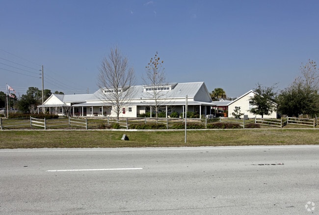

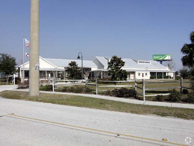

Property Detail
20 E 13Th St
01-26-30-0580-0002-0010
EUCALYPTUS HEIGHTS PB 1 PG 236 BLK 2 LOTS 1-9 & 22-24 LESS S 35 FT LOTS 6, 7, 8 & 9 FOR RD R/W & VAC ALLEY LYING BETWEEN LOTS 1-6 & LOTS 7-14 LESS S 35 FT
Medicalbuilding
Osceola
SHB
Florida
B and X Area of moderate flood hazard, usually the area between the limits of the 100-year and 500-year floods.
1
2024
1.77 AC
2025
St Cloud
043600
Orlando
8,627 SF
Orlando-Kissimmee-Sanford, FL
NEARBY LISTINGS FOR SALE OR LEASE
DEMOGRAPHICS near 20 E 13Th St
1 mile
3 mile
5 mile
2025 Total Population
8,372
45,973
99,619
2030 Population
9,728
53,777
117,281
Pop Growth 2025-2030
+ 16.20%
+ 16.98%
+ 17.73%
Average Age
40
40
39
2025 Total Households
3,222
16,611
33,891
HH Growth 2025-2030
+ 16.79%
+ 17.60%
+ 18.36%
Median Household Inc
$81,008
$83,024
$89,290
Avg Household Size
2.60
2.70
2.90
2025 Avg HH Vehicles
2.00
2.00
2.00
Median Home Value
$351,349
$376,900
$406,926
Median Year Built
1987
1999
2006
Nearby Places
Map Layers
Map Styles
 Street
 Aerial
Transit
 Traffic
 Biking
Places
Listings with unknown addresses are not visible on the map
- Restaurants
- Banks
- Shops
- Fitness
- Groceries
PUBLIC TRANSPORTATION
COMMUTER RAIL
Drive
Walk
Distance
19 min
9.6 mi
AIRPORT
Orlando International
Drive
Walk
Distance
Orlando International
33 min
19.3 mi
Nearby Properties
Address
Land Use
TOTAL SIZE
Lot Size
Zoning
Address
Land Use
TOTAL SIZE
Lot Size
Zoning
270,959 SF
10.84 AC
SPUD
Address
Land Use
TOTAL SIZE
Lot Size
Zoning
313,120 SF
54.86 AC
SP
Address
Land Use
TOTAL SIZE
Lot Size
Zoning
118,121 SF
237.16 AC
SP
Address
Land Use
TOTAL SIZE
Lot Size
Zoning
208,677 SF
12.64 AC
Address
Land Use
TOTAL SIZE
Lot Size
Zoning
185,953 SF
63.41 AC
SP
Address
Land Use
TOTAL SIZE
Lot Size
Zoning
77,928 SF
24.79 AC
SHB
Address
Land Use
TOTAL SIZE
Lot Size
Zoning
127,960 SF
14.40 AC
SPUD
Address
Land Use
TOTAL SIZE
Lot Size
Zoning
106,078 SF
15.04 AC
SP
Address
Land Use
TOTAL SIZE
Lot Size
Zoning
50,025 SF
4.45 AC
SP
Address
Land Use
TOTAL SIZE
Lot Size
Zoning
79,854 SF
8.89 AC
SHB
Address
Land Use
TOTAL SIZE
Lot Size
Zoning
136,124 SF
14.46 AC
SAC
Address
Land Use
TOTAL SIZE
Lot Size
Zoning
55,521 SF
10.75 AC
SHB
Address
Land Use
TOTAL SIZE
Lot Size
Zoning
187,534 SF
19.79 AC
Address
Land Use
TOTAL SIZE
Lot Size
Zoning
84,902 SF
11.12 AC
SPUD
Address
Land Use
TOTAL SIZE
Lot Size
Zoning
66,682 SF
8.42 AC
SHB
Address
Land Use
TOTAL SIZE
Lot Size
Zoning
89,482 SF
4.82 AC
SPUD
Address
Land Use
TOTAL SIZE
Lot Size
Zoning
30,520 SF
5.94 AC
SHB
Address
Land Use
TOTAL SIZE
Lot Size
Zoning
88,369 SF
15.54 AC
Address
Land Use
TOTAL SIZE
Lot Size
Zoning
92,108 SF
11.44 AC
SHB
Address
Land Use
TOTAL SIZE
Lot Size
Zoning
86,610 SF
10.79 AC
SP
Address
Land Use
TOTAL SIZE
Lot Size
Zoning
72,904 SF
6.39 AC
SR3
Address
Land Use
TOTAL SIZE
Lot Size
Zoning
13.38 AC
Address
Land Use
TOTAL SIZE
Lot Size
Zoning
23,597 SF
2.47 AC
SPUD
Address
Land Use
TOTAL SIZE
Lot Size
Zoning
60,211 SF
6.46 AC
SPUD
Address
Land Use
TOTAL SIZE
Lot Size
Zoning
44,380 SF
7.84 AC
SHB
Address
Land Use
TOTAL SIZE
Lot Size
Zoning
70,375 SF
4.58 AC
OAR2
Address
Land Use
TOTAL SIZE
Lot Size
Zoning
70,280 SF
2.01 AC
SPUD
Address
Land Use
TOTAL SIZE
Lot Size
Zoning
20,634 SF
4.55 AC
SHB
Address
Land Use
TOTAL SIZE
Lot Size
Zoning
1,400 SF
5.07 AC
SP
Address
Land Use
TOTAL SIZE
Lot Size
Zoning
113,211 SF
6.80 AC
SI2
The World's #1 Commercial Real Estate Marketplace
Connect with us
© 2026 CoStar Group
The information above has been obtained from sources believed reliable. While we do not doubt its accuracy we have not verified it and make no guarantee, warranty or representation about it. It is your responsibility to independently confirm its accuracy and completeness. Any projections, opinions, assumptions, or estimates used are for example only and do not represent the current or future performance of the property. The value of this transaction to you depends on tax and other factors which should be evaluated by your tax, financial, and legal advisors. You and your advisors should conduct a careful, independent investigation of the property to determine to your satisfaction the suitability of the property for your needs.