Property Record
200 3Rd St, Bridgeport, PA 19405
NEARBY LISTINGS FOR SALE OR LEASE
Property Detail
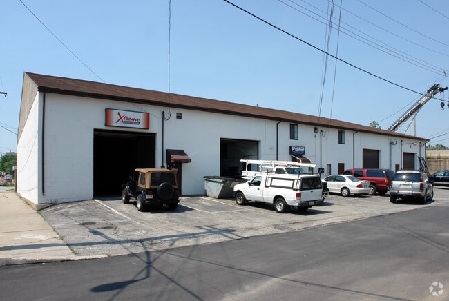
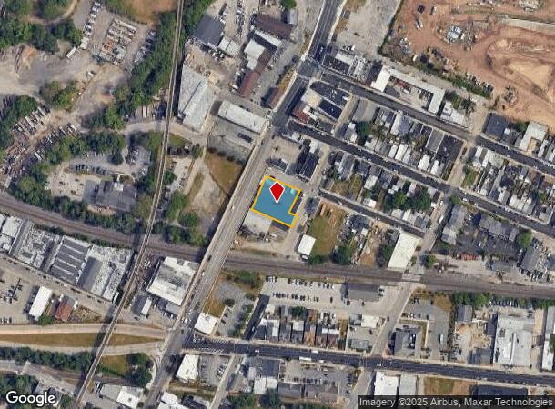
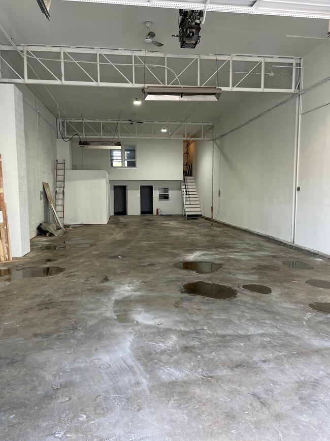
200 3Rd St
02-00-05952-004
INC 02 00 05948 00 8
Warehouse
Montgomery
X
Pennsylvania
42029C0120G
18
2024
0.40 AC
2025
East Montgomery Cty
205700
Philadelphia
16,800 SF
Philadelphia-Camden-Wilmington, PA-NJ-DE-MD
DEMOGRAPHICS near 200 3Rd St
1 mile
3 mile
5 mile
2024 Total Population
18,983
97,523
201,829
2029 Population
19,290
99,254
205,938
Pop Growth 2024-2029
+ 1.62%
+ 1.77%
+ 2.04%
Average Age
35
39
40
2024 Total Households
6,857
38,951
80,410
HH Growth 2024-2029
+ 1.68%
+ 1.81%
+ 2.16%
Median Household Inc
$54,906
$80,541
$99,862
Avg Household Size
2.60
2.40
2.40
2024 Avg HH Vehicles
1.00
2.00
2.00
Median Home Value
$222,003
$292,164
$377,774
Median Year Built
1948
1963
1969
Nearby Places
Map Layers
Map Styles
 Street
 Aerial
Transit
 Traffic
 Biking
Places
Listings with unknown addresses are not visible on the map
- Restaurants
- Banks
- Shops
- Fitness
- Groceries
PUBLIC TRANSPORTATION
COMMUTER RAIL
Norristown Transportation Center (R6 Line) (R6 - Southeastern Pennsylvania Transportation Authority Regional Rail (SEPTA Regional Rail))
Drive
Walk
Distance
Norristown Transportation Center (R6 Line) (R6 - Southeastern Pennsylvania Transportation Authority Regional Rail (SEPTA Regional Rail))
2 min
10 min
0.5 mi
Main Street (Norristown) (R6 - Southeastern Pennsylvania Transportation Authority Regional Rail (SEPTA Regional Rail))
Drive
Walk
Distance
Main Street (Norristown) (R6 - Southeastern Pennsylvania Transportation Authority Regional Rail (SEPTA Regional Rail))
4 min
19 min
1.0 mi
AIRPORT
Philadelphia International
Drive
Walk
Distance
Philadelphia International
44 min
26.7 mi
Trenton Mercer
Drive
Walk
Distance
Trenton Mercer
56 min
39.2 mi
Freight Ports
South Jersey Port
Drive
Walk
Distance
South Jersey Port
37 min
21.3 mi
SALE & LEASE HISTORY
LISTING DATE
SALE/LEASE

Sep 12, 2023
For Lease
Nearby Properties
Address
Land Use
TOTAL SIZE
Lot Size
Zoning
Address
Land Use
TOTAL SIZE
Lot Size
Zoning
2,373,472 SF
96.77 AC
SC
Address
Land Use
TOTAL SIZE
Lot Size
Zoning
1,807,465 SF
120.12 AC
R2
Address
Land Use
TOTAL SIZE
Lot Size
Zoning
679,715 SF
58.23 AC
R2
Address
Land Use
TOTAL SIZE
Lot Size
Zoning
1,724,092 SF
24 AC
SC
Address
Land Use
TOTAL SIZE
Lot Size
Zoning
469,066 SF
47 AC
MU
Address
Land Use
TOTAL SIZE
Lot Size
Zoning
388,042 SF
24.45 AC
SM
Address
Land Use
TOTAL SIZE
Lot Size
Zoning
872,232 SF
51.99 AC
G
Address
Land Use
TOTAL SIZE
Lot Size
Zoning
422,975 SF
92.05 AC
RA
Address
Land Use
TOTAL SIZE
Lot Size
Zoning
413,892 SF
21.94 AC
SM
Address
Land Use
TOTAL SIZE
Lot Size
Zoning
843,567 SF
50.79 AC
HI
Address
Land Use
TOTAL SIZE
Lot Size
Zoning
197,108 SF
2.08 AC
SC
Address
Land Use
TOTAL SIZE
Lot Size
Zoning
217,564 SF
12.64 AC
IN
Address
Land Use
TOTAL SIZE
Lot Size
Zoning
231,665 SF
26.34 AC
OSR
Address
Land Use
TOTAL SIZE
Lot Size
Zoning
804,184 SF
26.72 AC
HR
Address
Land Use
TOTAL SIZE
Lot Size
Zoning
370,404 SF
15.55 AC
SM1
Address
Land Use
TOTAL SIZE
Lot Size
Zoning
114,121 SF
16.80 AC
LI
Address
Land Use
TOTAL SIZE
Lot Size
Zoning
961,106 SF
5.47 AC
LI
Address
Land Use
TOTAL SIZE
Lot Size
Zoning
452,740 SF
11.03 AC
C
Address
Land Use
TOTAL SIZE
Lot Size
Zoning
310,900 SF
55.48 AC
HI
Address
Land Use
TOTAL SIZE
Lot Size
Zoning
10.44 AC
HI
Address
Land Use
TOTAL SIZE
Lot Size
Zoning
320,804 SF
30.85 AC
CR
Address
Land Use
TOTAL SIZE
Lot Size
Zoning
333,974 SF
18.56 AC
HR
Address
Land Use
TOTAL SIZE
Lot Size
Zoning
667,719 SF
23.73 AC
BP
Address
Land Use
TOTAL SIZE
Lot Size
Zoning
94,055 SF
16.24 AC
LI
Address
Land Use
TOTAL SIZE
Lot Size
Zoning
142,124 SF
14.50 AC
AR
Address
Land Use
TOTAL SIZE
Lot Size
Zoning
320,737 SF
0.98 AC
TC
Address
Land Use
TOTAL SIZE
Lot Size
Zoning
639,052 SF
45 AC
SM
Address
Land Use
TOTAL SIZE
Lot Size
Zoning
416,392 SF
26.56 AC
HR
Address
Land Use
TOTAL SIZE
Lot Size
Zoning
224,220 SF
2.06 AC
SC
Address
Land Use
TOTAL SIZE
Lot Size
Zoning
298,856 SF
9.58 AC
HR
The World's #1 Commercial Real Estate Marketplace
Connect with us
© 2026 CoStar Group
The information above has been obtained from sources believed reliable. While we do not doubt its accuracy we have not verified it and make no guarantee, warranty or representation about it. It is your responsibility to independently confirm its accuracy and completeness. Any projections, opinions, assumptions, or estimates used are for example only and do not represent the current or future performance of the property. The value of this transaction to you depends on tax and other factors which should be evaluated by your tax, financial, and legal advisors. You and your advisors should conduct a careful, independent investigation of the property to determine to your satisfaction the suitability of the property for your needs.