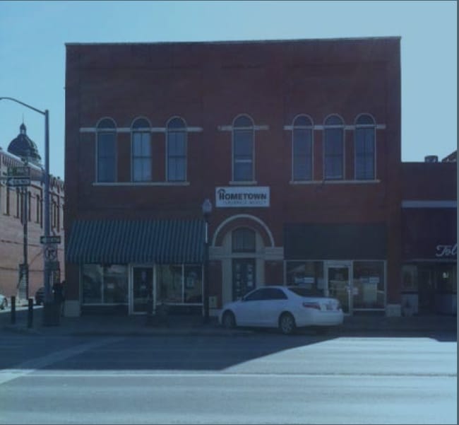
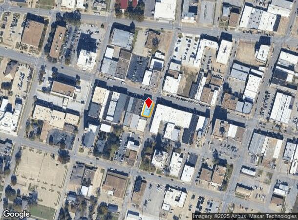
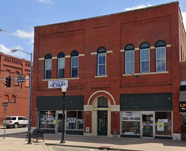
Property Record
200 W Main St, Ardmore, OK 73401
Current Lease Availabilities
NEARBY LISTINGS FOR SALE OR LEASE
-
-
-
-
-
-
-
No Photo
-
View all Ardmore listings for lease on LoopNet.com
Property Detail
200 W Main St
Ardmore, OK
Ardmore City
0010-00-376-005-0-001-00
ARDMORE LOTS & BLKS, BLK 376 LOT 5 N104.10' E50.33' (104.10X50.33)
Storebuilding
Carter
X
Oklahoma
40019C0445C
5
2024
0.12 AC
2025
Oklahoma East Area
892900
Other Market Areas
4,900 SF
DEMOGRAPHICS near 200 W Main St
1 Mile
3 Mile
5 Mile
2024 Total Population
8,840
24,753
29,331
2029 Population
9,204
25,574
30,256
Pop Growth 2024-2029
+ 4.12%
+ 3.32%
+ 3.15%
Average Age
39
41
41
2024 Total Households
3,493
9,977
11,714
HH Growth 2024-2029
+ 4.12%
+ 3.26%
+ 3.12%
Median Household Inc
$37,953
$45,657
$49,220
Avg Household Size
2.30
2.30
2.40
2024 Avg HH Vehicles
2.00
2.00
2.00
Median Home Value
$89,600
$136,163
$150,184
Median Year Built
1953
1967
1972
Nearby Places
Map Layers
Map Styles
 Street
 Aerial
- Restaurants
- Banks
- Shops
- Fitness
- Groceries
PUBLIC TRANSPORTATION
COMMUTER RAIL
Ardmore Amtrak Station (Heartland Flyer - Amtrak)
DRIVE
WALK
Distance
Ardmore Amtrak Station (Heartland Flyer - Amtrak)
1 min
5 min
0.3 mi
Freight Ports
Tulsa Port of Inola
DRIVE
WALK
Distance
Tulsa Port of Inola
241 min
206.6 mi
Nearby Properties
Address
Land Use
TOTAL SIZE
Lot Size
Zoning
Address
Land Use
TOTAL SIZE
Lot Size
Zoning
2,565 SF
5.42 AC
C1
Address
Land Use
TOTAL SIZE
Lot Size
Zoning
3,090 SF
17.88 AC
Address
Land Use
TOTAL SIZE
Lot Size
Zoning
15,336 SF
108.27 AC
C1
Address
Land Use
TOTAL SIZE
Lot Size
Zoning
1,020 SF
34.64 AC
C1
Address
Land Use
TOTAL SIZE
Lot Size
Zoning
120 SF
1.80 AC
C1
Address
Land Use
TOTAL SIZE
Lot Size
Zoning
2,859 SF
1.94 AC
C1
Address
Land Use
TOTAL SIZE
Lot Size
Zoning
2,018 SF
12.23 AC
Address
Land Use
TOTAL SIZE
Lot Size
Zoning
1,593 SF
10.52 AC
C1
Address
Land Use
TOTAL SIZE
Lot Size
Zoning
6,148 SF
3.34 AC
C1
Address
Land Use
TOTAL SIZE
Lot Size
Zoning
1,324 SF
3.13 AC
C1
Address
Land Use
TOTAL SIZE
Lot Size
Zoning
828 SF
12.24 AC
C1
Address
Land Use
TOTAL SIZE
Lot Size
Zoning
3,655 SF
4.90 AC
C1
Address
Land Use
TOTAL SIZE
Lot Size
Zoning
6,348 SF
7.69 AC
C1
Address
Land Use
TOTAL SIZE
Lot Size
Zoning
5,290 SF
2.75 AC
C1
Address
Land Use
TOTAL SIZE
Lot Size
Zoning
27,476 SF
12.53 AC
C1
Address
Land Use
TOTAL SIZE
Lot Size
Zoning
44,073 SF
17.07 AC
C1
Address
Land Use
TOTAL SIZE
Lot Size
Zoning
62,600 SF
5.15 AC
Address
Land Use
TOTAL SIZE
Lot Size
Zoning
3,188 SF
2.75 AC
C1
Address
Land Use
TOTAL SIZE
Lot Size
Zoning
25 SF
197.79 AC
C1
Address
Land Use
TOTAL SIZE
Lot Size
Zoning
1,225 SF
4.36 AC
C1
Address
Land Use
TOTAL SIZE
Lot Size
Zoning
4,294 SF
2.56 AC
C1
Address
Land Use
TOTAL SIZE
Lot Size
Zoning
1,040 SF
38.87 AC
C1
Address
Land Use
TOTAL SIZE
Lot Size
Zoning
18,185 SF
3.65 AC
C1
Address
Land Use
TOTAL SIZE
Lot Size
Zoning
1,479 SF
2.33 AC
C1
Address
Land Use
TOTAL SIZE
Lot Size
Zoning
224 SF
6.98 AC
C1
Address
Land Use
TOTAL SIZE
Lot Size
Zoning
11,856 SF
5.63 AC
R1
Address
Land Use
TOTAL SIZE
Lot Size
Zoning
60 SF
10.72 AC
C1
Address
Land Use
TOTAL SIZE
Lot Size
Zoning
41,201 SF
6.96 AC
C1
Address
Land Use
TOTAL SIZE
Lot Size
Zoning
408 SF
2.76 AC
Address
Land Use
TOTAL SIZE
Lot Size
Zoning
3,167 SF
2.73 AC
C1
The World's #1 Commercial Real Estate Marketplace
Connect with us
© 2026 CoStar Group
The information above has been obtained from sources believed reliable. While we do not doubt its accuracy we have not verified it and make no guarantee, warranty or representation about it. It is your responsibility to independently confirm its accuracy and completeness. Any projections, opinions, assumptions, or estimates used are for example only and do not represent the current or future performance of the property. The value of this transaction to you depends on tax and other factors which should be evaluated by your tax, financial, and legal advisors. You and your advisors should conduct a careful, independent investigation of the property to determine to your satisfaction the suitability of the property for your needs.