Property Record
2100 S Main St, Mapleton, UT 84664
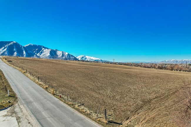


Property Detail
2100 S Main St
Provo-Orem-Lehi, UT
COM N 0 DEG 19 2 W 684.77 FT FR E 1/4 COR. SEC. 22, T8S, R3E, SLB&M.; N 0 DEG 19 2 W 684.77 FT; S 89 DEG 40 58 W 660 FT; S 0 DEG 19 2 E 684.77 FT; N 89 DEG 40 57 E 660 FT TO BEG. AREA 10.369 AC.
27-033-0238
UTAH
Vacantlandnec
Utah
2024
10.37 AC
2025
Utah County
010303
Salt Lake City
NEARBY LISTINGS FOR SALE OR LEASE
-
-
Hwy 147 (400 N) Spanish Fork Pkwy
Spanish Fork, UT 84660
$1,289,376 - $7,980,176
0.74 - 2 AC Lot
Land
-
-
-
-
-
-
View all Mapleton listings for sale on LoopNet.com
DEMOGRAPHICS near 2100 S Main St
1 mile
3 mile
5 mile
2024 Total Population
2,678
47,449
95,832
2029 Population
3,214
55,350
110,839
Pop Growth 2024-2029
+ 20.01%
+ 16.65%
+ 15.66%
Average Age
34
32
32
2024 Total Households
677
12,077
26,466
HH Growth 2024-2029
+ 20.24%
+ 17.09%
+ 15.88%
Median Household Inc
$147,291
$108,344
$94,233
Avg Household Size
3.90
3.90
3.60
2024 Avg HH Vehicles
3.00
3.00
3.00
Median Home Value
$829,304
$493,050
$441,837
Median Year Built
2010
2006
2000
Nearby Places
Map Layers
Map Styles
 Street
 Aerial
Transit
 Traffic
 Biking
Places
Listings with unknown addresses are not visible on the map
- Restaurants
- Banks
- Shops
- Fitness
- Groceries
PUBLIC TRANSPORTATION
AIRPORT
Provo Municipal
Drive
Walk
Distance
Provo Municipal
22 min
13.9 mi
Freight Ports
Port of Stockton
Drive
Walk
Distance
Port of Stockton
771 min
750.5 mi
SALE & LEASE HISTORY
LISTING DATE
SALE/LEASE

Mar 31, 2025
For Sale
Nearby Properties
Address
Land Use
TOTAL SIZE
Lot Size
Zoning
Address
Land Use
TOTAL SIZE
Lot Size
Zoning
10,479 SF
69.93 AC
RA5
Address
Land Use
TOTAL SIZE
Lot Size
Zoning
96,879 SF
7.91 AC
Address
Land Use
TOTAL SIZE
Lot Size
Zoning
82,610 SF
2.46 AC
Address
Land Use
TOTAL SIZE
Lot Size
Zoning
82,610 SF
2.02 AC
Address
Land Use
TOTAL SIZE
Lot Size
Zoning
49,436 SF
6.30 AC
Address
Land Use
TOTAL SIZE
Lot Size
Zoning
88,763 SF
5.89 AC
Address
Land Use
TOTAL SIZE
Lot Size
Zoning
18,948 SF
0.21 AC
Address
Land Use
TOTAL SIZE
Lot Size
Zoning
41,305 SF
1.90 AC
Address
Land Use
TOTAL SIZE
Lot Size
Zoning
50,437 SF
1.03 AC
Address
Land Use
TOTAL SIZE
Lot Size
Zoning
54,208 SF
20.51 AC
Address
Land Use
TOTAL SIZE
Lot Size
Zoning
83,171 SF
2.85 AC
Address
Land Use
TOTAL SIZE
Lot Size
Zoning
49,722 SF
1.60 AC
Address
Land Use
TOTAL SIZE
Lot Size
Zoning
73,926 SF
4.49 AC
Address
Land Use
TOTAL SIZE
Lot Size
Zoning
36,021 SF
1.54 AC
Address
Land Use
TOTAL SIZE
Lot Size
Zoning
67,146 SF
4.26 AC
Address
Land Use
TOTAL SIZE
Lot Size
Zoning
75,796 SF
3.07 AC
Address
Land Use
TOTAL SIZE
Lot Size
Zoning
79,987 SF
5.23 AC
Address
Land Use
TOTAL SIZE
Lot Size
Zoning
5,758 SF
3.08 AC
Address
Land Use
TOTAL SIZE
Lot Size
Zoning
18,948 SF
0.21 AC
Address
Land Use
TOTAL SIZE
Lot Size
Zoning
11,487 SF
1.30 AC
Address
Land Use
TOTAL SIZE
Lot Size
Zoning
4,540 SF
1.48 AC
Address
Land Use
TOTAL SIZE
Lot Size
Zoning
18,214 SF
8.08 AC
Address
Land Use
TOTAL SIZE
Lot Size
Zoning
15.97 AC
Address
Land Use
TOTAL SIZE
Lot Size
Zoning
6,602 SF
8.77 AC
Address
Land Use
TOTAL SIZE
Lot Size
Zoning
27,916 SF
1.37 AC
Address
Land Use
TOTAL SIZE
Lot Size
Zoning
16.07 AC
Address
Land Use
TOTAL SIZE
Lot Size
Zoning
18,698 SF
1.65 AC
Address
Land Use
TOTAL SIZE
Lot Size
Zoning
11,384 SF
5 AC
Address
Land Use
TOTAL SIZE
Lot Size
Zoning
20,659 SF
0.28 AC
Address
Land Use
TOTAL SIZE
Lot Size
Zoning
7,121 SF
2.18 AC
The World's #1 Commercial Real Estate Marketplace
Connect with us
© 2026 CoStar Group
The information above has been obtained from sources believed reliable. While we do not doubt its accuracy we have not verified it and make no guarantee, warranty or representation about it. It is your responsibility to independently confirm its accuracy and completeness. Any projections, opinions, assumptions, or estimates used are for example only and do not represent the current or future performance of the property. The value of this transaction to you depends on tax and other factors which should be evaluated by your tax, financial, and legal advisors. You and your advisors should conduct a careful, independent investigation of the property to determine to your satisfaction the suitability of the property for your needs.