Property Record
2004 Noble St, Swissvale, PA 15218


NEARBY LISTINGS FOR SALE OR LEASE
Property Detail
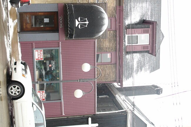
2004 Noble St
Pittsburgh, PA
R L Miller Plan
0178-D-00306-0000-00
R L MILLER PLAN PT 14-15 LOT 26.75XAVG105.19X36 .9 RR IN ALL NOBLE ST 2 1/2 STY BRK HSE&STO 2004
Retailwithmorethanonenonretailuse
Allegheny
X
Pennsylvania
42003C0367H
306
2024
0.07 AC
2025
Parkway East Corridor
515100
Pittsburgh
DEMOGRAPHICS near 2004 Noble St
1 Mile
3 Mile
5 Mile
2024 Total Population
15,030
130,064
305,461
2029 Population
14,691
128,942
302,145
Pop Growth 2024-2029
(2.26%)
(0.86%)
(1.09%)
Average Age
42
41
40
2024 Total Households
7,438
60,616
141,247
HH Growth 2024-2029
(2.34%)
(0.98%)
(1.24%)
Median Household Inc
$58,761
$53,636
$52,361
Avg Household Size
2.00
2.00
2.00
2024 Avg HH Vehicles
1.00
1.00
1.00
Median Home Value
$170,664
$161,477
$157,819
Median Year Built
1948
1949
1950
Nearby Places
Map Layers
Map Styles
 Street
 Aerial
- Restaurants
- Banks
- Shops
- Fitness
- Groceries
PUBLIC TRANSPORTATION
COMMUTER RAIL
DRIVE
WALK
Distance
13 min
7.3 mi
AIRPORT
Pittsburgh International
DRIVE
WALK
Distance
Pittsburgh International
36 min
23.8 mi
Arnold Palmer Regional
DRIVE
WALK
Distance
Arnold Palmer Regional
58 min
37.3 mi
Nearby Properties
Address
Land Use
TOTAL SIZE
Lot Size
Zoning
Address
Land Use
TOTAL SIZE
Lot Size
Zoning
1.22 AC
Address
Land Use
TOTAL SIZE
Lot Size
Zoning
1,950 SF
21.62 AC
Address
Land Use
TOTAL SIZE
Lot Size
Zoning
5.32 AC
Address
Land Use
TOTAL SIZE
Lot Size
Zoning
1.34 AC
Address
Land Use
TOTAL SIZE
Lot Size
Zoning
42.65 AC
Address
Land Use
TOTAL SIZE
Lot Size
Zoning
Address
Land Use
TOTAL SIZE
Lot Size
Zoning
7.79 AC
Address
Land Use
TOTAL SIZE
Lot Size
Zoning
15.90 AC
Address
Land Use
TOTAL SIZE
Lot Size
Zoning
2.92 AC
Address
Land Use
TOTAL SIZE
Lot Size
Zoning
Address
Land Use
TOTAL SIZE
Lot Size
Zoning
9.69 AC
Address
Land Use
TOTAL SIZE
Lot Size
Zoning
23.87 AC
Address
Land Use
TOTAL SIZE
Lot Size
Zoning
Address
Land Use
TOTAL SIZE
Lot Size
Zoning
Address
Land Use
TOTAL SIZE
Lot Size
Zoning
162.82 AC
Address
Land Use
TOTAL SIZE
Lot Size
Zoning
2.92 AC
Address
Land Use
TOTAL SIZE
Lot Size
Zoning
0.93 AC
Address
Land Use
TOTAL SIZE
Lot Size
Zoning
19.85 AC
Address
Land Use
TOTAL SIZE
Lot Size
Zoning
121.64 AC
Address
Land Use
TOTAL SIZE
Lot Size
Zoning
Address
Land Use
TOTAL SIZE
Lot Size
Zoning
5.22 AC
Address
Land Use
TOTAL SIZE
Lot Size
Zoning
Address
Land Use
TOTAL SIZE
Lot Size
Zoning
1.70 AC
Address
Land Use
TOTAL SIZE
Lot Size
Zoning
Address
Land Use
TOTAL SIZE
Lot Size
Zoning
Address
Land Use
TOTAL SIZE
Lot Size
Zoning
Address
Land Use
TOTAL SIZE
Lot Size
Zoning
Address
Land Use
TOTAL SIZE
Lot Size
Zoning
13.51 AC
Address
Land Use
TOTAL SIZE
Lot Size
Zoning
12.51 AC
Address
Land Use
TOTAL SIZE
Lot Size
Zoning
11.25 AC
The World's #1 Commercial Real Estate Marketplace
Connect with us
© 2026 CoStar Group
The information above has been obtained from sources believed reliable. While we do not doubt its accuracy we have not verified it and make no guarantee, warranty or representation about it. It is your responsibility to independently confirm its accuracy and completeness. Any projections, opinions, assumptions, or estimates used are for example only and do not represent the current or future performance of the property. The value of this transaction to you depends on tax and other factors which should be evaluated by your tax, financial, and legal advisors. You and your advisors should conduct a careful, independent investigation of the property to determine to your satisfaction the suitability of the property for your needs.