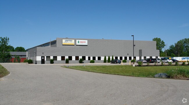
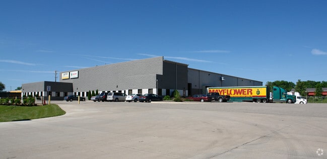
Property Record
2005 Seagar St, Lansing, MI 48906

Property Detail
2005 Seagar St
01-01-04-380-007
N 66 FT OF E 73.26 FT LOT 7 OF TOWNSEND'S SUB ON SEC'S 4, 5, 8 & 9; ALSO LOT 13 TURNER & SMITH'S SUB; ALSO PART SW 1/4 SEC 4 COM NE COR LOT 12 SAID SMITH'S SUB, TH W 403.11 FT, N 176.24 FT, W 255.91 FT, N 596.68 FT TO CON RAIL RR R/W, SE'LY ALONG R/W
Commercialnec
Ingham
I HVY
Michigan
B and X Area of moderate flood hazard, usually the area between the limits of the 100-year and 500-year floods.
7
2025
4.85 AC
2025
Central Lansing
006600
West Michigan
51,248 SF
Lansing-East Lansing, MI
NEARBY LISTINGS FOR SALE OR LEASE
DEMOGRAPHICS near 2005 Seagar St
1 mile
3 mile
5 mile
2025 Total Population
10,154
64,788
176,286
2030 Population
10,426
66,329
181,143
Pop Growth 2025-2030
+ 2.68%
+ 2.38%
+ 2.76%
Average Age
36
38
37
2025 Total Households
4,305
29,168
74,052
HH Growth 2025-2030
+ 2.76%
+ 2.52%
+ 2.87%
Median Household Inc
$51,341
$56,771
$56,264
Avg Household Size
2.20
2.10
2.10
2025 Avg HH Vehicles
1.00
1.00
2.00
Median Home Value
$88,152
$142,187
$171,808
Median Year Built
1948
1955
1966
Nearby Places
Map Layers
Map Styles
 Street
 Aerial
Layers
 Traffic
 Biking
Places
Listings with unknown addresses are not visible on the map
- Restaurants
- Banks
- Shops
- Fitness
- Groceries
PUBLIC TRANSPORTATION
COMMUTER RAIL
Drive
Walk
Distance
12 min
5.6 mi
AIRPORT
Capital Region International
Drive
Walk
Distance
Capital Region International
6 min
2.7 mi
Nearby Properties
Address
Land Use
TOTAL SIZE
Lot Size
Zoning
Address
Land Use
TOTAL SIZE
Lot Size
Zoning
42,875 SF
35 AC
PD
Address
Land Use
TOTAL SIZE
Lot Size
Zoning
7,579 SF
83.53 AC
PD
Address
Land Use
TOTAL SIZE
Lot Size
Zoning
42,875 SF
28.77 AC
Address
Land Use
TOTAL SIZE
Lot Size
Zoning
111,180 SF
3.63 AC
G-1 BUS
Address
Land Use
TOTAL SIZE
Lot Size
Zoning
63,461 SF
32 AC
F COMM
Address
Land Use
TOTAL SIZE
Lot Size
Zoning
177,300 SF
8.72 AC
Address
Land Use
TOTAL SIZE
Lot Size
Zoning
69,851 SF
134.23 AC
I HVY
Address
Land Use
TOTAL SIZE
Lot Size
Zoning
13.13 AC
Address
Land Use
TOTAL SIZE
Lot Size
Zoning
66.43 AC
Address
Land Use
TOTAL SIZE
Lot Size
Zoning
2,137 SF
12.72 AC
H LT IN
Address
Land Use
TOTAL SIZE
Lot Size
Zoning
185,190 SF
0.41 AC
G-1 BUS
Address
Land Use
TOTAL SIZE
Lot Size
Zoning
191,680 SF
24.36 AC
B4
Address
Land Use
TOTAL SIZE
Lot Size
Zoning
150,589 SF
3.06 AC
D-1 PRO
Address
Land Use
TOTAL SIZE
Lot Size
Zoning
142,152 SF
47.56 AC
B4
Address
Land Use
TOTAL SIZE
Lot Size
Zoning
332,832 SF
2.48 AC
G-1 BUS
Address
Land Use
TOTAL SIZE
Lot Size
Zoning
169,704 SF
0.67 AC
G-1 BUS
Address
Land Use
TOTAL SIZE
Lot Size
Zoning
63.94 AC
Address
Land Use
TOTAL SIZE
Lot Size
Zoning
165,684 SF
1.20 AC
G-1 BUS
Address
Land Use
TOTAL SIZE
Lot Size
Zoning
159,455 SF
0.42 AC
Address
Land Use
TOTAL SIZE
Lot Size
Zoning
157,548 SF
0.72 AC
Address
Land Use
TOTAL SIZE
Lot Size
Zoning
114,681 SF
1.08 AC
G-1 BUS
Address
Land Use
TOTAL SIZE
Lot Size
Zoning
61,194 SF
0.55 AC
F COMME
Address
Land Use
TOTAL SIZE
Lot Size
Zoning
67,365 SF
4.19 AC
H LT IN
Address
Land Use
TOTAL SIZE
Lot Size
Zoning
Address
Land Use
TOTAL SIZE
Lot Size
Zoning
121,536 SF
2 AC
Address
Land Use
TOTAL SIZE
Lot Size
Zoning
76,606 SF
1.75 AC
Address
Land Use
TOTAL SIZE
Lot Size
Zoning
140,722 SF
1.40 AC
Address
Land Use
TOTAL SIZE
Lot Size
Zoning
69,768 SF
8.22 AC
D ADMIN
Address
Land Use
TOTAL SIZE
Lot Size
Zoning
2,000 SF
0.91 AC
PD
The World's #1 Commercial Real Estate Marketplace
Connect with us
© 2026 CoStar Group
The information above has been obtained from sources believed reliable. While we do not doubt its accuracy we have not verified it and make no guarantee, warranty or representation about it. It is your responsibility to independently confirm its accuracy and completeness. Any projections, opinions, assumptions, or estimates used are for example only and do not represent the current or future performance of the property. The value of this transaction to you depends on tax and other factors which should be evaluated by your tax, financial, and legal advisors. You and your advisors should conduct a careful, independent investigation of the property to determine to your satisfaction the suitability of the property for your needs.