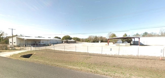
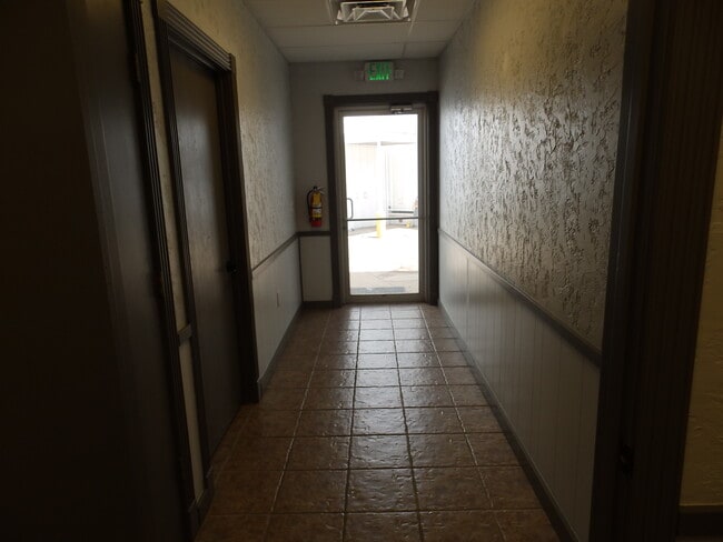
Property Record
2005 W Tile Factory Rd, Palestine, TX 75801

Current Lease Availabilities
Property Detail
2005 W Tile Factory Rd
R14108
A0033 JORDAN, JOSEPH BLOCK 1204 TRACT 4A
Industrialgeneral
ANDERSON
B and X Area of moderate flood hazard, usually the area between the limits of the 100-year and 500-year floods.
Texas
2025
2.80 AC
2025
Texas East Area
950600
Other Market Areas
13,832 SF
Palestine, TX
NEARBY LISTINGS FOR SALE OR LEASE
DEMOGRAPHICS near 2005 W Tile Factory Rd
1 mile
3 mile
5 mile
2025 Total Population
1,981
10,890
24,386
2030 Population
2,021
11,097
24,750
Pop Growth 2025-2030
+ 2.02%
+ 1.90%
+ 1.49%
Average Age
39
40
39
2025 Total Households
704
3,056
8,080
HH Growth 2025-2030
+ 1.99%
+ 2.23%
+ 1.49%
Median Household Inc
$47,764
$46,500
$47,033
Avg Household Size
2.70
2.70
2.60
2025 Avg HH Vehicles
2.00
2.00
2.00
Median Home Value
$158,518
$175,392
$167,534
Median Year Built
1980
1980
1979
Nearby Places
Map Layers
Map Styles
 Street
 Aerial
Transit
 Traffic
 Biking
Places
Listings with unknown addresses are not visible on the map
- Restaurants
- Banks
- Shops
- Fitness
- Groceries
Nearby Properties
Address
Land Use
TOTAL SIZE
Lot Size
Zoning
Address
Land Use
TOTAL SIZE
Lot Size
Zoning
Address
Land Use
TOTAL SIZE
Lot Size
Zoning
Address
Land Use
TOTAL SIZE
Lot Size
Zoning
189,215 SF
20.10 AC
Address
Land Use
TOTAL SIZE
Lot Size
Zoning
47,006 SF
16.53 AC
Address
Land Use
TOTAL SIZE
Lot Size
Zoning
128,411 SF
11.21 AC
Address
Land Use
TOTAL SIZE
Lot Size
Zoning
55,418 SF
46.17 AC
Address
Land Use
TOTAL SIZE
Lot Size
Zoning
36,952 SF
19.14 AC
Address
Land Use
TOTAL SIZE
Lot Size
Zoning
101,535 SF
40.36 AC
Address
Land Use
TOTAL SIZE
Lot Size
Zoning
162,160 SF
43.88 AC
Address
Land Use
TOTAL SIZE
Lot Size
Zoning
118,867 SF
9.27 AC
Address
Land Use
TOTAL SIZE
Lot Size
Zoning
36,735 SF
3.29 AC
Address
Land Use
TOTAL SIZE
Lot Size
Zoning
15,060 SF
3 AC
Address
Land Use
TOTAL SIZE
Lot Size
Zoning
45,605 SF
8.99 AC
Address
Land Use
TOTAL SIZE
Lot Size
Zoning
44,736 SF
9 AC
Address
Land Use
TOTAL SIZE
Lot Size
Zoning
31,104 SF
3.31 AC
Address
Land Use
TOTAL SIZE
Lot Size
Zoning
203,552 SF
10.59 AC
Address
Land Use
TOTAL SIZE
Lot Size
Zoning
19,250 SF
6 AC
Address
Land Use
TOTAL SIZE
Lot Size
Zoning
37,792 SF
3 AC
Address
Land Use
TOTAL SIZE
Lot Size
Zoning
102,052 SF
7 AC
Address
Land Use
TOTAL SIZE
Lot Size
Zoning
21,144 SF
5.60 AC
Address
Land Use
TOTAL SIZE
Lot Size
Zoning
27,014 SF
2.70 AC
Address
Land Use
TOTAL SIZE
Lot Size
Zoning
6,802 SF
25.42 AC
Address
Land Use
TOTAL SIZE
Lot Size
Zoning
10,936 SF
7.73 AC
Address
Land Use
TOTAL SIZE
Lot Size
Zoning
60,119 SF
26 AC
Address
Land Use
TOTAL SIZE
Lot Size
Zoning
6,462 SF
2 AC
Address
Land Use
TOTAL SIZE
Lot Size
Zoning
19,808 SF
33.38 AC
Address
Land Use
TOTAL SIZE
Lot Size
Zoning
8,879 SF
2.81 AC
Address
Land Use
TOTAL SIZE
Lot Size
Zoning
28,554 SF
9.97 AC
Address
Land Use
TOTAL SIZE
Lot Size
Zoning
44,025 SF
5.01 AC
Address
Land Use
TOTAL SIZE
Lot Size
Zoning
2,378 SF
240.15 AC
The World's #1 Commercial Real Estate Marketplace
Connect with us
© 2026 CoStar Group
The information above has been obtained from sources believed reliable. While we do not doubt its accuracy we have not verified it and make no guarantee, warranty or representation about it. It is your responsibility to independently confirm its accuracy and completeness. Any projections, opinions, assumptions, or estimates used are for example only and do not represent the current or future performance of the property. The value of this transaction to you depends on tax and other factors which should be evaluated by your tax, financial, and legal advisors. You and your advisors should conduct a careful, independent investigation of the property to determine to your satisfaction the suitability of the property for your needs.