Property Record
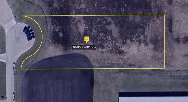
201 1St Ave Se, Mapleton, ND 58059
NEARBY LISTINGS FOR SALE OR LEASE
Property Detail
201 1St Ave Se
Other Market Areas
I-94 Industrial Park
Fargo, ND-MN
LOT: 1 BLOCK: 4 ADDITION: I-94 INDUSTRIAL PARK SECOND ADDITION ADDITIONAL: I-94 INDUSTRIAL PARK 2ND ADDN LT 1 BLK 4
18-0560-00130-010
Cass
Commercialacreage
North Dakota
2024
1
2024
0.24 AC
040800
Fargo
DEMOGRAPHICS near 201 1St Ave Se
1 Mile
3 Mile
5 Mile
2024 Total Population
1,338
1,532
1,803
2029 Population
1,432
1,640
1,927
Pop Growth 2024-2029
+ 7.03%
+ 7.05%
+ 6.88%
Average Age
35
36
36
2024 Total Households
466
534
633
HH Growth 2024-2029
+ 7.73%
+ 7.68%
+ 7.42%
Median Household Inc
$98,703
$98,538
$97,584
Avg Household Size
2.90
2.90
2.90
2024 Avg HH Vehicles
2.00
2.00
2.00
Median Home Value
$285,826
$285,273
$283,620
Median Year Built
1987
1987
1987
Nearby Places
Map Layers
Map Styles
 Street
 Aerial
- Restaurants
- Banks
- Shops
- Fitness
- Groceries
PUBLIC TRANSPORTATION
AIRPORT
Hector International
DRIVE
WALK
Distance
Hector International
29 min
17.1 mi
Freight Ports
Port Milwaukee
DRIVE
WALK
Distance
Port Milwaukee
644 min
585.3 mi
Nearby Properties
Address
Land Use
TOTAL SIZE
Lot Size
Zoning
Address
Land Use
TOTAL SIZE
Lot Size
Zoning
106,400 SF
20 AC
Address
Land Use
TOTAL SIZE
Lot Size
Zoning
164,569 SF
2.47 AC
Address
Land Use
TOTAL SIZE
Lot Size
Zoning
50,962 SF
9.99 AC
Address
Land Use
TOTAL SIZE
Lot Size
Zoning
42,252 SF
9.53 AC
Address
Land Use
TOTAL SIZE
Lot Size
Zoning
1,624 SF
Address
Land Use
TOTAL SIZE
Lot Size
Zoning
48,762 SF
11.88 AC
Address
Land Use
TOTAL SIZE
Lot Size
Zoning
Address
Land Use
TOTAL SIZE
Lot Size
Zoning
21,410 SF
2.08 AC
Address
Land Use
TOTAL SIZE
Lot Size
Zoning
60,000 SF
6.50 AC
Address
Land Use
TOTAL SIZE
Lot Size
Zoning
1.85 AC
Address
Land Use
TOTAL SIZE
Lot Size
Zoning
Address
Land Use
TOTAL SIZE
Lot Size
Zoning
17,568 SF
2.83 AC
Address
Land Use
TOTAL SIZE
Lot Size
Zoning
12,600 SF
4.07 AC
Address
Land Use
TOTAL SIZE
Lot Size
Zoning
8,640 SF
1.74 AC
Address
Land Use
TOTAL SIZE
Lot Size
Zoning
2,240 SF
2.80 AC
Address
Land Use
TOTAL SIZE
Lot Size
Zoning
Address
Land Use
TOTAL SIZE
Lot Size
Zoning
10,756 SF
Address
Land Use
TOTAL SIZE
Lot Size
Zoning
Address
Land Use
TOTAL SIZE
Lot Size
Zoning
11,100 SF
1.57 AC
Address
Land Use
TOTAL SIZE
Lot Size
Zoning
9,666 SF
0.64 AC
Address
Land Use
TOTAL SIZE
Lot Size
Zoning
12,000 SF
2.25 AC
Address
Land Use
TOTAL SIZE
Lot Size
Zoning
2.06 AC
Address
Land Use
TOTAL SIZE
Lot Size
Zoning
10,080 SF
2 AC
Address
Land Use
TOTAL SIZE
Lot Size
Zoning
3,979 SF
Address
Land Use
TOTAL SIZE
Lot Size
Zoning
4,404 SF
Address
Land Use
TOTAL SIZE
Lot Size
Zoning
8.75 AC
Address
Land Use
TOTAL SIZE
Lot Size
Zoning
3,488 SF
7.29 AC
Address
Land Use
TOTAL SIZE
Lot Size
Zoning
5,040 SF
100.27 AC
Address
Land Use
TOTAL SIZE
Lot Size
Zoning
4,096 SF
Address
Land Use
TOTAL SIZE
Lot Size
Zoning
7,680 SF
The World's #1 Commercial Real Estate Marketplace
Connect with us
© 2026 CoStar Group
The information above has been obtained from sources believed reliable. While we do not doubt its accuracy we have not verified it and make no guarantee, warranty or representation about it. It is your responsibility to independently confirm its accuracy and completeness. Any projections, opinions, assumptions, or estimates used are for example only and do not represent the current or future performance of the property. The value of this transaction to you depends on tax and other factors which should be evaluated by your tax, financial, and legal advisors. You and your advisors should conduct a careful, independent investigation of the property to determine to your satisfaction the suitability of the property for your needs.